Category:Stody
Jump to navigation
Jump to search
English: Stody is a village and a civil parish in the English county of Norfolk . The village is south west of the town of Holt.The nearest railway station is at Sheringham for the Bittern Line which runs between Sheringham, Cromer and Norwich. The nearest airport is Norwich International Airport.
village in the United Kingdom  | |||||
| Upload media | |||||
| Instance of | |||||
|---|---|---|---|---|---|
| Location | North Norfolk, Norfolk, East of England, England | ||||
| Area |
| ||||
| Said to be the same as | Stody (Wikimedia duplicated page, civil parish) | ||||
 | |||||
Subcategories
This category has the following 3 subcategories, out of 3 total.
Media in category "Stody"
The following 44 files are in this category, out of 44 total.
-
 Cultivated field south of Thornage - geograph.org.uk - 2270686.jpg 640 × 480; 104 KB
-

-

-
 Disused railway formation near Stody.jpg 2,288 × 1,712; 740 KB
-

-
 Fields south of Stody - geograph.org.uk - 3014687.jpg 640 × 480; 99 KB
-

-
 Just a grass field ^ - geograph.org.uk - 1564665.jpg 640 × 420; 40 KB
-
 Looking towards Sebastopol - geograph.org.uk - 787274.jpg 640 × 440; 130 KB
-
 Minor road south of Thornage - geograph.org.uk - 2270673.jpg 640 × 480; 164 KB
-
 Minor road through Stody - geograph.org.uk - 2270696.jpg 480 × 640; 129 KB
-
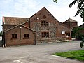 North Norfolk Radio - geograph.org.uk - 788150.jpg 640 × 480; 145 KB
-
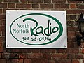 North Norfolk Radio 96.2 and 103.2 FM - geograph.org.uk - 788159.jpg 613 × 459; 146 KB
-
 Old railway bridge buttresses - geograph.org.uk - 4581340.jpg 640 × 480; 201 KB
-
 On the edge of Sebastopol - geograph.org.uk - 787318.jpg 640 × 480; 159 KB
-
 Once a railway crossed the road here - geograph.org.uk - 1564655.jpg 640 × 440; 83 KB
-
 Pasture east of St Mary's church, Stody - geograph.org.uk - 2270701.jpg 640 × 480; 123 KB
-
 Pasture south of St Mary's church, Stody - geograph.org.uk - 2270700.jpg 640 × 480; 127 KB
-

-
 Railway embankment near Hunworth - geograph.org.uk - 2987068.jpg 1,024 × 768; 211 KB
-
 Road through Lodge Wood - geograph.org.uk - 4957685.jpg 1,600 × 1,200; 1.17 MB
-

-
 Stody electricity substation - geograph.org.uk - 2270175.jpg 640 × 480; 167 KB
-
 Stody Hall from Stody churchyard - geograph.org.uk - 2270200.jpg 640 × 480; 260 KB
-
 Thatched Cottages - geograph.org.uk - 4957688.jpg 1,600 × 1,200; 804 KB
-
 The eastern edge of Lodge Plantation - geograph.org.uk - 787304.jpg 640 × 480; 115 KB
-
 The west tower, St. Mary's church, Stody - geograph.org.uk - 6329007.jpg 668 × 1,024; 110 KB
-
 Track through Lodge Plantation - geograph.org.uk - 788412.jpg 480 × 640; 186 KB
-

-
 View towards Beck Farm - geograph.org.uk - 547725.jpg 640 × 480; 63 KB
-
 View towards Oakhill Plantation - geograph.org.uk - 787310.jpg 480 × 640; 141 KB
-
 Where Pinkney Lane ends - geograph.org.uk - 546915.jpg 640 × 480; 81 KB
-

-
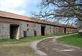 A very long barn - geograph.org.uk - 763741.jpg 640 × 440; 189 KB
-
 Chapel Cottage - geograph.org.uk - 763693.jpg 640 × 463; 185 KB
-
 Cottage opposite the church - geograph.org.uk - 764400.jpg 480 × 640; 196 KB
-
 Drainage ditch traversing pastureland - geograph.org.uk - 763723.jpg 480 × 640; 135 KB
-
 Flintwall Cottage - geograph.org.uk - 763601.jpg 640 × 480; 134 KB
-
 Footpath near Stody - geograph.org.uk - 448698.jpg 640 × 480; 118 KB
-
 Hall Farm, Stody - geograph.org.uk - 448683.jpg 640 × 480; 108 KB
-
 Heading east past Town Farm - geograph.org.uk - 763628.jpg 640 × 461; 87 KB
-
 Holt Road (B1110) past old cottages - geograph.org.uk - 763595.jpg 640 × 463; 110 KB
-
 Houses beside the B1110 (Holt Road) - geograph.org.uk - 763591.jpg 640 × 460; 109 KB
-
 Lethersett Road - geograph.org.uk - 763636.jpg 480 × 640; 84 KB


_past_old_cottages_-_geograph.org.uk_-_763595.jpg)
_-_geograph.org.uk_-_763591.jpg)
