Category:Steenhus in den Klöbertannen
Jump to navigation
Jump to search
| Object location | | View all coordinates using: OpenStreetMap |
|---|
Media in category "Steenhus in den Klöbertannen"
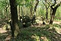
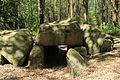
The following 23 files are in this category, out of 23 total.
-
 NLD Großsteingrab Werpeloh 1 01.jpg 6,000 × 4,000; 4.52 MB
-
 NLD Großsteingrab Werpeloh 1 02.jpg 6,000 × 4,000; 4.09 MB
-
 NLD Großsteingrab Werpeloh 1 03.jpg 6,000 × 4,000; 4.25 MB
-
 NLD Großsteingrab Werpeloh 1 04.jpg 6,000 × 4,000; 4.21 MB
-
 Steenhus in den Klöbertannen.jpg 3,648 × 2,736; 4.08 MB
-
 Steenhus.jpg 4,128 × 3,096; 4.08 MB
-
 Werpeloh - Großsteingrab in den Klöbertannen + Steenhus in den Klöbertannen 01 ies.jpg 5,616 × 3,744; 33.86 MB
-
 Werpeloh - Steenhus in den Klöbertannen 01 ies.jpg 5,616 × 3,744; 33.67 MB
-
 Werpeloh - Steenhus in den Klöbertannen 02 ies.jpg 3,744 × 5,616; 15.69 MB
-
 Werpeloh - Steenhus in den Klöbertannen 03 ies.jpg 5,616 × 3,744; 17.15 MB
-
 Werpeloh - Steenhus in den Klöbertannen 04 ies.jpg 5,616 × 3,744; 16.12 MB
-
 Werpeloh - Steenhus in den Klöbertannen 05 ies.jpg 5,616 × 3,744; 16.49 MB
-
 Werpeloh - Steenhus in den Klöbertannen 06 ies.jpg 5,616 × 3,744; 29.81 MB
-
 Werpeloh - Steenhus in den Klöbertannen 07 ies.jpg 5,616 × 3,744; 23.18 MB
-
 Werpeloh - Steenhus in den Klöbertannen 08 ies.jpg 5,616 × 3,744; 25.37 MB
-
 Werpeloh - Steenhus in den Klöbertannen 09 ies.jpg 5,616 × 3,744; 27.56 MB
-
 Werpeloh - Steenhus in den Klöbertannen 10 ies.jpg 5,616 × 3,744; 28.55 MB
-
 Werpeloh - Steenhus in den Klöbertannen 11 ies.jpg 5,616 × 3,744; 26.34 MB
-
 Werpeloh - Steenhus in den Klöbertannen 12 ies.jpg 5,616 × 3,744; 27.29 MB
-
 Werpeloh - Steenhus in den Klöbertannen 13 ies.jpg 5,616 × 3,744; 27.59 MB
-
 Werpeloh - Steenhus in den Klöbertannen 14 ies.jpg 5,616 × 3,744; 24.31 MB
-
 Werpeloh - Steenhus in den Klöbertannen 15 ies.jpg 5,616 × 3,744; 22.33 MB
-
 Werpeloh - Steenhus in den Klöbertannen 16 ies.jpg 5,616 × 3,744; 27.76 MB


