Category:Stanway, Gloucestershire
Jump to navigation
Jump to search
village and civil parish in Gloucestershire, UK  | |||||
| Upload media | |||||
| Instance of | |||||
|---|---|---|---|---|---|
| Location | Tewkesbury, Gloucestershire, South West England, England | ||||
 | |||||
English: Stanway is a small village in Gloucestershire, England, about one mile south of Stanton: both villages are on the Cotswold Way. It is part of the Tewkesbury Borough Council area.
Subcategories
This category has the following 13 subcategories, out of 13 total.
- Taddington, Gloucestershire (22 F)
- Wood Stanway (12 F)
B
D
G
- Gatehouse, Stanway House (20 F)
H
S
- Stanway Viaduct, Gloucestershire (13 F)
- Stanway War Memorial (4 F)
T
- Tithe Barn, Stanway (6 F)
Media in category "Stanway, Gloucestershire"
The following 200 files are in this category, out of 781 total.
(previous page) (next page)-
 Stanway estate cottages - geograph.org.uk - 1549609.jpg 640 × 480; 248 KB
-
 "Foremarke Hall" at Toddington - geograph.org.uk - 5126533.jpg 2,095 × 3,084; 930 KB
-
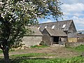
 A barn near Upper Coscombe - geograph.org.uk - 3428527.jpg 800 × 600; 155 KB
-
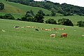
 A cluster of cows in Stanway Park - geograph.org.uk - 4628190.jpg 6,000 × 4,000; 4.87 MB
-
 A corner in Stanway - geograph.org.uk - 4093767.jpg 1,600 × 1,064; 596 KB
-
 A Field near Didbrook - geograph.org.uk - 6286392.jpg 800 × 533; 649 KB
-
 A gift from JM Barrie - Stanway, Gloucestershire - geograph.org.uk - 6245817.jpg 1,024 × 651; 140 KB
-
 A mixture of styles - geograph.org.uk - 2491302.jpg 4,288 × 3,216; 2.97 MB
-
 A pipeline is here - geograph.org.uk - 2491356.jpg 4,288 × 3,216; 1.03 MB
-
 A tennis court at Stanway - geograph.org.uk - 3426974.jpg 800 × 600; 169 KB
-
 Across the field - geograph.org.uk - 2355126.jpg 4,288 × 3,216; 2.21 MB
-
 Across the field - geograph.org.uk - 2490904.jpg 4,288 × 3,216; 1.5 MB
-
 Across the muddy field - geograph.org.uk - 1726437.jpg 4,000 × 3,000; 2.7 MB
-
 Across the road (1) - geograph.org.uk - 2353606.jpg 4,288 × 3,216; 3.32 MB
-
 Across the road (2) - geograph.org.uk - 2353608.jpg 4,288 × 3,216; 2.69 MB
-
 Advert for a business in Taddington - geograph.org.uk - 4957720.jpg 1,600 × 1,067; 731 KB
-
 All Aboard - geograph.org.uk - 4664158.jpg 2,000 × 1,322; 1.55 MB
-
 Almost out of the woods - geograph.org.uk - 2702551.jpg 4,288 × 3,216; 3.23 MB
-
 Along the track - geograph.org.uk - 1726441.jpg 4,000 × 3,000; 3.99 MB
-
 Alongside Longpark Wood - geograph.org.uk - 2702382.jpg 4,228 × 2,877; 2.92 MB
-
 Alongside the woods - geograph.org.uk - 2355153.jpg 4,288 × 3,216; 3.45 MB
-
 An house in Stanway Village - geograph.org.uk - 3427196.jpg 800 × 600; 160 KB
-
 Animal shelter - geograph.org.uk - 2707491.jpg 4,288 × 3,216; 2.57 MB
-
 Animals grazing on strip lynchets - geograph.org.uk - 2519314.jpg 1,024 × 768; 99 KB
-
 Another way - geograph.org.uk - 2353646.jpg 4,288 × 3,216; 2.79 MB
-
 Approaching Taddington - geograph.org.uk - 3190558.jpg 640 × 427; 195 KB
-
 Arable land near Stanway Hill - geograph.org.uk - 1292738.jpg 640 × 426; 74 KB
-
 Arable land north of Stanway Park - geograph.org.uk - 1549538.jpg 640 × 480; 242 KB
-
 Arable land west of Ireley Farm - geograph.org.uk - 1550523.jpg 640 × 480; 219 KB
-
 Arched gateway - geograph.org.uk - 6104165.jpg 768 × 1,024; 291 KB
-
 Archway, Hailes Abbey, near Winchcombe, Glos - geograph.org.uk - 4915668.jpg 684 × 1,024; 298 KB
-
 Arrival at Toddington - geograph.org.uk - 4301161.jpg 800 × 539; 110 KB
-
 Assembly of sheep near Hailes Abbey - geograph.org.uk - 4632749.jpg 6,000 × 4,000; 4.54 MB
-
 Autumn colour on the Way - geograph.org.uk - 2354064.jpg 4,288 × 3,216; 2.77 MB
-
 Autumnal lane - geograph.org.uk - 1546144.jpg 640 × 480; 253 KB
-
 Avenue of trees across the Stanway Estate - geograph.org.uk - 4631381.jpg 6,000 × 4,000; 5.11 MB
-
 Avenue of trees near Wood Stanway - geograph.org.uk - 4630106.jpg 6,000 × 4,000; 3.84 MB
-
 Avenue of trees to Stanway House - geograph.org.uk - 2222724.jpg 1,024 × 768; 325 KB
-

-
 B4077 - Toddington roundabout - geograph.org.uk - 2652818.jpg 640 × 480; 54 KB
-

-
 B4077 approaching Stanway crossroads - geograph.org.uk - 2652812.jpg 640 × 480; 72 KB
-
 B4077 at Newcombe Wood bends - geograph.org.uk - 2652792.jpg 640 × 480; 77 KB
-
 B4077 at Stumps Cross - geograph.org.uk - 2652768.jpg 640 × 480; 80 KB
-
 B4077 at The Slade - geograph.org.uk - 2652798.jpg 640 × 480; 81 KB
-
 B4077 descending from Stumps Cross - geograph.org.uk - 2652770.jpg 640 × 480; 91 KB
-
 B4077 entering Toddington - geograph.org.uk - 2652817.jpg 640 × 480; 66 KB
-
 B4077 in Coscombe Grove - geograph.org.uk - 4957691.jpg 1,600 × 1,599; 997 KB
-
 B4077 near Coscombe Grove - geograph.org.uk - 2652787.jpg 640 × 480; 86 KB
-
 B4077 near Lower Coscombe - geograph.org.uk - 2652782.jpg 640 × 480; 87 KB
-
 B4077 nearing Stumps Cross - geograph.org.uk - 2652766.jpg 640 × 480; 80 KB
-
 Barn at Stumps Cross - geograph.org.uk - 4309478.jpg 1,024 × 680; 231 KB
-
 Barn near Stanway House - geograph.org.uk - 1292721.jpg 640 × 426; 68 KB
-
 Barns near Upper Coscombe - geograph.org.uk - 3428535.jpg 800 × 600; 152 KB
-
 Bee-keeping in Stanway - geograph.org.uk - 4629992.jpg 6,000 × 4,000; 5.55 MB
-
 Between the wood and the field - geograph.org.uk - 2702392.jpg 4,288 × 3,216; 2.59 MB
-
 Beware of Trains, Toddington Station - geograph.org.uk - 5301641.jpg 3,404 × 2,424; 1.33 MB
-
 Black-faced sheep 1 - geograph.org.uk - 1546123.jpg 640 × 481; 273 KB
-
 Bridge over brook near Didbrook - geograph.org.uk - 4957009.jpg 1,600 × 1,200; 809 KB
-
 Bridleway by the wood - geograph.org.uk - 2355147.jpg 4,288 × 3,216; 3.36 MB
-
 Bridleway near Stanway - geograph.org.uk - 1609351.jpg 640 × 480; 85 KB
-
 Bridleway to Snowshill - geograph.org.uk - 2917619.jpg 4,320 × 3,240; 5 MB
-
 Bridleway up the Cotswold scarp 2 - geograph.org.uk - 1547559.jpg 640 × 480; 284 KB
-
 Bridleway up the hill - geograph.org.uk - 2702320.jpg 4,288 × 3,216; 3.73 MB
-
 Byway meets road - geograph.org.uk - 1947386.jpg 4,000 × 3,000; 2.7 MB
-
 Byway to bridleway - geograph.org.uk - 2489369.jpg 4,288 × 3,216; 2.25 MB
-
 Camp site - geograph.org.uk - 2489379.jpg 4,288 × 3,216; 1.36 MB
-
 Campden Lane - geograph.org.uk - 2487854.jpg 4,288 × 3,216; 2.48 MB
-
 Campden Lane - geograph.org.uk - 3428514.jpg 800 × 600; 153 KB
-
 Campden Lane - geograph.org.uk - 3428538.jpg 800 × 600; 154 KB
-
 Campden Lane - geograph.org.uk - 3428544.jpg 800 × 600; 147 KB
-
 Campden Lane heading towards Stumps Cross - geograph.org.uk - 4631298.jpg 6,000 × 4,000; 4.84 MB
-
 Carey's Covert - geograph.org.uk - 2963439.jpg 5,184 × 3,456; 4.3 MB
-
 Careys Farm, Taddington - geograph.org.uk - 1635491.jpg 640 × 480; 80 KB
-
 Cattle grazing in Stanway Park - geograph.org.uk - 3532894.jpg 4,752 × 3,168; 2.62 MB
-
 Cattle grazing in Stanway Park - geograph.org.uk - 3983296.jpg 4,752 × 3,168; 4 MB
-
 Cattle grazing near Didbrook - geograph.org.uk - 3930545.jpg 4,752 × 3,168; 2.77 MB
-
 Cattle grazing near Haile-on-the-Hill - geograph.org.uk - 3478000.jpg 4,752 × 3,168; 3 MB
-
 Change sides - geograph.org.uk - 2486801.jpg 4,288 × 3,216; 1.21 MB
-
 Choice of route - geograph.org.uk - 2647194.jpg 640 × 480; 123 KB
-
 Church at Hailes Abbey - geograph.org.uk - 5861282.jpg 1,024 × 768; 208 KB
-
 Climb the hill - geograph.org.uk - 2702544.jpg 4,288 × 3,216; 5.48 MB
-
 Cloisters at Hailes Abbey - geograph.org.uk - 4632718.jpg 6,000 × 4,000; 4.43 MB
-
 Coat of Arms, Stanway House - geograph.org.uk - 6104161.jpg 768 × 1,024; 289 KB
-
 Collecting the harvest - geograph.org.uk - 3190598.jpg 640 × 441; 198 KB
-
 Copper beech - geograph.org.uk - 2707485.jpg 3,216 × 4,288; 1.95 MB
-
 Cotswold cottages near Stanway - geograph.org.uk - 2427315.jpg 640 × 480; 115 KB
-
 Cotswold Farmland - geograph.org.uk - 2353622.jpg 4,288 × 3,216; 2.7 MB
-
 Cotswold Farmland - geograph.org.uk - 5575040.jpg 640 × 427; 79 KB
-
 Cotswold Farmland View - geograph.org.uk - 5575035.jpg 640 × 398; 88 KB
-
 Cotswold grassland - geograph.org.uk - 3048692.jpg 1,024 × 680; 229 KB
-
 Cotswold Way - geograph.org.uk - 2487873.jpg 4,288 × 3,216; 1.76 MB
-
 Cotswold Way 021 (Stanway Watermill) - geograph.org.uk - 3661384.jpg 480 × 640; 133 KB
-

-
 Cotswold Way 023 (Salters Lane) - geograph.org.uk - 3661405.jpg 640 × 480; 216 KB
-
 Cotswold Way 024 - geograph.org.uk - 3661411.jpg 640 × 480; 229 KB
-
 Cotswold Way near Stanway - geograph.org.uk - 916425.jpg 640 × 426; 118 KB
-
 Cotswold Way near Stumps Cross - geograph.org.uk - 4309481.jpg 800 × 531; 77 KB
-
 Cotswolds in summer - geograph.org.uk - 1440861.jpg 640 × 480; 209 KB
-
 Country junction - geograph.org.uk - 2489722.jpg 4,288 × 3,216; 2.43 MB
-
 Cows below The Slade - geograph.org.uk - 4630090.jpg 6,000 × 4,000; 4.65 MB
-
 Cows grazing in a field near Hailes - geograph.org.uk - 6286075.jpg 800 × 533; 480 KB
-
 Crop and grass research (1) - geograph.org.uk - 2490836.jpg 4,288 × 3,216; 1.69 MB
-
 Crossroads near Mawkin Farm - geograph.org.uk - 4957704.jpg 1,600 × 1,067; 610 KB
-
 Deer on the path in Lidcombe Wood - geograph.org.uk - 2427289.jpg 640 × 480; 99 KB
-

-
 Didbrook - geograph.org.uk - 4093682.jpg 1,600 × 1,064; 465 KB
-
 Didbrook church - geograph.org.uk - 4418063.jpg 640 × 480; 131 KB
-
 Didbrook Farm - geograph.org.uk - 3480814.jpg 4,000 × 3,000; 4.01 MB
-
 Didbrook Farm - geograph.org.uk - 3480818.jpg 4,000 × 3,000; 4.57 MB
-
 Didbrook Farm - geograph.org.uk - 6286381.jpg 800 × 600; 588 KB
-
 Didbrook from the south - geograph.org.uk - 3810064.jpg 4,752 × 3,168; 2.78 MB
-
 Diesel and steam at Toddington, Gloucs - geograph.org.uk - 4479354.jpg 640 × 435; 185 KB
-
 Diesel locomotive and train, Toddington Station - geograph.org.uk - 5887053.jpg 1,024 × 768; 232 KB
-
 Diesel locomotive, Toddington Station - geograph.org.uk - 5886897.jpg 1,024 × 777; 282 KB
-
 Diesel Rail Car on bridge - geograph.org.uk - 2654941.jpg 640 × 480; 59 KB
-
 Disused footpath (1) - geograph.org.uk - 2353782.jpg 4,288 × 3,216; 3.15 MB
-
 Disused footpath (2) - geograph.org.uk - 2353783.jpg 4,288 × 3,216; 5.97 MB
-
 Disused footpath (3) - geograph.org.uk - 2353788.jpg 4,288 × 3,216; 3.19 MB
-

-
 Down the escarpment - geograph.org.uk - 2354085.jpg 4,288 × 3,216; 3.07 MB
-
 Driveway to Stanway Grounds - geograph.org.uk - 1609432.jpg 640 × 480; 108 KB
-

-
 Enclosed path - geograph.org.uk - 2355365.jpg 4,288 × 3,216; 3.28 MB
-
 Entering Stanway - geograph.org.uk - 3426963.jpg 800 × 600; 170 KB
-
 Entering Stanway Park - geograph.org.uk - 1549532.jpg 640 × 480; 259 KB
-
 Entering Toddington - geograph.org.uk - 5575021.jpg 640 × 437; 92 KB
-
 Entrance Quarry, near Stumps Cross - geograph.org.uk - 1164650.jpg 640 × 426; 68 KB
-
 Entrance to Guiting Quarry - geograph.org.uk - 4957697.jpg 1,600 × 1,067; 738 KB
-
 Entrance to Manor Farm - geograph.org.uk - 3190571.jpg 640 × 427; 218 KB
-
 Entrance to the fruit farm - geograph.org.uk - 2489376.jpg 4,288 × 3,216; 3.18 MB
-
 Entrance to Toddington Garden Centre - geograph.org.uk - 4415856.jpg 800 × 427; 65 KB
-
 Escarpment view - geograph.org.uk - 2486776.jpg 4,288 × 3,216; 2.57 MB
-
 Ewe and her lamb in March 2015 - geograph.org.uk - 4374607.jpg 4,752 × 3,168; 2.71 MB
-
 Fallen and cleared - geograph.org.uk - 2702344.jpg 4,288 × 3,216; 3.58 MB
-
 Fallen chestnut stump, Cotswold Way - geograph.org.uk - 2781659.jpg 640 × 480; 74 KB
-
 Farm pull-off in Taddington - geograph.org.uk - 4957732.jpg 1,600 × 1,200; 746 KB
-
 Farm track off Salter's Lane - geograph.org.uk - 4632755.jpg 6,000 × 4,000; 4.43 MB
-
 Farm track to Stumps Cross - geograph.org.uk - 2222735.jpg 1,024 × 768; 299 KB
-
 Farm Track, Stanway Grounds - geograph.org.uk - 6287078.jpg 800 × 600; 760 KB
-
 Farmhouse at Wood Stanway - geograph.org.uk - 4630072.jpg 6,000 × 4,000; 5.04 MB
-
 Farmland below Hailes Wood - geograph.org.uk - 4632694.jpg 6,000 × 4,000; 3.95 MB
-
 Farmland near Stanway - geograph.org.uk - 5888470.jpg 1,024 × 768; 202 KB
-
 Farmland View - geograph.org.uk - 5575046.jpg 640 × 466; 95 KB
-

-
 Field edge path - geograph.org.uk - 1946212.jpg 4,000 × 3,000; 3.33 MB
-
 Field edge path - geograph.org.uk - 2490877.jpg 4,288 × 3,216; 1.26 MB
-
 Field of onions - geograph.org.uk - 4093626.jpg 1,600 × 1,064; 345 KB
-
 Field-edge path joins Cotswold Way - geograph.org.uk - 2654946.jpg 640 × 480; 128 KB
-
 Fields above Hailes - geograph.org.uk - 4632792.jpg 6,000 × 4,000; 5.36 MB
-
 Fields east of Toddington Station - geograph.org.uk - 4665038.jpg 2,000 × 1,333; 1.46 MB
-
 Figure of St George, Stanway war memorial - geograph.org.uk - 5823504.jpg 768 × 1,024; 451 KB
-
 Fine trees - geograph.org.uk - 2486757.jpg 4,288 × 3,216; 3.21 MB
-

-
 Flat farmland north of Little Ireley Farm - geograph.org.uk - 4956997.jpg 1,600 × 1,199; 751 KB
-
 Flowery embankment above small field - geograph.org.uk - 1940459.jpg 1,024 × 768; 135 KB
-
 Follow that sheep - geograph.org.uk - 2486790.jpg 4,288 × 3,216; 2.58 MB
-
 Footpath across a stream near Stanway - geograph.org.uk - 4495612.jpg 4,000 × 3,000; 3.88 MB
-
 Footpath alongside the GWR - geograph.org.uk - 2489891.jpg 1,024 × 768; 166 KB
-
 Footpath leaves the road - geograph.org.uk - 2491348.jpg 4,288 × 3,216; 3.94 MB
-
 Footpath meets road - geograph.org.uk - 2348823.jpg 4,288 × 3,216; 4.03 MB
-
 Footpath meets road - geograph.org.uk - 2707659.jpg 4,288 × 3,216; 2.7 MB
-
 Footpath near Winchcombe - geograph.org.uk - 4498401.jpg 4,000 × 3,000; 3.98 MB
-
 Footpath through Stanway Ash Plantation - geograph.org.uk - 4958829.jpg 1,600 × 1,200; 764 KB
-
 Footpath to Stanway - geograph.org.uk - 1611738.jpg 640 × 480; 106 KB
-
 FOR YOUR TO-MORROW WE GAVE OUR TO-DAY - geograph.org.uk - 5823507.jpg 1,024 × 768; 376 KB
-
 Forage barn, Upper Coscombe - geograph.org.uk - 2963312.jpg 5,184 × 3,456; 3.15 MB
-
 Foremarke Hall at Toddington - geograph.org.uk - 5575024.jpg 640 × 426; 108 KB
-

-

-
 Former quarry in Coscombe Grove - geograph.org.uk - 4957686.jpg 1,200 × 1,600; 817 KB
-
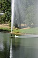
 Fountain in the grounds of Stanway House - geograph.org.uk - 5863970.jpg 680 × 1,024; 192 KB
-
 Fountain in the grounds of Stanway House - geograph.org.uk - 5863975.jpg 680 × 1,024; 242 KB
-
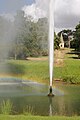
 Fountain in the grounds of Stanway House - geograph.org.uk - 5863982.jpg 1,024 × 680; 216 KB
-
 Fountain in the grounds of Stanway House - geograph.org.uk - 5863984.jpg 680 × 1,024; 207 KB
-
 Four ways to go (1) - geograph.org.uk - 1946242.jpg 4,000 × 3,000; 2.43 MB
-
 Four ways to go (1) - geograph.org.uk - 2702568.jpg 4,288 × 3,216; 3.22 MB
-
 Four ways to go (2) - geograph.org.uk - 1946251.jpg 4,000 × 3,000; 2.64 MB
-
 Four ways to go (2) - geograph.org.uk - 2702572.jpg 4,288 × 3,216; 3.76 MB
-
 Four ways to go (3) - geograph.org.uk - 1946259.jpg 4,000 × 3,000; 2.38 MB
-
 Four ways to go (3) - geograph.org.uk - 2703467.jpg 4,288 × 3,216; 2.53 MB
-
 Four ways to go (4) - geograph.org.uk - 1946267.jpg 4,000 × 3,000; 2.15 MB
-
 Four ways to go (4) - geograph.org.uk - 2703470.jpg 4,288 × 3,216; 3.56 MB
-
 Frank's Bridge - geograph.org.uk - 1611706.jpg 640 × 480; 115 KB
-
 Freight train near Hailes - geograph.org.uk - 3480827.jpg 4,000 × 3,000; 4.23 MB
-
 From Campden Lane looking towards the top of the hill - geograph.org.uk - 4631313.jpg 6,000 × 4,000; 5.07 MB
-
 Fruit trees - geograph.org.uk - 2489370.jpg 4,288 × 3,216; 2.03 MB
-
 Fruit trees at Hayles Fruit Farm - geograph.org.uk - 4632661.jpg 6,000 × 4,000; 5.29 MB
-

-
 Glebe Farm (1) - geograph.org.uk - 2355129.jpg 4,288 × 3,216; 2.35 MB
-
 Glebe Farm (2) - geograph.org.uk - 2355131.jpg 4,288 × 3,216; 3.87 MB
-
 Glebe Farm (3) - geograph.org.uk - 2355133.jpg 4,288 × 3,216; 2.23 MB
-
 Glebe Farm, Wood Stanway - geograph.org.uk - 3427217.jpg 800 × 600; 167 KB
-
 Glimpse of Papermill Farm - geograph.org.uk - 1547549.jpg 640 × 480; 261 KB
-

-
 Gloucestershire Warkwickshire Railway - geograph.org.uk - 4495534.jpg 4,000 × 3,000; 3.18 MB
-
 Gloucestershire Warkwickshire Railway - geograph.org.uk - 4495542.jpg 4,000 × 3,000; 3.85 MB
-
 Gloucestershire Warkwickshire Railway - geograph.org.uk - 4495544.jpg 4,000 × 3,000; 2.03 MB
-
 Gloucestershire Warkwickshire Railway - geograph.org.uk - 4495574.jpg 3,744 × 1,656; 1.56 MB
-
 Gloucestershire Warkwickshire Railway - geograph.org.uk - 4495578.jpg 4,000 × 3,000; 4.4 MB


_-_geograph.org.uk_-_2353606.jpg)
_-_geograph.org.uk_-_2353608.jpg)


_-_geograph.org.uk_-_3661384.jpg)
_-_geograph.org.uk_-_3661386.jpg)
_-_geograph.org.uk_-_3661405.jpg)


_-_geograph.org.uk_-_2490836.jpg)


_-_geograph.org.uk_-_2353782.jpg)
_-_geograph.org.uk_-_2353783.jpg)
_-_geograph.org.uk_-_2353788.jpg)


_-_geograph.org.uk_-_1946242.jpg)
_-_geograph.org.uk_-_2702568.jpg)
_-_geograph.org.uk_-_1946251.jpg)
_-_geograph.org.uk_-_2702572.jpg)
_-_geograph.org.uk_-_1946259.jpg)
_-_geograph.org.uk_-_2703467.jpg)
_-_geograph.org.uk_-_1946267.jpg)
_-_geograph.org.uk_-_2703470.jpg)


_-_geograph.org.uk_-_2355129.jpg)
_-_geograph.org.uk_-_2355131.jpg)
_-_geograph.org.uk_-_2355133.jpg)


