Category:South Otterington
Jump to navigation
Jump to search
village and civil parish in North Yorkshire, United Kingdom  | |||||
| Upload media | |||||
| Instance of | |||||
|---|---|---|---|---|---|
| Location | Hambleton, North Yorkshire, Yorkshire and the Humber, England | ||||
| Population |
| ||||
| Area |
| ||||
 | |||||
Subcategories
This category has the following 3 subcategories, out of 3 total.
O
- Otterington railway station (42 F)
Media in category "South Otterington"
The following 146 files are in this category, out of 146 total.
-
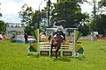
 2015 show - geograph.org.uk - 4539077.jpg 640 × 428; 103 KB
-
 A167 and embankment of disused railway - geograph.org.uk - 3469273.jpg 1,024 × 683; 147 KB
-
 A167 between Kirby Wiske and South Otterington - geograph.org.uk - 5641078.jpg 5,184 × 3,456; 6.63 MB
-
 A167 heading south - geograph.org.uk - 2718762.jpg 640 × 480; 51 KB
-
 A167 towards Northallerton - geograph.org.uk - 2718777.jpg 640 × 480; 101 KB
-
 Access into the Hollybush Christian Fellowship - geograph.org.uk - 5641077.jpg 5,184 × 3,456; 6.85 MB
-

-

-
-
 Benchmark on bridge of disused railway - geograph.org.uk - 3469207.jpg 683 × 1,024; 280 KB
-
 Bridleway level crossing west of Thornton House - geograph.org.uk - 3602106.jpg 1,600 × 1,200; 561 KB
-
 Cattle displays - geograph.org.uk - 4537687.jpg 640 × 428; 97 KB
-
 Corpse Road, from the railway - geograph.org.uk - 4598895.jpg 1,276 × 1,239; 766 KB
-
 Countryside near Leach Grange - geograph.org.uk - 2336258.jpg 640 × 335; 22 KB
-
 Countryside to the South of Leachfield Grange - geograph.org.uk - 5643072.jpg 5,184 × 3,456; 6.68 MB
-
 Countryside to the West of Leachfield Grange - geograph.org.uk - 5643067.jpg 5,184 × 3,456; 5.2 MB
-
 Double Rainbow over the East Coast Mainline - geograph.org.uk - 5643073.jpg 5,184 × 3,456; 5.24 MB
-
 Entrance to Otterington Park Caravan Site - geograph.org.uk - 3602158.jpg 1,600 × 1,200; 481 KB
-
 Entrance to Station Farm - geograph.org.uk - 1660517.jpg 640 × 480; 113 KB
-
 Fairground at the show - geograph.org.uk - 4539080.jpg 640 × 428; 100 KB
-
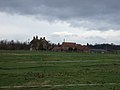
 Farm buildings at Leachfield Grange - geograph.org.uk - 2797084.jpg 3,256 × 1,632; 1.35 MB
-
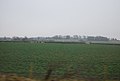
 Farmland at South Otterington - geograph.org.uk - 5052402.jpg 4,320 × 3,240; 2.84 MB
-

-
 Farmland near Broom Plantation - geograph.org.uk - 2670248.jpg 1,600 × 1,200; 251 KB
-
 Farmland near Whig Hall - geograph.org.uk - 2670245.jpg 800 × 533; 47 KB
-
 Farmland off the A167 - geograph.org.uk - 2718757.jpg 640 × 480; 54 KB
-
 Field entrance off the A167 - geograph.org.uk - 2718774.jpg 640 × 480; 82 KB
-
 Fields at Otterington Hall - geograph.org.uk - 4538587.jpg 640 × 428; 106 KB
-
 Fields east of North Otterington - geograph.org.uk - 4586523.jpg 1,600 × 651; 191 KB
-
 Fields east of North Otterington - geograph.org.uk - 4586526.jpg 1,600 × 614; 162 KB
-
 Fields east of North Otterington - geograph.org.uk - 4598923.jpg 1,600 × 795; 183 KB
-
 Fields east of North Otterington - geograph.org.uk - 4598978.jpg 1,600 × 844; 181 KB
-
 Fields east of North Otterington - geograph.org.uk - 4598979.jpg 1,600 × 796; 158 KB
-
 Fields to the North of Leachfield Grange - geograph.org.uk - 5643039.jpg 5,184 × 3,456; 5.36 MB
-
 Footpath through bridge of disused railway - geograph.org.uk - 3469223.jpg 683 × 1,024; 278 KB
-
 Heavy horses - geograph.org.uk - 4539064.jpg 640 × 428; 85 KB
-
 Horses exercising - geograph.org.uk - 4537680.jpg 640 × 428; 67 KB
-
 Horses grazing - geograph.org.uk - 4536993.jpg 640 × 428; 109 KB
-
 Horses near Otterington Hall - geograph.org.uk - 4537681.jpg 640 × 428; 74 KB
-
 Horses warming up - geograph.org.uk - 4537682.jpg 640 × 428; 78 KB
-
 House west of Leachfield Grange - geograph.org.uk - 3604210.jpg 1,214 × 911; 391 KB
-

-

-
 Jumping fence 3 - geograph.org.uk - 4539081.jpg 640 × 428; 136 KB
-
-

-
 Leachfield Grange - Home of Shepherds Purse Cheeses - geograph.org.uk - 5643051.jpg 5,184 × 3,456; 6.99 MB
-
 Loading alpacas - geograph.org.uk - 4539088.jpg 640 × 428; 112 KB
-

-
 Lovers' Lane - geograph.org.uk - 1806225.jpg 640 × 480; 116 KB
-
 Newby Wiske - geograph.org.uk - 470620.jpg 640 × 480; 58 KB
-
 Newsham Grange - geograph.org.uk - 2718780.jpg 640 × 480; 49 KB
-
 North Yorkshire farmland - geograph.org.uk - 2670249.jpg 800 × 600; 88 KB
-
 Old plough strips, South Otterington - geograph.org.uk - 980498.jpg 640 × 480; 81 KB
-
 On the Bridleway between Newholme and Leachfield Grange (1) - geograph.org.uk - 5643027.jpg 5,184 × 3,456; 5.87 MB
-
 On the Bridleway between Newholme and Leachfield Grange (2) - geograph.org.uk - 5643033.jpg 5,184 × 3,456; 5.99 MB
-
 Otterington Bridge - geograph.org.uk - 5005310.jpg 640 × 480; 100 KB
-
 Otterington Bridge - geograph.org.uk - 5642746.jpg 5,184 × 3,094; 6.53 MB
-
 Otterington Hall - geograph.org.uk - 3602143.jpg 1,600 × 1,200; 451 KB
-
 Otterington Hall Farm - geograph.org.uk - 3602135.jpg 1,600 × 1,200; 435 KB
-
 Otterington railway station MMB 17.jpg 4,072 × 2,111; 3.67 MB
-
 Otterington station remains, 1995 - geograph.org.uk - 5407125.jpg 2,359 × 1,203; 1.97 MB
-
 Pools at Otterington Hall - geograph.org.uk - 4538593.jpg 640 × 428; 101 KB
-
 Poultry tent - geograph.org.uk - 4539067.jpg 640 × 428; 103 KB
-
 Railway towards Thirsk Station - geograph.org.uk - 2718744.jpg 640 × 480; 72 KB
-
 River Wiske in flood - geograph.org.uk - 6104377.jpg 3,683 × 2,850; 3.17 MB
-
 Roundabout, Boroughbridge Road - geograph.org.uk - 477508.jpg 640 × 412; 269 KB
-
 Sheep grazing on disused railway embankment - geograph.org.uk - 2718789.jpg 1,600 × 1,200; 322 KB
-
 Sheep Pasture - geograph.org.uk - 152373.jpg 640 × 480; 72 KB
-
 Show jumping - geograph.org.uk - 4537737.jpg 640 × 428; 110 KB
-
 Show jumping in progress - geograph.org.uk - 4539060.jpg 640 × 480; 112 KB
-
 Showjumping course - geograph.org.uk - 4536979.jpg 640 × 428; 94 KB
-

-
 South otterington (49776758067).jpg 1,586 × 1,035; 1.04 MB
-

-
 South Otterington Mill - geograph.org.uk - 4661547.jpg 2,000 × 1,499; 627 KB
-
 South Otterington MMB 01 Coverdale.jpg 4,230 × 2,520; 5.35 MB
-
 South Otterington MMB 02 Coverdale.jpg 4,233 × 2,670; 6.37 MB
-
 South Otterington MMB 03 Station Farm.jpg 4,203 × 2,784; 5.32 MB
-
 South Otterington MMB 04.jpg 4,077 × 2,037; 3.56 MB
-
 South Otterington MMB 05.jpg 3,888 × 2,535; 3.32 MB
-
 South Otterington MMB 06 Coverdale.jpg 4,248 × 2,517; 5.04 MB
-
 South Otterington MMB 07 Coverdale.jpg 4,221 × 2,574; 4.69 MB
-
 South Otterington MMB 08.jpg 4,143 × 2,748; 2.73 MB
-
 South Otterington MMB 09.jpg 4,155 × 2,586; 3.74 MB
-
 South Otterington MMB 10.jpg 4,128 × 2,706; 2.67 MB
-
 South Otterington MMB 11.jpg 4,152 × 2,751; 2.71 MB
-
 South Otterington MMB 12 Coverdale.jpg 4,209 × 2,598; 4.32 MB
-
 South Otterington MMB 13.jpg 4,099 × 2,631; 3.23 MB
-
 South Otterington MMB 14.jpg 4,182 × 2,532; 2.07 MB
-
 South Otterington MMB 15.jpg 4,071 × 2,655; 1.84 MB
-
 South Otterington MMB 16.jpg 4,188 × 2,418; 2.05 MB
-
 South Otterington MMB 17.jpg 2,571 × 1,557; 1.23 MB
-
 South Otterington MMB 18.jpg 3,531 × 2,154; 3.05 MB
-
 South Otterington MMB 19.jpg 3,669 × 2,133; 3.95 MB
-
 South Otterington MMB 20.jpg 2,847 × 1,860; 2.77 MB
-
 South Otterington MMB 21.jpg 4,056 × 2,508; 3.4 MB
-
 South Otterington MMB 22 Coverdale.jpg 4,119 × 2,676; 2.38 MB
-
 South Otterington School - geograph.org.uk - 980541.jpg 640 × 366; 57 KB
-
 South Otterington.jpg 640 × 480; 46 KB
-
 St Andrews, South Otterington - geograph.org.uk - 3099889.jpg 800 × 600; 137 KB
-
 St. Andrew's Church, South Otterington - geograph.org.uk - 5642753.jpg 5,184 × 3,456; 5.51 MB
-
 Station House, Otterington - geograph.org.uk - 3604191.jpg 1,600 × 1,200; 533 KB
-

-
 The Green, Little Otterington - geograph.org.uk - 980472.jpg 640 × 480; 69 KB
-
 The Mill, South Otterington - geograph.org.uk - 2718746.jpg 640 × 480; 50 KB
-
 The Otterington Shorthorn - geograph.org.uk - 2718748.jpg 640 × 480; 58 KB
-
 The Otterington Shorthorn - geograph.org.uk - 980536.jpg 640 × 480; 60 KB
-
 The Otterington Shorthorn Inn - geograph.org.uk - 5642759.jpg 5,176 × 3,080; 4.1 MB
-

-

-
 The Otterington Shorthorn Pub. - geograph.org.uk - 420009.jpg 640 × 480; 70 KB
-
 The village hall - geograph.org.uk - 980478.jpg 640 × 388; 73 KB
-
 The War Memorial at South Otterington - geograph.org.uk - 3099896.jpg 600 × 800; 166 KB
-
 The Wiske in flood - geograph.org.uk - 6104382.jpg 4,320 × 3,240; 1.66 MB
-
 Track to Otterington Hall Farm - geograph.org.uk - 2718784.jpg 640 × 480; 48 KB
-
 Traction engine display - geograph.org.uk - 4539078.jpg 640 × 428; 99 KB
-
 Traction engines - geograph.org.uk - 4537685.jpg 640 × 428; 115 KB
-
 Tractor and trailer of tractors - geograph.org.uk - 4539094.jpg 640 × 428; 107 KB
-
 Tractor queue - geograph.org.uk - 4539073.jpg 640 × 428; 100 KB
-
 Tractors heading for the main ring - geograph.org.uk - 4539070.jpg 428 × 640; 113 KB
-
 Tricky bridge and gate on the bridleway south of Newholme - geograph.org.uk - 3604205.jpg 1,600 × 1,200; 1.08 MB
-

-
 View east towards Leachfield Grange - geograph.org.uk - 4598981.jpg 1,600 × 597; 123 KB
-
 View east up the brook towards Leachfield Grange - geograph.org.uk - 4585508.jpg 1,600 × 737; 204 KB
-
 Walkers Garage, South Otterington - geograph.org.uk - 980522.jpg 640 × 339; 44 KB
-
 Warm up ring - geograph.org.uk - 4539068.jpg 640 × 428; 108 KB
-
 Wellfield House Farm - geograph.org.uk - 3602130.jpg 1,594 × 985; 209 KB
-
 Bestmire Lane and Brockholme Farm - geograph.org.uk - 380765.jpg 640 × 480; 83 KB
-
 Breckenbrough House - geograph.org.uk - 741833.jpg 640 × 427; 86 KB
-
 Bridge over the River Wiske. - geograph.org.uk - 420034.jpg 640 × 480; 131 KB
-
 Entering Newby Wiske from the north. - geograph.org.uk - 420043.jpg 640 × 480; 83 KB
-
 Farm track and copse by A167 - geograph.org.uk - 322938.jpg 640 × 480; 122 KB
-
 Farm Track leading to Saltkiln Farm. - geograph.org.uk - 368106.jpg 640 × 480; 99 KB
-
 Field edge track near Hollybush. - geograph.org.uk - 403407.jpg 640 × 480; 49 KB
-
 Fieldside Track - geograph.org.uk - 402125.jpg 640 × 480; 101 KB
-

-
 Footpath near Otterington Hall Farm - geograph.org.uk - 416243.jpg 480 × 640; 142 KB
-
 Former Railway Line - geograph.org.uk - 440920.jpg 640 × 480; 78 KB
-
 Foss Sike Lane, Sand Hutton. - geograph.org.uk - 402098.jpg 640 × 480; 95 KB
-
 Foss Sike Stell - geograph.org.uk - 402113.jpg 480 × 640; 75 KB
-
 Lodge Cottage by A167 - geograph.org.uk - 403419.jpg 640 × 480; 99 KB
-
 More Turkey Anyone^ - geograph.org.uk - 402077.jpg 640 × 480; 51 KB
-
 Old farm house, Newby Wiske. - geograph.org.uk - 420051.jpg 640 × 480; 81 KB
-

-
 Turkey Farm Territory - geograph.org.uk - 402068.jpg 640 × 480; 46 KB


_-_geograph.org.uk_-_5643027.jpg)
_-_geograph.org.uk_-_5643033.jpg)


_-_Station_Road_-_geograph.org.uk_-_5005304.jpg)
.jpg)


_-_Station_Road_-_geograph.org.uk_-_5005297.jpg)


