Category:September 2008 in Staffordshire
Jump to navigation
Jump to search
Ceremonial counties of England: Bedfordshire · Berkshire · Buckinghamshire · Cambridgeshire · Cheshire · Cornwall · Cumbria · Derbyshire · Devon · Dorset · Durham · East Riding of Yorkshire · East Sussex · Essex · Gloucestershire · Greater London · Greater Manchester · Hampshire · Herefordshire · Hertfordshire · Isle of Wight · Kent · Lancashire · Leicestershire · Lincolnshire · Merseyside · Norfolk · North Yorkshire · Northamptonshire · Northumberland · Nottinghamshire · Oxfordshire · Rutland · Shropshire · Somerset · South Yorkshire · Staffordshire · Suffolk · Surrey · Tyne and Wear · Warwickshire · West Midlands · West Sussex · West Yorkshire · Wiltshire · Worcestershire
City-counties: Bristol ·
Former historic counties:
Other former counties:
City-counties: Bristol ·
Former historic counties:
Other former counties:
Deutsch: Bilder, die im September 2008 in Staffordshire aufgenommen worden sind. Bitte beachten Sie, dass dies weder das Datum des Uploads noch das Datum des Scannens eines Fotos ist.
English: Images/pictures taken in Staffordshire during September 2008. Note this is not the date of the upload, nor the date a photo was scanned.
Español: Fotografías o imágenes tomadas en Staffordshire durante septiembre 2008. No es la fecha de subida ni escaneo, sino la fecha en que las fotografías o imágenes se crearon.
Esperanto: Bildoj faritaj en Staffordshire en septembro 2008. Tio ne estas la dato, kiam la bildoj estis alŝutitaj aŭ skanitaj.
Français : Photographies ou images prises en Staffordshire durant septembre 2008. Ce n'est pas la date du téléchargement ou du scan.
Galego: Fotografías ou imaxes tomadas en Staffordshire durante setembro 2008. Non é a data de subida nin escaneamento, senón a data na que se crearon as fotografías ou imaxes.
Italiano: Fotografie o immagini scattate a Staffordshire nel settembre 2008. Nota bene: la data non si riferisce né a quella di upload né a quella in cui la foto è stata digitalizzata.
Norsk bokmål: Bilder tatt i Staffordshire i løpet av september 2008. Merk at dette ikke er datoen for opplasting, eller når et bilde har blitt skannet.
Norsk nynorsk: Bilete teke i Staffordshire i løpet av september 2008. Merk at dette ikkje er datoen for opplasting, eller når eit bilete har vorte skanna.
Русский: Изображения, сделанные в Staffordshire в течение сентябрь 2008 (не дата загрузки изображения).
Українська: Зображення, зроблені в Staffordshire протягом вересень 2008. Зауважте, що це не дата завантаження чи дата сканування фотографії.
| September 2007 | ← | September 2008 | → | September 2009 | |||||||
| Jan | Feb | Mar | Apr | May | Jun | Jul | Aug | Sep | Oct | Nov | Dec |
| 23 | 28 | 13 | 16 | 43 | 96 | 19 | 45 | 57 | 21 | 12 | 22 |
|---|---|---|---|---|---|---|---|---|---|---|---|
Media in category "September 2008 in Staffordshire"
The following 57 files are in this category, out of 57 total.
-
 'The Shroppie' south of Watling Street - geograph.org.uk - 965280.jpg 640 × 480; 110 KB
-
 1804 Caldon Tramway at Whiston - geograph.org.uk - 987519.jpg 640 × 480; 68 KB
-
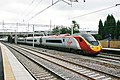
 Hugh llewelyn 323 322 (6420163445).jpg 600 × 399; 111 KB
-
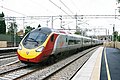
 Hugh llewelyn 390 041 (6420163727).jpg 600 × 399; 108 KB
-
 Hugh llewelyn 390 046 (6420163973).jpg 490 × 326; 58 KB
-
 A449 north of Prestwood, Staffordshire - geograph.org.uk - 984588.jpg 640 × 480; 129 KB
-
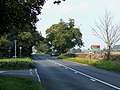
 A5 Near Weeford - geograph.org.uk - 982084.jpg 640 × 480; 73 KB
-
-
 Bales in flood - geograph.org.uk - 954980.jpg 640 × 426; 119 KB
-

-

-

-

-
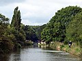
 Canalside Crane at Norbury - geograph.org.uk - 965198.jpg 480 × 640; 113 KB
-

-
 Crossing the Dove Aqueduct - geograph.org.uk - 955051.jpg 640 × 480; 112 KB
-
 Factory beside the Trent and Mersey Canal - geograph.org.uk - 965359.jpg 472 × 640; 103 KB
-
 Fence in the floods - geograph.org.uk - 954984.jpg 640 × 426; 68 KB
-
 Fence in the floods - geograph.org.uk - 954987.jpg 640 × 426; 59 KB
-
 Fence in the floods - geograph.org.uk - 954989.jpg 640 × 426; 86 KB
-

-

-

-
 Footpath From Hints - geograph.org.uk - 982203.jpg 640 × 480; 100 KB
-
 Footpath From Hints Church - geograph.org.uk - 982217.jpg 640 × 480; 140 KB
-
 Footpath Near Barton Gate - geograph.org.uk - 969739.jpg 480 × 640; 84 KB
-

-
 Footpath To Hints - geograph.org.uk - 982190.jpg 640 × 480; 136 KB
-
 Footpath to Lawnswood, Staffordshire - geograph.org.uk - 984746.jpg 480 × 640; 121 KB
-
 Footpath To Sandborough - geograph.org.uk - 969830.jpg 640 × 480; 131 KB
-
 Footpath towards Wordesley, West Midlands - geograph.org.uk - 979570.jpg 640 × 429; 126 KB
-
 Footpath, Hadley End - geograph.org.uk - 969815.jpg 640 × 480; 134 KB
-
 In the depths of Stoke Top Lock - geograph.org.uk - 986654.jpg 469 × 640; 101 KB
-

-
 Iron Bridge on the Trent and Mersey Canal - geograph.org.uk - 965356.jpg 640 × 480; 115 KB
-
 Looking northwards from Norbury Junction - geograph.org.uk - 965214.jpg 640 × 480; 114 KB
-

-
 Moored Boats at Norbury Junction - geograph.org.uk - 965190.jpg 640 × 480; 82 KB
-
 Mystery Railway sign, Stafford Common - geograph.org.uk - 987932.jpg 640 × 480; 121 KB
-

-

-
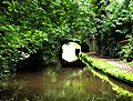
 Out of Cowley Tunnel - geograph.org.uk - 961822.jpg 640 × 480; 66 KB
-

-
 Pill box near Rolleston - geograph.org.uk - 954986.jpg 640 × 426; 125 KB
-
 River Dove near Rolleston - geograph.org.uk - 955081.jpg 640 × 480; 116 KB
-
 Rye Hill Bridge on the Shroppie - geograph.org.uk - 961825.jpg 640 × 480; 163 KB
-
 Stranded boats on the Stourbridge Canal - geograph.org.uk - 971899.jpg 640 × 480; 144 KB
-
 Tattenhill Lock - geograph.org.uk - 1132983.jpg 640 × 480; 65 KB
-

-
 The Boat - geograph.org.uk - 965771.jpg 640 × 480; 78 KB
-

-

-

-
 Tour of Britain 2008 Stoke J1.JPG 1,600 × 1,200; 329 KB
-

-

-
 Why's that then^ - geograph.org.uk - 954411.jpg 640 × 480; 182 KB


.jpg)
.jpg)
.jpg)


