Category:Seahouses
Jump to navigation
Jump to search
village in Northumberland, United Kingdom _07.jpg) | |||||
| Upload media | |||||
| Instance of | |||||
|---|---|---|---|---|---|
| Location | North Sunderland, Northumberland, North East England, England | ||||
 | |||||
English: Seahouses is a large village on the North Northumberland coast in England. It is about 20 km north of Alnwick, within the Northumberland Coast Area of Outstanding Natural Beauty.
Nederlands: Seahouses is een kustplaats in het bestuurlijke gebied Berwick-upon-Tweed, in het Engelse graafschap Northumberland.
Subcategories
This category has the following 8 subcategories, out of 8 total.
H
S
- Seahouses lighthouse (13 F)
- Seahouses railway station (2 F)
- Seahouses War Memorial (10 F)
T
- Travelsure (bus company) (2 F)
Media in category "Seahouses"
The following 200 files are in this category, out of 395 total.
(previous page) (next page)-
 ... post office, Seahouses, Northumberland. (2902702254).jpg 1,280 × 960; 164 KB
-
 175th Anniversary of the Forfarshire rescue - geograph.org.uk - 3641917.jpg 3,053 × 2,300; 1.11 MB
-
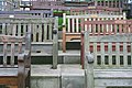 A Crowd of Benches - geograph.org.uk - 975292.jpg 640 × 427; 245 KB
-
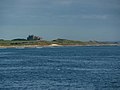
 Across Seahouses harbour - geograph.org.uk - 6235345.jpg 1,024 × 683; 413 KB
-
 Apartments at Seahouses - geograph.org.uk - 5482112.jpg 3,264 × 2,448; 2.02 MB
-
 Approaching Seahouses - geograph.org.uk - 4441291.jpg 1,600 × 992; 218 KB
-
 Approaching the main street of Seahouses - geograph.org.uk - 3380083.jpg 4,572 × 3,408; 4.29 MB
-
 Asterias rubens - Heritage Coast East (30861934690).jpg 1,500 × 963; 291 KB
-
 Bamburgh Castle - geograph.org.uk - 1930199.jpg 640 × 480; 100 KB
-
 Bamburgh Castle - geograph.org.uk - 2967987.jpg 2,267 × 1,246; 1.89 MB
-

-
 Bamburgh MMB 33.jpg 4,604 × 2,454; 3.39 MB
-
 Bamburgh MMB 34.jpg 4,548 × 2,508; 3.5 MB
-
 Beach and harbour, Seahouses - geograph.org.uk - 4519717.jpg 1,024 × 768; 179 KB
-
 Beach at Greenhill near Seahouses - geograph.org.uk - 946776.jpg 640 × 378; 42 KB
-
 Beach at Seahouses - geograph.org.uk - 946266.jpg 640 × 405; 63 KB
-
 Beach beside St Aidan's Dunes - geograph.org.uk - 728151.jpg 640 × 426; 52 KB
-
 Beach North of Seahouses - geograph.org.uk - 924187.jpg 640 × 342; 51 KB
-
 Beach south of Seahouses - geograph.org.uk - 915663.jpg 640 × 480; 63 KB
-
 Beach south of Seahouses - geograph.org.uk - 915680.jpg 640 × 456; 116 KB
-
 Beach south of Seahouses - geograph.org.uk - 918829.jpg 640 × 480; 70 KB
-
 Beach south of Seahouses - geograph.org.uk - 918834.jpg 640 × 480; 58 KB
-
 Beach south of Seahouses - geograph.org.uk - 918838.jpg 640 × 480; 110 KB
-
 Beach south of Seahouses - geograph.org.uk - 918842.jpg 640 × 480; 82 KB
-
 Beach south of Seahouses - geograph.org.uk - 918845.jpg 640 × 480; 77 KB
-
 Beach south of Seahouses - geograph.org.uk - 918850.jpg 640 × 480; 82 KB
-
 Beach south of Seahouses - geograph.org.uk - 924877.jpg 640 × 480; 107 KB
-
 Beach south of Seahouses - geograph.org.uk - 928624.jpg 640 × 480; 49 KB
-

-
 Big wave^ - geograph.org.uk - 571373.jpg 640 × 480; 48 KB
-
 Black Swan Inn - geograph.org.uk - 2700356.jpg 640 × 430; 71 KB
-
 Black Swan Inn, Seahouses - geograph.org.uk - 3485832.jpg 3,872 × 2,592; 3.98 MB
-
 Boarding a boat trip to the Farnes - geograph.org.uk - 3122852.jpg 1,024 × 768; 258 KB
-
 Boarding the pleasure boat - geograph.org.uk - 3089868.jpg 1,024 × 768; 123 KB
-
 Boat in Seahouses Harbour - geograph.org.uk - 2677971.jpg 640 × 430; 62 KB
-
 Boats in Seahouses Harbour - geograph.org.uk - 4648308.jpg 2,048 × 1,152; 621 KB
-
 Boats in Seahouses Harbour - geograph.org.uk - 5803694.jpg 4,032 × 3,024; 2.37 MB
-
 Boats in Seahouses Harbour - geograph.org.uk - 5805951.jpg 4,032 × 3,024; 1.46 MB
-
 Boats in Seahouses Harbour - geograph.org.uk - 5805963.jpg 4,032 × 3,024; 2.17 MB
-
 Braidcarr Rocks - geograph.org.uk - 2702315.jpg 640 × 430; 58 KB
-
 Braidcarr Rocks - geograph.org.uk - 2702322.jpg 640 × 430; 70 KB
-
 Braidcarr Rocks - geograph.org.uk - 924866.jpg 640 × 480; 131 KB
-
 Breakwater - geograph.org.uk - 3600543.jpg 640 × 428; 73 KB
-
 Breakwater at Seahouses harbour - geograph.org.uk - 5933240.jpg 1,600 × 1,200; 418 KB
-
 Breakwater, North Sunderland Harbour - geograph.org.uk - 3027667.jpg 640 × 480; 36 KB
-
 Breakwater, Seahouses - geograph.org.uk - 2691643.jpg 640 × 387; 45 KB
-
 British Isles rural and coastal (5561777943).jpg 4,288 × 2,848; 1.93 MB
-
 Buildings on the edge of Seahouses - geograph.org.uk - 2702319.jpg 640 × 430; 44 KB
-
 Carr End, Seahouses - geograph.org.uk - 456658.jpg 640 × 480; 81 KB
-
 Catamaran with gull flock - geograph.org.uk - 5803698.jpg 4,032 × 3,024; 1.42 MB
-

-
 Co-operative food store, Seahouses - geograph.org.uk - 2515945.jpg 640 × 427; 246 KB
-
 Coast path, south of Seahouses - geograph.org.uk - 915634.jpg 640 × 480; 49 KB
-
 Coast path, south of Seahouses - geograph.org.uk - 924888.jpg 640 × 480; 169 KB
-
 Coast path, south of Seahouses - geograph.org.uk - 924899.jpg 640 × 480; 117 KB
-

-

-
 Coastal Northumberland , Shoreston Sands, Seahouses - geograph.org.uk - 4015755.jpg 1,600 × 1,200; 153 KB
-

-

-

-
 Coastguard Station, Seahouses - geograph.org.uk - 4613130.jpg 4,503 × 3,377; 2.51 MB
-
 Concrete cubes on the beach south of Seahouses - geograph.org.uk - 3122864.jpg 1,024 × 768; 262 KB
-
 Council car park at Seahouses - geograph.org.uk - 3485772.jpg 3,872 × 2,592; 3.27 MB
-
 Crazy Golf, Seahouses - geograph.org.uk - 3444445.jpg 640 × 480; 103 KB
-
 Crewe St - geograph.org.uk - 2696702.jpg 640 × 430; 63 KB
-
 Crewe St - geograph.org.uk - 2700362.jpg 640 × 430; 66 KB
-
 Crewe Street, Seahouses - geograph.org.uk - 4519773.jpg 1,024 × 768; 172 KB
-
 Curry Leaf, Seahouses - geograph.org.uk - 2617418.jpg 640 × 459; 50 KB
-
 Disused Railway - geograph.org.uk - 180346.jpg 640 × 480; 183 KB
-
 Disused railway, Seahouses - geograph.org.uk - 2562723.jpg 640 × 480; 379 KB
-
 Dunstan View, Seahouses - geograph.org.uk - 3089836.jpg 1,024 × 768; 175 KB
-
 Eider Ducks with ducklings in Seahouses harbour - geograph.org.uk - 5976855.jpg 4,608 × 3,456; 4.71 MB
-
 End of the pier, Seahouses harbour - geograph.org.uk - 5511113.jpg 2,831 × 1,938; 2.28 MB
-
 Entering the inner harbour - geograph.org.uk - 4053672.jpg 1,600 × 1,200; 171 KB
-
 Entrance to Seahouses Harbour - geograph.org.uk - 5430861.jpg 4,896 × 2,055; 3.13 MB
-
 Evening in Seahouses Harbour - geograph.org.uk - 3613616.jpg 1,024 × 576; 189 KB
-
 Exiting North Sunderland Harbour - geograph.org.uk - 5067536.jpg 640 × 427; 104 KB
-

-
 Filling Station, King Street, Seahouses - geograph.org.uk - 3089824.jpg 1,024 × 768; 119 KB
-
 Fisherman's Flat, Seahouses - geograph.org.uk - 3474725.jpg 3,187 × 2,359; 3.41 MB
-
 Fishing Boat - geograph.org.uk - 2967981.jpg 640 × 429; 61 KB
-
 Fishing boat, Seahouses harbour - geograph.org.uk - 4520282.jpg 1,024 × 768; 175 KB
-
 Fishing Boats in Seahouses Harbour - geograph.org.uk - 4138519.jpg 1,600 × 1,067; 420 KB
-

-
 Fishing Boats Seahouses - geograph.org.uk - 5502324.jpg 640 × 419; 116 KB
-
 Fishing boats, Seahouses inner harbour - geograph.org.uk - 5507698.jpg 2,476 × 1,860; 1.88 MB
-

-
 Foreshore at Seahouses - geograph.org.uk - 924171.jpg 640 × 480; 77 KB
-
 Foreshore to the north of Seahouses - geograph.org.uk - 805383.jpg 640 × 426; 109 KB
-
 From Seahouses - geograph.org.uk - 1709100.jpg 640 × 428; 51 KB
-
 Gift shop above the harbour, Seahouses - geograph.org.uk - 1379455.jpg 640 × 447; 106 KB
-
 Gift shop, Seahouses - geograph.org.uk - 3492297.jpg 1,024 × 678; 150 KB
-
 Ginnel Leading Down to the Harbour - geograph.org.uk - 427299.jpg 427 × 640; 71 KB
-

-

-
 Greenhill Rocks, Seahouses - geograph.org.uk - 946744.jpg 640 × 480; 70 KB
-
 Gunpowder store, Pace Hill, Seahouses - geograph.org.uk - 410689.jpg 640 × 426; 131 KB
-
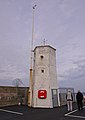
 H.M. Coastguard, Seahouses - geograph.org.uk - 2515949.jpg 640 × 480; 251 KB
-
 Harbour Office, Seahouses - geograph.org.uk - 1926934.jpg 480 × 640; 116 KB
-
 Harbour Road, Seahouses - geograph.org.uk - 1926962.jpg 640 × 480; 126 KB
-
 Harbour Wall and Lighthouse, Seahouses - geograph.org.uk - 4613144.jpg 3,456 × 4,608; 2.93 MB
-
 Harbour wall repairs - geograph.org.uk - 6235344.jpg 1,024 × 683; 403 KB
-
 Heavy seas outside Seahouses Harbour - geograph.org.uk - 5387065.jpg 1,500 × 769; 1 MB
-

-
 HM Coastguard, Seahouses - geograph.org.uk - 2676110.jpg 640 × 430; 54 KB
-

-

-
 Houses on Crewe St - geograph.org.uk - 2696691.jpg 640 × 430; 55 KB
-
 Houses on Crewe Street, Seahouses - geograph.org.uk - 2398962.jpg 800 × 536; 86 KB
-

-
 Inner harbour, Seahouses - geograph.org.uk - 4520230.jpg 1,024 × 768; 181 KB
-
 Inner Harbour, Seahouses - geograph.org.uk - 5507388.jpg 3,147 × 2,098; 1.74 MB
-
 King Street, Seahouses - geograph.org.uk - 2379010.jpg 800 × 600; 212 KB
-
 Kings Field - geograph.org.uk - 2660153.jpg 640 × 430; 54 KB
-
 Kipperfactoryseahouses.jpg 384 × 256; 19 KB
-

-
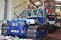 Lifeboat and tractor, Seahouses - geograph.org.uk - 3494096.jpg 1,024 × 678; 186 KB
-
 Lighthouse on Inner Farne - geograph.org.uk - 4520249.jpg 1,024 × 768; 90 KB
-

-
 Lighthouse, Seahouses Harbour - geograph.org.uk - 2399590.jpg 2,440 × 3,436; 4.73 MB
-

-
 Lime kilns, Seahouses - geograph.org.uk - 456528.jpg 640 × 480; 100 KB
-
 Little Rock - geograph.org.uk - 179685.jpg 640 × 480; 119 KB
-

-
 Lobster pots Seahouses - panoramio.jpg 2,592 × 1,936; 2.08 MB
-

-
 Looking north west from Seahouses - geograph.org.uk - 935026.jpg 640 × 480; 42 KB
-

-
 Looking south from Seahouses - geograph.org.uk - 2378906.jpg 800 × 600; 242 KB
-

-

-

-

-
 Low tide at Seahouses harbour. - geograph.org.uk - 5193259.jpg 640 × 480; 80 KB
-

-
 Main car park at Seahouses - geograph.org.uk - 1402435.jpg 640 × 480; 53 KB
-
 Main St - geograph.org.uk - 2696705.jpg 640 × 430; 59 KB
-
 Main Street - geograph.org.uk - 427206.jpg 640 × 427; 65 KB
-
 Main Street, Seahouses - geograph.org.uk - 1926915.jpg 640 × 480; 108 KB
-
 Main Street, Seahouses - geograph.org.uk - 2379014.jpg 800 × 600; 257 KB
-
 Main Street, Seahouses - geograph.org.uk - 3017216.jpg 1,600 × 1,200; 322 KB
-
 Memorial - geograph.org.uk - 521467.jpg 640 × 480; 104 KB
-
 Mine, Seahouses - geograph.org.uk - 2562743.jpg 640 × 480; 281 KB
-
 Mini Golf, Seahouses - geograph.org.uk - 2065405.jpg 640 × 480; 111 KB
-
 National Trust Shop, Seahouses - geograph.org.uk - 1942682.jpg 640 × 480; 128 KB
-
 National Trust shop, Seahouses - geograph.org.uk - 2562751.jpg 640 × 480; 255 KB
-
 National Trust shop, Seahouses - geograph.org.uk - 2676108.jpg 640 × 430; 72 KB
-
 National Trust Shop, Seahouses - geograph.org.uk - 3089909.jpg 1,024 × 768; 152 KB
-
 Navigational buoy off Seahouses - geograph.org.uk - 5805000.jpg 3,253 × 2,471; 1.05 MB
-
 Neptune chippy Seahouses - geograph.org.uk - 908409.jpg 640 × 427; 57 KB
-
 Newton Point, Low Tide - geograph.org.uk - 497701.jpg 640 × 480; 94 KB
-
 Night view of Seahouses Harbour - geograph.org.uk - 5986632.jpg 640 × 360; 49 KB
-
 No Parking Within Lines - geograph.org.uk - 5515839.jpg 3,888 × 2,592; 1.31 MB
-
 North Street, Seahouses - geograph.org.uk - 2378913.jpg 800 × 600; 235 KB
-
 North Sunderland Harbour - geograph.org.uk - 3027665.jpg 640 × 480; 48 KB
-
 North Sunderland Harbour - geograph.org.uk - 4441298.jpg 1,600 × 1,195; 339 KB
-
 North Sunderland Harbour - geograph.org.uk - 4774341.jpg 800 × 557; 404 KB
-
 North Sunderland Harbour - geograph.org.uk - 4774345.jpg 800 × 530; 381 KB
-
 North Sunderland harbour - geograph.org.uk - 5172141.jpg 640 × 480; 39 KB
-
 North Sunderland Harbour - geograph.org.uk - 5482105.jpg 3,264 × 2,448; 2.33 MB
-
 North Sunderland Harbour - geograph.org.uk - 5482501.jpg 3,264 × 2,448; 2.84 MB
-
 North Sunderland Harbour - geograph.org.uk - 5490530.jpg 3,266 × 2,177; 1.25 MB
-
 North Sunderland Harbour - geograph.org.uk - 6310058.jpg 1,024 × 678; 514 KB
-
 Northumberland Interiors , Coxon's Cafe, Seahouses - geograph.org.uk - 3219316.jpg 1,600 × 1,200; 337 KB
-
 Northumberland Townscape , Dunstan View, Seahouses - geograph.org.uk - 3219304.jpg 1,600 × 1,200; 328 KB
-

-
 Olde Ship, Seahouses - geograph.org.uk - 2065407.jpg 640 × 480; 93 KB
-
 Opposite The Sunset At Seahouses - geograph.org.uk - 751861.jpg 600 × 402; 33 KB
-
 Ordnance Survey One-Inch Sheet 71 Alnwick, Published 1947.jpg 10,849 × 12,736; 16.19 MB
-
 Ordnance Survey One-inch Sheet 71 Alnwick, Published 1965.jpg 8,193 × 9,887; 10.43 MB
-
 Ordnance Survey Sheet NU 23 Farne Islands, Published 1954.jpg 7,708 × 8,874; 22.17 MB
-
 Outbound from North Sunderland harbour...... - geograph.org.uk - 5552520.jpg 4,996 × 3,330; 2.41 MB
-
 Outer harbour wall at Seahouses - geograph.org.uk - 5803697.jpg 4,032 × 3,024; 1.58 MB
-
 Pace Hill - geograph.org.uk - 2400304.jpg 800 × 536; 89 KB
-
 Pace Hill, Seahouses - geograph.org.uk - 2400074.jpg 800 × 536; 87 KB
-
 Part Financed.jpg 3,100 × 2,400; 1.54 MB
-
 Passing fishing boat - geograph.org.uk - 3600545.jpg 640 × 428; 75 KB
-
 Path to the coast, south of Seahouses - geograph.org.uk - 915629.jpg 640 × 480; 107 KB
-

-
 Pinnacles, Seahouses - geograph.org.uk - 2660018.jpg 640 × 441; 63 KB
-
 Playing crazy golf, Seahouses - geograph.org.uk - 2379023.jpg 800 × 600; 248 KB
-

-
 Powder Store, North Sunderland Harbour - geograph.org.uk - 5482505.jpg 3,264 × 2,448; 3.12 MB
-

-

-
 Public Convenience, Seahouses - geograph.org.uk - 2660002.jpg 640 × 430; 45 KB
-
 Rainbow - Seahouses (4888761925).jpg 2,048 × 1,365; 382 KB
-
 Rear of The Viking, Seahouses - geograph.org.uk - 2399758.jpg 800 × 536; 64 KB
-

-
 Ripples on the Beach - geograph.org.uk - 919904.jpg 640 × 480; 36 KB
-
 RNLI Lifeboat "Grace Darling" approaching Seahouses harbour - geograph.org.uk - 3641935.jpg 3,183 × 2,304; 1.26 MB
-
 RNLI lifeboat "Grace Darling" nearing Seahouses - geograph.org.uk - 3641945.jpg 3,070 × 2,304; 1.14 MB
-
 Road in to town centre at Seahouses - geograph.org.uk - 1402430.jpg 640 × 480; 49 KB
-
 Road to Seahouses Harbour - geograph.org.uk - 2065412.jpg 640 × 480; 69 KB
-

-

-
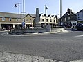
 Roundabout on Main Street, Seahouses - geograph.org.uk - 2158762.jpg 608 × 456; 105 KB
-

-
 Sea, Houses - geograph.org.uk - 5511428.jpg 1,600 × 998; 421 KB
.jpg)


.jpg)


.jpg)


_-_geograph.org.uk_-_3401458.jpg)


_-_geograph.org.uk_-_2696695.jpg)


_Harbour_-_geograph.org.uk_-_2696688.jpg)


_-_geograph.org.uk_-_986233.jpg)
_-_geograph.org.uk_-_986728.jpg)

.jpg)


