Category:Schwarzenbachtalsperre
Jump to navigation
Jump to search
| Object location | | View all coordinates using: OpenStreetMap |
|---|
dam  | |||||
| Upload media | |||||
| Instance of | |||||
|---|---|---|---|---|---|
| Made from material | |||||
| Location | Forbach, Rastatt district, Region Mittlerer Oberrhein, Karlsruhe Government Region, Baden-Württemberg, Germany | ||||
| Operator | |||||
| Start time |
| ||||
 | |||||
Subcategories
This category has the following 3 subcategories, out of 3 total.
Media in category "Schwarzenbachtalsperre"
The following 26 files are in this category, out of 26 total.
-
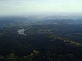
 Blackforest.JPG 4,272 × 2,848; 1.77 MB
-
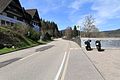
 Forbach - L83 + Schwarzenbachtalsperre 01 ies.jpg 5,616 × 3,744; 19.81 MB
-
 Forbach - L83 + Schwarzenbachtalsperre 02 ies.jpg 5,616 × 3,745; 22.56 MB
-
 Forbach - L83 + Schwarzenbachtalsperre 03 ies.jpg 5,616 × 3,745; 18.28 MB
-
 Forbach - L83 + Schwarzenbachtalsperre 04 ies.jpg 5,616 × 3,745; 18.94 MB
-
 Forbach - L83 - Schwarzenbachtalsperre 13 ies.jpg 3,744 × 5,616; 17.24 MB
-
 Forbach - L83 - Schwarzenbachtalsperre 14 ies.jpg 5,616 × 3,744; 18.65 MB
-
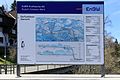
 Infotafel Rudolf-Fettweis-Werk.jpg 3,424 × 2,633; 807 KB
-
 Parking lot at Schwarzenbachtalsperre 2020-03-15 01.jpg 8,368 × 5,584; 24.65 MB
-
 Parking lot at Schwarzenbachtalsperre 2020-03-15 02.jpg 8,368 × 5,584; 24.71 MB
-
 Rastplatz an der Schwarzenbachtalsperre - panoramio.jpg 4,608 × 3,456; 8.73 MB
-
 Schwarzenbachtalsperre - panoramio.jpg 2,560 × 1,920; 1.57 MB
-
 Schwarzenbachtalsperre im Herbst - panoramio.jpg 2,592 × 3,888; 4.07 MB
-
 Schwarzenbachtalsperre008.JPG 4,000 × 3,000; 4.75 MB
-
 Schwarzenbachtalsperre019.JPG 4,000 × 3,000; 4.64 MB
-
 Schwarzenbachtalsperre026.JPG 4,000 × 3,000; 4.89 MB
-
 Schwarzenbachtalsperre027.JPG 4,000 × 3,000; 4.87 MB
-
 Tafel Schwarzenbachtalsperre.jpg 2,560 × 1,920; 546 KB
-
 Track around Schwarzenbachtalsperre 2020-03-10 01.jpg 8,368 × 5,584; 23.53 MB
-
 Track around Schwarzenbachtalsperre 2020-03-10 02.jpg 8,368 × 5,584; 23.81 MB
-
 Track around Schwarzenbachtalsperre 2020-03-10 03.jpg 8,368 × 5,584; 22.93 MB
-
 Track around Schwarzenbachtalsperre 2020-03-10 04.jpg 8,368 × 5,584; 23.68 MB
-
 Track around Schwarzenbachtalsperre 2020-03-10 05.jpg 8,368 × 5,584; 22.85 MB
-
 Trail at Schwarzenbachtalsperre dam 2020-03-10.jpg 8,368 × 5,584; 24.72 MB
-
 View from trail at Schwarzenbachtalsperre dam 2020-03-10.jpg 8,368 × 5,584; 24.51 MB
-
 Winter im Schwarzwald - panoramio (1).jpg 4,608 × 3,456; 7.31 MB


.jpg)