Category:Schron OPDOT Żabickie 68-ZB-11
Jump to navigation
Jump to search
| Object location | | View all coordinates using: OpenStreetMap |
|---|
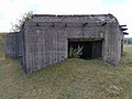
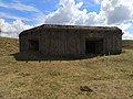
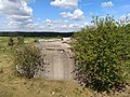
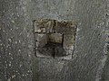
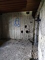
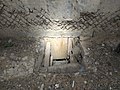
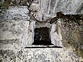
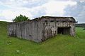
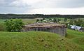
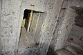
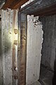
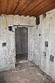
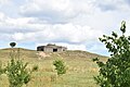
Dwukondygnacyjny schron do ognia czołowego ppanc. i ckm. Oznaczenie Kriepost 68-ZB-11, typ OPDOT-7a-P, Punkt Oporu Żabickie, 68 Grodzieński Rejon Umocniony, Linia Mołotowa. Uzbrojenie: 2xDOT-4 (armata kal. 45 mm + ckm, niezamontowane pancerze), 1xNPS-3 (ckm, niezamontowany pancerz)
Media in category "Schron OPDOT Żabickie 68-ZB-11"
The following 152 files are in this category, out of 152 total.
-
 68-ZB-11-OPDOT Zabickie 01.jpg 8,000 × 6,000; 17.6 MB
-
 68-ZB-11-OPDOT Zabickie 02.jpg 8,000 × 6,000; 16.5 MB
-
 68-ZB-11-OPDOT Zabickie 03.jpg 8,000 × 6,000; 17.04 MB
-
 68-ZB-11-OPDOT Zabickie 04.jpg 8,000 × 6,000; 18.93 MB
-
 68-ZB-11-OPDOT Zabickie 05.jpg 8,000 × 6,000; 16.5 MB
-
 68-ZB-11-OPDOT Zabickie 06.jpg 8,000 × 6,000; 19.03 MB
-
 68-ZB-11-OPDOT Zabickie 07.jpg 8,000 × 6,000; 25.69 MB
-
 68-ZB-11-OPDOT Zabickie 08.jpg 8,000 × 6,000; 27.38 MB
-
 68-ZB-11-OPDOT Zabickie 09.jpg 8,000 × 6,000; 27.26 MB
-
 68-ZB-11-OPDOT Zabickie 10.jpg 8,000 × 6,000; 25.96 MB
-
 68-ZB-11-OPDOT Zabickie 11.jpg 8,000 × 6,000; 24.98 MB
-
 68-ZB-11-OPDOT Zabickie 12.jpg 6,000 × 8,000; 26.28 MB
-
 68-ZB-11-OPDOT Zabickie 13.jpg 6,000 × 8,000; 28.7 MB
-
 68-ZB-11-OPDOT Zabickie 14.jpg 8,000 × 6,000; 21.99 MB
-
 68-ZB-11-OPDOT Zabickie 15.jpg 6,000 × 8,000; 21.28 MB
-
 68-ZB-11-OPDOT Zabickie 16.jpg 8,000 × 6,000; 16.09 MB
-
 68-ZB-11-OPDOT Zabickie 17.jpg 6,000 × 8,000; 15.75 MB
-
 68-ZB-11-OPDOT Zabickie 18.jpg 8,000 × 6,000; 15.49 MB
-
 68-ZB-11-OPDOT Zabickie 19.jpg 8,000 × 6,000; 14.86 MB
-
 68-ZB-11-OPDOT Zabickie 20.jpg 6,000 × 8,000; 13.77 MB
-
 68-ZB-11-OPDOT Zabickie 21.jpg 6,000 × 8,000; 15.51 MB
-
 68-ZB-11-OPDOT Zabickie 22.jpg 8,000 × 6,000; 15.56 MB
-
 68-ZB-11-OPDOT Zabickie 23.jpg 6,000 × 8,000; 14.01 MB
-
 68-ZB-11-OPDOT Zabickie 24.jpg 6,000 × 8,000; 15.05 MB
-
 68-ZB-11-OPDOT Zabickie 25.jpg 6,000 × 8,000; 13.47 MB
-
 68-ZB-11-OPDOT Zabickie 26.jpg 8,000 × 6,000; 16.58 MB
-
 68-ZB-11-OPDOT Zabickie 27.jpg 6,000 × 8,000; 13.83 MB
-
 68-ZB-11-OPDOT Zabickie 28.jpg 8,000 × 6,000; 15.7 MB
-
 68-ZB-11-OPDOT Zabickie 29.jpg 6,000 × 8,000; 15.23 MB
-
 68-ZB-11-OPDOT Zabickie 30.jpg 8,000 × 6,000; 17.03 MB
-
 68-ZB-11-OPDOT Zabickie 31.jpg 6,000 × 8,000; 14.48 MB
-
 68-ZB-11-OPDOT Zabickie 32.jpg 6,000 × 8,000; 13.35 MB
-
 68-ZB-11-OPDOT Zabickie 33.jpg 8,000 × 6,000; 14.95 MB
-
 68-ZB-11-OPDOT Zabickie 34.jpg 6,000 × 8,000; 17.65 MB
-
 68-ZB-11-OPDOT Zabickie 35.jpg 6,000 × 8,000; 17.61 MB
-
 68-ZB-11-OPDOT Zabickie 36.jpg 8,000 × 6,000; 18.33 MB
-
 68-ZB-11-OPDOT Zabickie 37.jpg 8,000 × 6,000; 18.34 MB
-
 68-ZB-11-OPDOT Zabickie 38.jpg 6,000 × 8,000; 16.91 MB
-
 68-ZB-11-OPDOT Zabickie 39.jpg 8,000 × 6,000; 14.38 MB
-
 68-ZB-11-OPDOT Zabickie 40.jpg 8,000 × 6,000; 15.31 MB
-
 68-ZB-11-OPDOT Zabickie 41.jpg 6,000 × 8,000; 13.1 MB
-
 68-ZB-11-OPDOT Zabickie 42.jpg 6,000 × 8,000; 12.96 MB
-
 68-ZB-11-OPDOT Zabickie 43.jpg 8,000 × 6,000; 15.48 MB
-
 68-ZB-11-OPDOT Zabickie 44.jpg 4,000 × 3,000; 2.34 MB
-
 68-ZB-11-OPDOT Zabickie 45.jpg 4,000 × 3,000; 2.42 MB
-
 68-ZB-11-OPDOT Zabickie 46.jpg 4,000 × 3,000; 5.19 MB
-
 68-ZB-11-OPDOT Zabickie 47.jpg 4,000 × 3,000; 2.21 MB
-
 68-ZB-11-OPDOT Zabickie 48.jpg 4,000 × 3,000; 5.42 MB
-
 68-ZB-11-OPDOT Zabickie 49.jpg 4,000 × 3,000; 5.1 MB
-
 68-ZB-11-OPDOT Zabickie 50.jpg 3,000 × 4,000; 5.6 MB
-
 68-ZB-11-OPDOT Zabickie 51.jpg 3,000 × 4,000; 4.68 MB
-
 68-ZB-11-OPDOT Zabickie 52.jpg 3,000 × 4,000; 4.97 MB
-
 68-ZB-11-OPDOT Zabickie 53.jpg 4,000 × 3,000; 5.33 MB
-
 68-ZB-11-OPDOT Zabickie 54.jpg 4,000 × 3,000; 5.2 MB
-
 68-ZB-11-OPDOT Zabickie 55.jpg 4,000 × 3,000; 5.42 MB
-
 68-ZB-11-OPDOT Zabickie 56.jpg 4,000 × 3,000; 4.75 MB
-
 68-ZB-11-OPDOT Zabickie 57.jpg 4,000 × 3,000; 5.77 MB
-
 68-ZB-11-OPDOT Zabickie 58.jpg 3,000 × 4,000; 4.81 MB
-
 68-ZB-11-OPDOT Zabickie 59.jpg 4,000 × 3,000; 5.19 MB
-
 68-ZB-11-OPDOT Zabickie 60.jpg 4,000 × 3,000; 5.66 MB
-
 68-ZB-11-OPDOT Zabickie 61.jpg 4,000 × 3,000; 5.78 MB
-
 68-ZB-11-OPDOT Zabickie 62.jpg 4,000 × 3,000; 4.98 MB
-
 68-ZB-11-OPDOT Zabickie 63.jpg 4,000 × 3,000; 4.84 MB
-
 68-ZB-11-OPDOT Zabickie 64.jpg 4,000 × 3,000; 5.65 MB
-
 68-ZB-11-OPDOT Zabickie 65.jpg 3,000 × 4,000; 4.71 MB
-
 68-ZB-11-OPDOT Zabickie 66.jpg 4,000 × 3,000; 5.33 MB
-
 68-ZB-11-OPDOT Zabickie 67.jpg 3,000 × 4,000; 4.89 MB
-
 68-ZB-11-OPDOT Zabickie 68.jpg 4,000 × 3,000; 5.54 MB
-
 68-ZB-11-OPDOT Zabickie 69.jpg 3,000 × 4,000; 4.33 MB
-
 68-ZB-11-OPDOT Zabickie 70.jpg 3,000 × 4,000; 5 MB
-
 68-ZB-11-OPDOT Zabickie 71.jpg 4,000 × 3,000; 4.36 MB
-
 Żabickie (Žabickiai, Жабіцкія) - bunker 02.JPG 2,304 × 1,536; 2.4 MB
-
 Żabickie (Žabickiai, Жабіцкія) - bunker.JPG 2,304 × 1,406; 2.36 MB
-
 Żabickie ZB-11, część I 01.jpg 6,000 × 4,000; 20.01 MB
-
 Żabickie ZB-11, część I 02.jpg 6,000 × 4,000; 17.24 MB
-
 Żabickie ZB-11, część I 03.jpg 6,000 × 4,000; 18.79 MB
-
 Żabickie ZB-11, część I 04.jpg 6,000 × 4,000; 18.78 MB
-
 Żabickie ZB-11, część I 05.jpg 6,000 × 4,000; 19.4 MB
-
 Żabickie ZB-11, część I 06.jpg 6,000 × 4,000; 18.9 MB
-
 Żabickie ZB-11, część I 07.jpg 6,000 × 4,000; 18.77 MB
-
 Żabickie ZB-11, część I 08.jpg 6,000 × 4,000; 20.83 MB
-
 Żabickie ZB-11, część I 09.jpg 6,000 × 4,000; 19.13 MB
-
 Żabickie ZB-11, część I 10.jpg 6,000 × 4,000; 15.61 MB
-
 Żabickie ZB-11, część I 11.jpg 6,000 × 4,000; 14.79 MB
-
 Żabickie ZB-11, część I 12.jpg 6,000 × 4,000; 14.76 MB
-
 Żabickie ZB-11, część I 13.jpg 6,000 × 4,000; 14.74 MB
-
 Żabickie ZB-11, część I 14.jpg 6,000 × 4,000; 14.15 MB
-
 Żabickie ZB-11, część I 15.jpg 6,000 × 4,000; 14.27 MB
-
 Żabickie ZB-11, część I 16.jpg 6,000 × 4,000; 15.19 MB
-
 Żabickie ZB-11, część I 17.jpg 6,000 × 4,000; 14.61 MB
-
 Żabickie ZB-11, część I 18.jpg 4,000 × 6,000; 14.67 MB
-
 Żabickie ZB-11, część I 19.jpg 4,000 × 6,000; 13.68 MB
-
 Żabickie ZB-11, część I 20.jpg 4,000 × 6,000; 15.7 MB
-
 Żabickie ZB-11, część I 21.jpg 6,000 × 4,000; 17.09 MB
-
 Żabickie ZB-11, część I 22.jpg 6,000 × 4,000; 14.35 MB
-
 Żabickie ZB-11, część I 23.jpg 6,000 × 4,000; 15.52 MB
-
 Żabickie ZB-11, część I 24.jpg 6,000 × 4,000; 15.67 MB
-
 Żabickie ZB-11, część I 25.jpg 6,000 × 4,000; 15.72 MB
-
 Żabickie ZB-11, część I 26.jpg 6,000 × 4,000; 14.72 MB
-
 Żabickie ZB-11, część I 27.jpg 6,000 × 4,000; 14.65 MB
-
 Żabickie ZB-11, część I 28.jpg 6,000 × 4,000; 14.86 MB
-
 Żabickie ZB-11, część I 29.jpg 6,000 × 4,000; 15.96 MB
-
 Żabickie ZB-11, część I 30.jpg 6,000 × 4,000; 16.98 MB
-
 Żabickie ZB-11, część I 31.jpg 4,000 × 6,000; 15.96 MB
-
 Żabickie ZB-11, część I 32.jpg 6,000 × 4,000; 16.82 MB
-
 Żabickie ZB-11, część I 33.jpg 6,000 × 4,000; 14.97 MB
-
 Żabickie ZB-11, część I 34.jpg 6,000 × 4,000; 15.15 MB
-
 Żabickie ZB-11, część I 35.jpg 6,000 × 4,000; 14.39 MB
-
 Żabickie ZB-11, część I 36.jpg 6,000 × 4,000; 14.35 MB
-
 Żabickie ZB-11, część I 37.jpg 6,000 × 4,000; 15.12 MB
-
 Żabickie ZB-11, część I 38.jpg 6,000 × 4,000; 15.45 MB
-
 Żabickie ZB-11, część I 39.jpg 4,000 × 6,000; 14.61 MB
-
 Żabickie ZB-11, część I 40.jpg 4,000 × 6,000; 14.23 MB
-
 Żabickie ZB-11, część I 41.jpg 6,000 × 4,000; 14.4 MB
-
 Żabickie ZB-11, część I 42.jpg 4,000 × 6,000; 15.3 MB
-
 Żabickie ZB-11, część I 43.jpg 6,000 × 4,000; 15.03 MB
-
 Żabickie ZB-11, część I 44.jpg 6,000 × 4,000; 15.54 MB
-
 Żabickie ZB-11, część I 45.jpg 6,000 × 4,000; 15.67 MB
-
 Żabickie ZB-11, część I 46.jpg 6,000 × 4,000; 16.3 MB
-
 Żabickie ZB-11, część I 47.jpg 6,000 × 4,000; 16.17 MB
-
 Żabickie ZB-11, część I 48.jpg 6,000 × 4,000; 16.2 MB
-
 Żabickie ZB-11, część I 49.jpg 4,000 × 6,000; 14.83 MB
-
 Żabickie ZB-11, część I 50.jpg 4,000 × 6,000; 17.81 MB
-
 Żabickie ZB-11, część II 01.jpg 4,000 × 6,000; 17.18 MB
-
 Żabickie ZB-11, część II 02.jpg 6,000 × 4,000; 14.96 MB
-
 Żabickie ZB-11, część II 03.jpg 6,000 × 4,000; 14.84 MB
-
 Żabickie ZB-11, część II 04.jpg 4,000 × 6,000; 15.54 MB
-
 Żabickie ZB-11, część II 05.jpg 6,000 × 4,000; 13.9 MB
-
 Żabickie ZB-11, część II 06.jpg 6,000 × 4,000; 13.63 MB
-
 Żabickie ZB-11, część II 07.jpg 6,000 × 4,000; 14.78 MB
-
 Żabickie ZB-11, część II 08.jpg 6,000 × 4,000; 14.04 MB
-
 Żabickie ZB-11, część II 09.jpg 6,000 × 4,000; 16.39 MB
-
 Żabickie ZB-11, część II 10.jpg 4,000 × 6,000; 16.93 MB
-
 Żabickie ZB-11, część II 11.jpg 4,000 × 6,000; 14.43 MB
-
 Żabickie ZB-11, część II 12.jpg 6,000 × 4,000; 15.78 MB
-
 Żabickie ZB-11, część II 13.jpg 4,000 × 6,000; 15.98 MB
-
 Żabickie ZB-11, część II 14.jpg 4,000 × 6,000; 14.5 MB
-
 Żabickie ZB-11, część II 15.jpg 6,000 × 4,000; 16.36 MB
-
 Żabickie ZB-11, część II 16.jpg 6,000 × 4,000; 16.19 MB
-
 Żabickie ZB-11, część II 17.jpg 6,000 × 4,000; 16.31 MB
-
 Żabickie ZB-11, część II 18.jpg 6,000 × 4,000; 16.35 MB
-
 Żabickie ZB-11, część II 19.jpg 6,000 × 4,000; 15.85 MB
-
 Żabickie ZB-11, część II 20.jpg 6,000 × 4,000; 14.46 MB
-
 Żabickie ZB-11, część II 21.jpg 6,000 × 4,000; 15.39 MB
-
 Żabickie ZB-11, część II 22.jpg 6,000 × 4,000; 21.19 MB
-
 Żabickie ZB-11, część II 23.jpg 6,000 × 4,000; 18.47 MB
-
 Żabickie ZB-11, część II 24.jpg 6,000 × 4,000; 17.07 MB
-
 Żabickie ZB-11, część II 25.jpg 6,000 × 4,000; 16.24 MB
-
 Żabickie ZB-11, część II 26.jpg 6,000 × 4,000; 17.24 MB
-
 Żabickie ZB-11, część II 27.jpg 6,000 × 4,000; 19.12 MB
-
 Żabickie ZB-11, część II 28.jpg 6,000 × 4,000; 17.98 MB
-
 Żabickie ZB-11, część II 29.jpg 6,000 × 4,000; 18.38 MB


_-_bunker_02.JPG)
_-_bunker.JPG)


