Category:Satellite pictures of Israel
Jump to navigation
Jump to search
Countries of Asia: Afghanistan · Armenia‡ · Azerbaijan‡ · Bahrain · Bangladesh · Bhutan · Brunei · Cambodia · People's Republic of China · Cyprus‡ · East Timor · Egypt‡ · Georgia‡ · India · Indonesia‡ · Iran · Iraq · Israel · Japan · Jordan · Kazakhstan‡ · Kuwait · Kyrgyzstan · Laos · Lebanon · Malaysia · Maldives · Mongolia · Myanmar · Nepal · North Korea · Oman · Pakistan · Philippines · Qatar · Russia‡ · Saudi Arabia · Singapore · South Korea · Sri Lanka · Syria · Tajikistan · Thailand · Turkey‡ · Turkmenistan · United Arab Emirates · Uzbekistan · Vietnam · Yemen
Limited recognition: Taiwan · State of Palestine – Other territories: British Indian Ocean Territory · Hong Kong
‡: partly located in Asia
Limited recognition: Taiwan · State of Palestine – Other territories: British Indian Ocean Territory · Hong Kong
‡: partly located in Asia
Satellite pictures of Israel and environs. See also Category:Maps of Israel.
Subcategories
This category has the following 7 subcategories, out of 7 total.
J
P
S
T
Media in category "Satellite pictures of Israel"
The following 48 files are in this category, out of 48 total.
-
 Aerial jordan.jpg 248 × 479; 37 KB
-
 AERONET Nes Ziona.2010337.aqua.250m.jpg 1,044 × 760; 141 KB
-
 Al-Lajat (Traconitide argob trachonities).png 1,394 × 1,775; 3.48 MB
-

-
 Bliski Wschód - mapa polityczna.jpg 2,200 × 2,800; 1.56 MB
-
 Border between Israel and Egypt visible from space.jpg 1,024 × 679; 151 KB
-
 Carmel Fire 2010 MODIS.gif 660 × 450; 367 KB
-
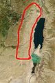
 Dead Sea (satellite view).jpg 2,048 × 1,280; 411 KB
-
 Dead Sea 1920px.jpg 832 × 1,920; 589 KB
-
 Dead Sea Comparative.jpg 540 × 437; 113 KB
-
 Dead Sea Galilee.jpg 1,162 × 1,920; 645 KB
-
 Dead Sea new salt.jpg 2,050 × 1,405; 1.46 MB
-
 Dead Sea, Israel by Hodoyoshi-1.jpg 2,048 × 1,280; 949 KB
-
 Dode zee.jpg 400 × 320; 29 KB
-
 Gaza, Jordan, Israel & Zaatari Refugee Camp (34460561521).jpg 12,649 × 13,073; 30.78 MB
-
 Gulf of Aqaba - Golf von Akaba.jpg 5,568 × 3,712; 4.07 MB
-
 HaifaFire24112016.jpg 892 × 844; 91 KB
-
 HaifaFireThemal.jpg 962 × 644; 42 KB
-
 Incense Route - Desert Cities in the Negev.jpg 621 × 1,030; 132 KB
-
 Israel amo 2010337 lrg.jpg 2,200 × 2,800; 836 KB
-
 Israel at night.jpg 425 × 934; 174 KB
-
 Israel Egypt Border.JPG 423 × 552; 113 KB
-
 Israel-Egypt-Gaza border region.jpg 720 × 480; 165 KB
-
 Judean Desert Map closeup.jpg 355 × 532; 64 KB
-
 Judean Desert Map.jpg 700 × 1,802; 316 KB
-
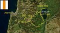 Map of Jesus Trail-he.jpg 477 × 263; 32 KB
-
 Map of Jesus Trail.jpg 675 × 820; 436 KB
-
 Map of Jesus Trail1.jpg 502 × 263; 39 KB
-
 March 2011 Snow in Lebanon.jpg 2,800 × 3,600; 1.51 MB
-
 MiddleEast A2003031 0820 250m without lines.jpg 2,200 × 2,800; 1.7 MB
-
 MiddleEast tmo 2013349 lrg.jpg 4,353 × 3,608; 1.72 MB
-
 MiddleEast tmo 2013349.jpg 720 × 720; 213 KB
-
 MiddleEast.A2003031.0820.250m (cropped-01).jpg 826 × 1,754; 662 KB
-
 MiddleEast.A2003031.0820.250m.jpg 2,200 × 2,800; 1.19 MB
-
 Modis near east.jpg 540 × 540; 80 KB
-
 Near east lrg.jpg 2,987 × 3,967; 2.62 MB
-
 Nighttime View of Northern Egypt and the Sinai Peninsula.jpg 4,928 × 3,280; 2.19 MB
-
 Palestine Routes Test.svg 412 × 600; 161 KB
-
 Redsea sandstorm May13-2005.jpg 5,600 × 4,400; 2.43 MB
-
 Satellite image Haifa bay.jpg 273 × 160; 7 KB
-
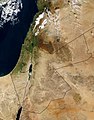
 Satellite image of Israel in January 2003.jpg 727 × 1,731; 393 KB
-
 Satellite of Eretz Israel.jpeg 282 × 260; 11 KB
-
 Satellite Sees Holiday Lights Brighten Cities - Cairo (15415292194).jpg 1,024 × 676; 81 KB
-
 SinaiFromTheISS2013.jpg 1,024 × 679; 148 KB
-
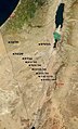
 Southeast mediterranean annotated geography.jpg 831 × 1,809; 525 KB
-
 Southern Israel Geology.jpg 551 × 751; 81 KB
-
 The Nile Delta and the Sinai Peninsula ESA200130.jpg 827 × 827; 362 KB
-
 Turquoise Swirls in the Black Sea.jpg 7,000 × 7,000; 16.71 MB


.png)


.jpg)


.jpg)


.jpg)


.jpg)


