Category:Sainte-Chapelle de Bourges
Jump to navigation
Jump to search
| Object location | | View all coordinates using: OpenStreetMap |
|---|
chapel located in Cher, in France   | |||||
| Upload media | |||||
| Instance of | |||||
|---|---|---|---|---|---|
| Location | Bourges, Cher, Centre-Val de Loire, Metropolitan France, France | ||||
| Architectural style | |||||
 | |||||
Subcategories
This category has the following 2 subcategories, out of 2 total.
Media in category "Sainte-Chapelle de Bourges"
The following 16 files are in this category, out of 16 total.
-
 Jean Fouquet - Heures d'Etienne Chevalier, n° 204 - L'Annonciation - Google Art Project.jpg 2,049 × 2,838; 1.88 MB
-

-
 Bourges Cathédrale 1241.jpg 3,456 × 5,184; 7.89 MB
-
 Bourges Cathédrale 1242.jpg 3,074 × 4,712; 3.33 MB
-
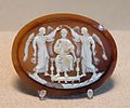 Cameo enthroned prince Louvre MR80.jpg 1,225 × 1,020; 798 KB
-
 Cameo prince Louvre MR54 (cropped).jpg 840 × 1,144; 459 KB
-
 Cameo prince Louvre MR54.jpg 1,050 × 1,400; 716 KB
-
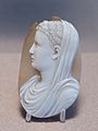
 Hans Holbein d. J. - Jeanne de Boulogne, Duchess of Berry - WGA11592.jpg 704 × 1,007; 72 KB
-
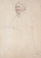 Jean de France, Duke of Berry, drawing of effigy, Hans Holbein the Younger.jpg 2,015 × 2,852; 2.35 MB
-
 Jean Fouquet 008.jpg 1,383 × 1,640; 1.61 MB
-
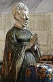
 JeanBerry svOndrej.jpg 804 × 802; 266 KB
-
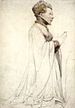
 Jeanne de Boulogne, Duchess of Berry, drawing of sculpture, Hans Holbein the Younger.jpg 2,317 × 3,350; 3.12 MB
-

-
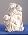 Le sommeil des apôtres.jpg 549 × 687; 53 KB
-

-
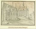 Sainte-Chapelle de Bourges.jpg 5,412 × 4,269; 2.46 MB
.jpg)


.jpg)


_by_Hans_Holbein_d.J..jpg)
