Category:SVG maps the Danube watercourse system
Jump to navigation
Jump to search
Media in category "SVG maps the Danube watercourse system"
The following 19 files are in this category, out of 19 total.
-
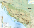 Dinaric Alps map-fr.svg 1,857 × 1,503; 3.63 MB
-
 Autriche hydro-de.svg 711 × 399; 233 KB
-
 Autriche hydro-fr.svg 711 × 399; 233 KB
-
 Bečva River (CZE) - location and watershed.svg 5,342 × 3,123; 138 KB
-
 Map at millstaetter see sv.svg 1,313 × 744; 238 KB
-
 Map at millstaetter see.svg 1,313 × 744; 124 KB
-
 Hornád River - location and watershed map.svg 4,680 × 2,518; 119 KB
-
 Hron River - location and watershed map.svg 4,680 × 2,518; 121 KB
-
 Hungary map blank.svg 1,600 × 1,400; 231 KB
-
 Ipeľ River (SVK) - location and watershed.svg 4,680 × 2,518; 122 KB
-
 Karte Traisen (Fluss).svg 1,200 × 1,200; 125 KB
-
 Belene Island map.svg 850 × 476; 59 KB
-
 Np gesaeuse.svg 1,270 × 950; 331 KB
-
 Rožnovská brázda (CZE) - location map.svg 5,342 × 3,123; 327 KB
-
 Slaná River - location and watershed map.svg 4,680 × 2,518; 118 KB
-
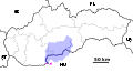
 Slovakia rivers without text 2008-11-17.svg 1,220 × 630; 190 KB
-
 Váh River (SVK) - location and watershed.svg 4,680 × 2,518; 128 KB
-
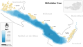
 Waterways of SE Central Europe.svg 1,415 × 1,059; 286 KB
-
 HQL Plan 4C.svg 1,140 × 655; 289 KB


_-_location_and_watershed.svg)


_-_location_and_watershed.svg)
.svg)


_-_location_map.svg)


_-_location_and_watershed.svg)

