Category:SVG map series of the Near East
Jump to navigation
Jump to search
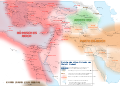
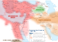
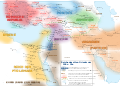
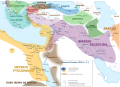
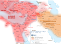
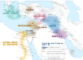
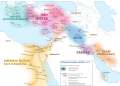
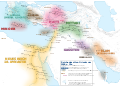
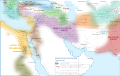
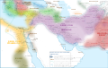
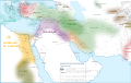
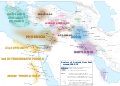
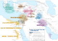
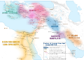
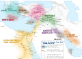
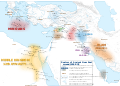
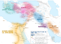
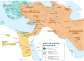
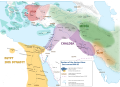
This category will contain two map series, detailing history of the Near East per century.
The first map series shows historical situations of the Ancient Orient from 2600 BCE to 600 AD/CE. (first draft finished in German, translation to English planned) The second map series will show historical situations of the Orient from 600 AD to current. (planned in a style similar to the first series)
The master file for the maps of the 1st series is file:Ancient Orient History Map basis.de.svg.
Media in category "SVG map series of the Near East"
The following 74 files are in this category, out of 74 total.
-
 Alter Orient 0001AD.svg 2,102 × 1,510; 5.05 MB
-
 Alter Orient 0100AD.svg 2,102 × 1,510; 4.9 MB
-
 Alter Orient 0100BC-es.svg 2,102 × 1,510; 3.84 MB
-
 Alter Orient 0100BC.svg 2,102 × 1,510; 4.77 MB
-
 Alter Orient 0200AD.svg 2,102 × 1,510; 4.73 MB
-
 Alter Orient 0200BC-es.svg 2,102 × 1,510; 3.64 MB
-
 Alter Orient 0200BC.svg 2,102 × 1,510; 4.9 MB
-
 Alter Orient 0300AD-es.svg 2,102 × 1,510; 3.89 MB
-
 Alter Orient 0300AD.svg 2,102 × 1,510; 5.13 MB
-
 Alter Orient 0300BC-es.svg 2,102 × 1,510; 3.6 MB
-
 Alter Orient 0300BC.svg 2,102 × 1,510; 5.03 MB
-
 Alter Orient 0400AD.svg 2,102 × 1,510; 4.96 MB
-
 Alter Orient 0400BC.svg 2,102 × 1,510; 4.71 MB
-
 Alter Orient 0500AD.svg 2,102 × 1,510; 4.83 MB
-
 Alter Orient 0500BC.svg 2,102 × 1,510; 4.83 MB
-
 Alter Orient 0600AD-es.svg 2,102 × 1,510; 3.55 MB
-
 Alter Orient 0600AD.svg 2,102 × 1,510; 4.71 MB
-
 Alter Orient 0600BC.svg 2,102 × 1,510; 4.95 MB
-
 Alter Orient 0700BC.svg 2,102 × 1,510; 4.7 MB
-
 Alter Orient 0800BC-es.svg 2,102 × 1,510; 3.54 MB
-
 Alter Orient 0800BC.svg 2,102 × 1,510; 4.81 MB
-
 Alter Orient 0900BC.svg 2,102 × 1,510; 4.93 MB
-
 Alter Orient 1000BC.svg 2,102 × 1,510; 4.69 MB
-
 Alter Orient 1100BC.svg 2,102 × 1,510; 4.79 MB
-
 Alter Orient 1200BC-es.svg 2,102 × 1,510; 3.57 MB
-
 Alter Orient 1200BC.svg 2,102 × 1,510; 4.71 MB
-
 Alter Orient 1300BC.svg 2,102 × 1,510; 4.71 MB
-
 Alter Orient 1400BC-pt.svg 2,060 × 1,471; 5.69 MB
-
 Alter Orient 1400BC.svg 2,102 × 1,510; 4.82 MB
-
 Alter Orient 1500BC.svg 2,102 × 1,510; 4.95 MB
-
 Alter Orient 1600BC.svg 2,102 × 1,510; 5.06 MB
-
 Alter Orient 1700BC-es.svg 2,102 × 1,510; 3.5 MB
-
 Alter Orient 1700BC.svg 2,102 × 1,510; 4.69 MB
-
 Alter Orient 1800BC.svg 2,102 × 1,510; 4.8 MB
-
 Alter Orient 1900BC.svg 2,102 × 1,510; 4.91 MB
-
 Alter Orient 2000BC.svg 2,102 × 1,510; 4.84 MB
-
 Alter Orient 2100BC.svg 2,102 × 1,510; 4.84 MB
-
 Alter Orient 2200BC.svg 2,102 × 1,510; 4.84 MB
-
 Alter Orient 2300BC.svg 2,102 × 1,510; 4.65 MB
-
 Alter Orient 2400BC.svg 2,102 × 1,510; 4.66 MB
-
 Alter Orient 2500BC.svg 2,102 × 1,510; 4.65 MB
-
 Alter Orient 2600BC.svg 2,102 × 1,510; 4.64 MB
-
 Alter Orient+Persien 100BC.svg 3,100 × 1,960; 14.78 MB
-
 Alter Orient+Persien 200BC.svg 3,100 × 1,960; 7.38 MB
-
 Alter Orient+Persien 300BC.svg 3,100 × 1,960; 7.38 MB
-
 Alter Orient+Persien 400BC.svg 3,100 × 1,960; 7.38 MB
-
 Alter Orient+Persien 500BC.svg 3,100 × 1,960; 7.38 MB
-
 Alter Orient+Persien 600BC.svg 3,100 × 1,960; 7.38 MB
-
 Ancient Near East 0700BC.svg 2,102 × 1,510; 4.7 MB
-
 Ancient Near East 0800BC.svg 2,102 × 1,510; 4.81 MB
-
 Ancient Near East 0900BC.svg 2,102 × 1,510; 4.92 MB
-
 Ancient Near East 1000BC.svg 2,102 × 1,510; 4.69 MB
-
 Ancient Near East 1100BC.svg 2,102 × 1,510; 4.78 MB
-
 Ancient Near East 1200BC.svg 2,102 × 1,510; 4.7 MB
-
 Ancient Near East 1300BC.svg 2,102 × 1,510; 4.71 MB
-
 Ancient Near East 1400BC.svg 2,102 × 1,510; 4.81 MB
-
 Ancient Near East 1500BC.svg 2,102 × 1,510; 4.93 MB
-
 Ancient Near East 1600BC.svg 2,102 × 1,510; 5.04 MB
-
 Ancient Near East 1700BC.svg 2,102 × 1,510; 4.69 MB
-
 Ancient Near East 1800BC.svg 2,102 × 1,510; 4.79 MB
-
 Ancient Near East 1900BC.svg 2,102 × 1,510; 4.89 MB
-
 Ancient Near East 2000BC.svg 2,102 × 1,510; 4.83 MB
-
 Ancient Near East 2100BC.svg 2,102 × 1,510; 4.83 MB
-
 Ancient Near East 2200BC.svg 2,102 × 1,510; 4.83 MB
-
 Ancient Near East 2300BC.svg 2,102 × 1,510; 4.65 MB
-
 Ancient Near East 2400BC.svg 2,102 × 1,510; 4.65 MB
-
 Ancient Near East 2500BC.svg 2,102 × 1,510; 4.65 MB
-
 Ancient Near East 2600BC.svg 2,102 × 1,510; 4.63 MB
-
 Ancient Orient History Map basis.de.svg 2,102 × 1,510; 8.63 MB
-
 Near East 400BC.svg 2,102 × 1,510; 4.7 MB
-
 Near East 500BC.svg 2,102 × 1,510; 4.81 MB
-
 Near East 600BC.svg 2,102 × 1,510; 4.93 MB
-
 Okcidenta Azio 1500 antaŭ nia erao (eo).svg 2,102 × 1,510; 4.93 MB
-
 Orient+Persien 1100AD.svg 3,100 × 1,960; 10.48 MB


.svg)
