Category:SVG locator maps of districts of Arunachal Pradesh - old
Jump to navigation
Jump to search
Media in category "SVG locator maps of districts of Arunachal Pradesh - old"
The following 16 files are in this category, out of 16 total.
-
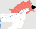 Arunachal Pradesh district location map Anjaw.svg 2,393 × 1,956; 261 KB
-
 Arunachal Pradesh district location map Changlang.svg 2,393 × 1,956; 261 KB
-
 Arunachal Pradesh district location map East Kameng.svg 2,393 × 1,956; 261 KB
-
 Arunachal Pradesh district location map East Siang.svg 2,393 × 1,956; 261 KB
-
 Arunachal Pradesh district location map Kurung Kumey.svg 2,393 × 1,956; 261 KB
-
 Arunachal Pradesh district location map Lohit.svg 2,393 × 1,956; 261 KB
-
 Arunachal Pradesh district location map Lower Dibang Valley.svg 2,393 × 1,956; 261 KB
-
 Arunachal Pradesh district location map Lower Subansiri.svg 2,393 × 1,956; 261 KB
-
 Arunachal Pradesh district location map Papum Pare.svg 2,393 × 1,956; 261 KB
-
 Arunachal Pradesh district location map Tawang.svg 2,393 × 1,956; 261 KB
-
 Arunachal Pradesh district location map Tirap.svg 2,393 × 1,956; 261 KB
-
 Arunachal Pradesh district location map Upper Dibang Valley.svg 2,393 × 1,956; 261 KB
-
 Arunachal Pradesh district location map Upper Siang.svg 2,393 × 1,956; 261 KB
-
 Arunachal Pradesh district location map Upper Subansiri.svg 2,393 × 1,956; 261 KB
-
 Arunachal Pradesh district location map West Kameng.svg 2,393 × 1,956; 261 KB
-
 Arunachal Pradesh district location map West Siang.svg 2,393 × 1,956; 261 KB


