Category:SVG locator maps of Puerto Rico (location map scheme)
Jump to navigation
Jump to search

|
SVG maps in this category are part of a locator map series applying the (de) widespread location map scheme. Please see root category to browse for more. |
.svg)
.svg)
.svg)
.svg)
.svg)
.svg)
.svg)
Locator maps design recommendations ▼ | |
|---|---|
Principles
Design Guidelines are based on ▸location map design of the German map shop (in German). It's preferable to derive new locator maps from existing location maps. Please keep both size and ratio in this case. Thus the new locator maps may still be applied as location map (▸Guide). Marker color is supposed to be darkred. Waterbodies may be transparent, to show other objects better. Please be aware that this guide is only a recommendation. It’s not an inevitable law!
Highlight small areas
“Remote” areas and mini maps
Mini maps show where the depicted area actually is situated. Check out ▸Vorlage:Positionskarte+ (in German) and ▸Modèle:Carte en coin (in French) of how to insert a mini map in virtually every map.
Disputed areas
Greyed special objects
Backgrounds
|

-en.svg)

.svg)
.svg)
.svg)

_(US48).svg)
_(small_islands_magnified)_(-mini_map_-rivers).svg)
.svg)
_(extra_close)_(US48).svg)
.svg)
_(zoom).svg)

.svg)


_(UNMIK).svg)
.svg)
_(disputed_hatched).svg)
_(claimed_and_disputed_hatched).svg)
.svg)
.svg)
_(%2Ball_claims_hatched).svg)

.svg)
_(shade).svg)
_(shade)_(special_marker).svg)
_(-mini_map).svg)
_(-mini_map).svg)
_(-mini_map).svg)


.svg)

.svg)
States of the United States: Alabama · Alaska · Arizona · Arkansas · California · Colorado · Connecticut · Delaware · Florida · Georgia · Hawaii · Idaho · Illinois · Indiana · Iowa · Kansas · Kentucky · Louisiana · Maine · Maryland · Massachusetts · Michigan · Minnesota · Mississippi · Missouri · Montana · Nebraska · Nevada · New Hampshire · New Jersey · New Mexico · New York · North Carolina · North Dakota · Ohio · Oklahoma · Oregon · Pennsylvania · Rhode Island · South Carolina · South Dakota · Tennessee · Texas · Utah · Vermont · Virginia · Washington · West Virginia · Wisconsin · Wyoming – Washington, D.C.
insular area of the United States: American Samoa · Guam · Northern Mariana Islands · Puerto Rico · United States Virgin Islands – Bajo Nuevo Bank · Baker Island · Howland Island · Jarvis Island · Johnston Atoll · Kingman Reef · Midway Atoll · Navassa Island · Palmyra Atoll · Serranilla Bank · Wake Island
insular area of the United States: American Samoa · Guam · Northern Mariana Islands · Puerto Rico · United States Virgin Islands – Bajo Nuevo Bank · Baker Island · Howland Island · Jarvis Island · Johnston Atoll · Kingman Reef · Midway Atoll · Navassa Island · Palmyra Atoll · Serranilla Bank · Wake Island
Media in category "SVG locator maps of Puerto Rico (location map scheme)"
The following 20 files are in this category, out of 20 total.
-
 Puerto Rico in its region.svg 351 × 197; 6.88 MB
-
 Puerto Rico in North America (-mini map -rivers).svg 1,181 × 1,185; 5.96 MB
-
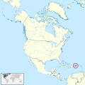 Puerto Rico in North America.svg 1,181 × 1,185; 6.92 MB
-
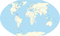 Puerto Rico in the world (de-facto) (W3).svg 3,188 × 1,948; 5.42 MB
-
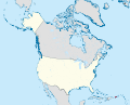
 Puerto Rico in United States (US48).svg 872 × 491; 7.89 MB
-
 Puerto Rico in United States (US48+2).svg 872 × 491; 7.89 MB
-
 Puerto Rico in United States (US49).svg 1,175 × 953; 7.89 MB
-
 Puerto Rico in United States (US49+1).svg 1,175 × 953; 7.92 MB
-
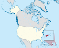
 Puerto Rico in United States (zoom + special marker) (US48).svg 872 × 491; 7.92 MB
-
 Puerto Rico in United States (zoom + special marker) (US48+2).svg 872 × 491; 7.91 MB
-
 Puerto Rico in United States (zoom + special marker) (US49).svg 1,175 × 953; 7.91 MB
-
 Puerto Rico in United States (zoom + special marker) (US49+1).svg 1,175 × 953; 7.94 MB
-
 Puerto Rico in United States (zoom) (US48).svg 872 × 491; 7.92 MB
-
 Puerto Rico in United States (zoom) (US48+2).svg 872 × 491; 7.91 MB
-
 Puerto Rico in United States (zoom) (US49).svg 1,175 × 953; 7.91 MB
-
 Puerto Rico in United States (zoom) (US49+1).svg 1,175 × 953; 7.94 MB
-
 Puerto Rico on the globe (Americas centered).svg 797 × 797; 591 KB
-
 Puerto Rico on the globe (Caribbean special) (Americas centered).svg 797 × 797; 647 KB
-
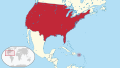 United States in its region (Lower 50 and Puerto Rico special).svg 862 × 485; 6.92 MB
-
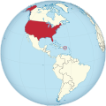 United States on the globe (Puerto Rico special) (Americas centered).svg 797 × 797; 662 KB

.svg)

_(W3).svg)
.svg)
.svg)
.svg)
.svg)
_(US48).svg)
_(US48%2B2).svg)
_(US49).svg)
_(US49%2B1).svg)
_(US48).svg)
_(US48%2B2).svg)
_(US49).svg)
_(US49%2B1).svg)
.svg)
_(Americas_centered).svg)
.svg)
_(Americas_centered).svg)