Category:SVG labeled maps of administrative divisions of Austria (location map scheme) (colored scheme)
Jump to navigation
Jump to search


.svg)


_(Paris_zoom).svg)
.svg)
,_administrative_divisions_-_de_-_colored_(multizoom).svg)
_-_colored.svg)
.svg)
,_administrative_divisions_-_Nmbrs_(multizoom).svg)
,_administrative_divisions_-_de_-_colored.svg)
_-_de_-_colored.svg)

.svg)

.svg)
Media in category "SVG labeled maps of administrative divisions of Austria (location map scheme) (colored scheme)"
The following 6 files are in this category, out of 6 total.
-
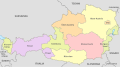
 Austria, administrative divisions - de - colored.svg 1,256 × 700; 653 KB
-
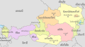
 Austria, administrative divisions - en - colored.svg 1,256 × 700; 648 KB
-
 Austria, administrative divisions - et - colored.svg 1,256 × 700; 663 KB
-
 Austria, administrative divisions - hu-.svg 1,256 × 700; 220 KB
-
 Austria, administrative divisions - Nmbrs - colored.svg 1,256 × 700; 453 KB
-
 Austria, administrative divisions - th - colored.svg 1,256 × 700; 868 KB


