Category:Road signs in Seminole County, Florida
Jump to navigation
Jump to search
Counties of Florida: Alachua · Baker · Bay · Bradford · Brevard · Broward · Calhoun · Charlotte · Citrus · Clay · Collier · Columbia · Dixie · Duval · Escambia · Flagler · Franklin · Gadsden · Gilchrist · Glades · Hamilton · Hardee · Hendry · Hernando · Highlands · Hillsborough · Holmes · Indian River · Jackson · Jefferson · Lafayette · Lake · Lee · Leon · Levy · Liberty · Madison · Manatee · Marion · Martin · Miami-Dade · Monroe · Nassau · Okaloosa · Okeechobee · Orange · Osceola · Palm Beach · Pasco · Pinellas · Polk · Putnam · Santa Rosa · Sarasota · Seminole · St. Johns · St. Lucie · Sumter · Suwannee · Taylor · Union · Volusia · Wakulla · Walton · Washington
Subcategories
This category has only the following subcategory.
Media in category "Road signs in Seminole County, Florida"
The following 46 files are in this category, out of 46 total.
-
 CA Bill Benedict Bridge; Memorial Sign.JPG 4,000 × 3,000; 2.49 MB
-
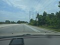
 CR419 Roadside - Chuluota (29556843342).jpg 2,400 × 1,600; 2.01 MB
-
 E End Seminole CR 46A @ US 17-92 & FL 46.jpg 3,648 × 2,736; 2.04 MB
-
 EB I-4 Rest Area 50221; Odd Signs.jpg 3,648 × 2,736; 2.01 MB
-
 EB I-4 Road Ranger sign near Lake Mary.jpg 1,281 × 717; 483 KB
-
 EB I-4 Seminole Co Rest Area; Main Building from Truck Lot.jpg 3,648 × 2,736; 2.05 MB
-
 EB I-4 Seminole Co Rest Area; Picnic Area Exit-1.jpg 1,629 × 913; 278 KB
-
 EB I-4 Seminole Co Rest Area; Picnic Area Exit-2.jpg 1,632 × 912; 245 KB
-
 EB I-4 Seminole Co Rest Area; Trucks vs Cars & Trailers.jpg 3,648 × 2,736; 2.06 MB
-
 EB I-4 Seminole Co Rest Area; Trucks vs Cars (Close-Up).jpg 3,648 × 1,589; 1.17 MB
-
 EB I-4; Last Rest Area.jpg 3,648 × 2,736; 2.08 MB
-
 Enormous-wall-at-fl-sr414-exit-429-oard.jpg 3,264 × 2,448; 3.73 MB
-
 Florida I4eb Exit 101A only.jpg 5,184 × 3,456; 4.74 MB
-
 Florida I4eb Exit 101A.jpg 5,184 × 3,456; 4.84 MB
-
 Florida I4eb Exit 101BC.jpg 5,184 × 3,456; 5.04 MB
-
 Florida I4eb Exit 104 1 mile.jpg 5,184 × 3,456; 4.62 MB
-
 Florida I4eb Exit 92 1 mile.jpg 5,184 × 3,456; 5 MB
-
 Florida I4eb Exit 92 ahead.jpg 5,184 × 3,456; 5.36 MB
-
 Florida I4eb Exit 92.jpg 5,184 × 3,456; 5.49 MB
-
 Florida I4eb Exit 94 1 mile.jpg 5,184 × 3,456; 5.18 MB
-
 Florida I4eb Exit 94 exit only.jpg 5,184 × 3,456; 4.92 MB
-
 Florida I4eb Exit 94.jpg 5,184 × 3,456; 4.79 MB
-
 Florida I4eb Exit 98 1 mile.jpg 5,184 × 3,456; 5.21 MB
-
 Florida I4eb Rest Area 50221 1 mile.jpg 5,184 × 3,456; 5.27 MB
-
 Florida I4eb Rest Area 50221 exit.jpg 5,184 × 3,456; 5.25 MB
-
 Florida I4eb Rest Area 50221 next right.jpg 5,184 × 3,456; 5.52 MB
-
 Florida I4eb Volusia County border.jpg 5,184 × 3,456; 5.04 MB
-
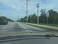
 Int4nCurvedRamp-US17nsUS92ewSigns (29043226283).jpg 2,400 × 1,600; 1.41 MB
-
 NB FL 415 @ Seminole CR 415.jpg 3,648 × 2,736; 2.05 MB
-
 NB FL 415 approaching Douglas Stenstrom Bridge.jpg 3,648 × 2,736; 2.06 MB
-
 NB FL 415 North of Seminole CR 415.jpg 3,648 × 2,736; 2.08 MB
-
 NB FL 415; Bus Stop; New Smyrna & Daytona Beaches.jpg 3,648 × 2,736; 2.08 MB
-
 NB FL 415; Explore Florida; Quincentennial.jpg 3,648 × 2,736; 2.05 MB
-
 NB FL 415; First Reassurance Shield.jpg 3,648 × 2,736; 2.06 MB
-
 NB FL 415; JCT Seminole CR 415.jpg 3,648 × 2,736; 2.05 MB
-
 NB US 17-92 Sign at Benedict Bridge.JPG 4,000 × 3,000; 2.61 MB
-
 NEB US 17-92; Monroe Road Widening Sign.jpg 3,648 × 2,736; 2.07 MB
-
 Seminole County 15.svg 450 × 450; 14 KB
-
 Seminole County Expressway.jpg 170 × 289; 13 KB
-
 Seminole Decatur County border, GA253WB.jpg 5,184 × 3,456; 8.6 MB
-
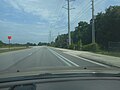
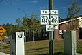 ToFL434-ToFL419signs (29043213173).jpg 2,400 × 1,600; 1.99 MB
-
 WB I-4 Seminole Co Rest Area; Back Dog Walk Sign.jpg 3,648 × 2,736; 2.06 MB
-
 WB I-4 Seminole Co Rest Area; Dog Walk Sign.jpg 3,648 × 2,736; 2.06 MB
-
 WB I-4 Seminole Co Rest Area; Main Building from Back.jpg 3,648 × 2,736; 2.05 MB
-
 WB I-4 Seminole Co Rest Area; Next One 49 Miles Away.jpg 3,648 × 2,736; 2.05 MB
-
 WB I-4 Seminole Co Rest Area; Picnic Area Closed at Night.jpg 3,648 × 2,736; 2.03 MB

.jpg)


.jpg)


.jpg)


.jpg)


