Category:Road signs in Lancaster County, Pennsylvania
Jump to navigation
Jump to search
Media in category "Road signs in Lancaster County, Pennsylvania"
The following 65 files are in this category, out of 65 total.
-
 0900 - Blue Ball - SR23@US322.JPG 4,000 × 3,000; 2.81 MB
-
 0902 - Blue Ball - SR23@US322.JPG 4,000 × 3,000; 3.05 MB
-

-

-

-

-

-

-

-

-
 Directions (6600769997).jpg 2,560 × 1,920; 1.23 MB
-
 EB PA 372 near N End PA 472 in Quarryville, PA - panoramio.jpg 3,841 × 2,893; 2.39 MB
-
 Esbenshade Road NB approaching PA 283 WB.jpeg 4,032 × 3,024; 4.58 MB
-
 Goodville Pennsylvania State Route 23.jpg 1,600 × 1,200; 381 KB
-
 PA 23 EB past PA 625.jpeg 4,032 × 3,024; 4.13 MB
-
 PA 23 EB past Snake Hill Road-Hartman Station Road.jpeg 4,032 × 3,024; 3.44 MB
-
 PA 230 EB at Esbenshade Road.jpeg 4,032 × 3,024; 3.85 MB
-
 PA 230 WB entering Elizabethtown.jpeg 4,032 × 3,024; 3.4 MB
-
 PA 230 WB entering Mount Joy.jpeg 4,032 × 3,024; 4.35 MB
-
 PA 241 NB past PA 743.jpeg 4,032 × 3,024; 3.86 MB
-
 PA 272 NB past Bushong Road.jpeg 4,032 × 3,024; 2.8 MB
-
 PA 272 NB past Eden Road.jpeg 4,032 × 3,024; 3.51 MB
-
 PA 272 NB shield past Eden Road intersection.jpeg 4,032 × 3,024; 3.53 MB
-
 PA 272 NB shield past Eden Road.jpeg 4,032 × 3,024; 3.85 MB
-
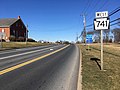
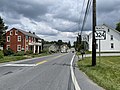 PA 324 NB past PA 741.jpeg 4,032 × 3,024; 3.93 MB
-
 PA 340 EB entering Intercourse.jpeg 4,032 × 3,024; 3.22 MB
-
 PA 340 EB past New Holland Road.jpeg 4,032 × 3,024; 3.69 MB
-
 PA 340-PA 772 EB approaching split.jpeg 4,032 × 3,024; 3.31 MB
-
 PA 372 at NE Corner of Lime Street; Quarryville, PA - panoramio.jpg 3,968 × 2,901; 3.17 MB
-
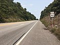
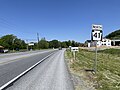 PA 41 NB approaching Gap.jpeg 4,032 × 3,024; 4.74 MB
-
 PA 41 NB approaching US 30.jpeg 4,032 × 3,024; 4.41 MB
-
 PA 441 NB past US 30.jpeg 4,032 × 3,024; 4.1 MB
-
 PA 462 EB past Jackson Drive.jpeg 4,032 × 3,024; 4.03 MB
-
 PA 462 WB past 3rd Street Columbia.jpeg 4,032 × 3,024; 2.94 MB
-
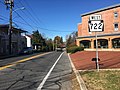
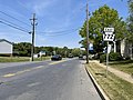
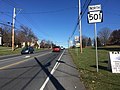 PA 501 NB past PA 722.jpeg 4,032 × 3,024; 3.28 MB
-
 PA 625 NB past PA 23.jpeg 4,032 × 3,024; 4.07 MB
-
 PA 72 NB past Hamaker Road.jpeg 4,032 × 3,024; 4.94 MB
-
 PA 72 NB past Lititz Road.jpeg 4,032 × 3,024; 3.48 MB
-
 PA 72 NB past PA 283.jpeg 4,032 × 3,024; 3.73 MB
-
 PA 722 WB past PA 501.jpeg 4,032 × 3,024; 3.32 MB
-
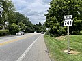 PA 741 WB past PA 324.jpeg 4,032 × 3,024; 5.61 MB
-
 PA 741 WB past PA 999.jpeg 4,032 × 3,024; 3.32 MB
-
 PA 743 NB past PA 241.jpeg 4,032 × 3,024; 4.25 MB
-
 PA 772 EB past Milton Grove Road.jpeg 4,032 × 3,024; 4.17 MB
-
 PA 772 EB past Old Market Street.jpeg 4,032 × 3,024; 4.15 MB
-
 PA 772 WB past New Haven Street.jpeg 4,032 × 3,024; 3.72 MB
-
 PA 772 WB past PA 340.jpeg 4,032 × 3,024; 3.63 MB
-
 PA 896 NB past Leaman Road.jpeg 4,032 × 3,024; 3.44 MB
-
 PA 897 NB past PA 23.jpeg 4,032 × 3,024; 4.28 MB
-
 PA 897 NB past PA 340.jpeg 4,032 × 3,024; 3.27 MB
-
 PA 999 EB past Schoolhouse Road-Roselawn Avenue.jpeg 4,032 × 3,024; 4.03 MB
-
 Pennsylvania Route 230 eastern terminus.JPG 2,400 × 1,800; 3.45 MB
-
 Strasburg Township, PA, USA - panoramio (13).jpg 3,818 × 2,769; 2.06 MB
-
 Terre Hill, Pennsylvania.jpg 3,648 × 2,736; 4.2 MB
-
 To PA 283 square shield at Sheetz in Mount Joy.jpeg 4,032 × 3,024; 4.83 MB
-
 US 222-PA 272 SB-PA 72 NB approaching Prince Street.jpeg 4,032 × 3,024; 2.39 MB
-
 US 30 no DUI.JPG 2,272 × 1,704; 1.09 MB
-
 US 30 WB past Ronks Road.jpeg 4,032 × 3,024; 3.28 MB
-
 US 30 x PA 41.JPG 2,272 × 1,704; 1.02 MB
-
 US 30 x PA 772.JPG 2,272 × 1,704; 343 KB
-
 US 30 x PA 896.JPG 2,272 × 1,704; 1.01 MB
-
 US 30 x PA 897.JPG 2,272 × 1,704; 448 KB
-
 US 322 WB past PA 23.jpeg 4,032 × 3,024; 4.2 MB
-
 West Earl Township PA WGAL sign on PA 272 NB.jpeg 3,024 × 4,032; 2.97 MB
-
 White Rock Forge Covered Bridge First Approach 2900px.jpg 2,900 × 1,980; 2.36 MB


_entering_Fulton_Township,_Lancaster_County,_Pennsylvania_from_Rock_Springs,_Cecil_County,_Maryland.jpg)
_at_River_Road_in_Conestoga_Township,_Lancaster_County,_Pennsylvania.jpg)
_at_Millwood_Road_in_Pequea_Township,_Lancaster_County,_Pennsylvania.jpg)
_at_North_Duke_Street_in_Manor_Township,_Lancaster_County,_Pennsylvania.jpg)
_at_Centerville_Road_along_the_border_of_Manor_Township_and_East_Hempfield_Township_in_Lancaster_County,_Pennsylvania.jpg)
_at_Creek_Road_in_Manheim_Township,_Lancaster_County,_Pennsylvania.jpg)
_at_Union_School_Road_in_East_Donegal_Township,_Lancaster_County,_Pennsylvania.jpg)
_at_Pennsylvania_State_Route_743_(Maytown_Road)_and_North_Decatur_Street_in_East_Donegal_Township,_Lancaster_County,_Pennsylvania.jpg)
.jpg)


.jpg)


