Category:River Otter
Jump to navigation
Jump to search
river in Somerset and Devon, England   | |||||
| Upload media | |||||
| Instance of | |||||
|---|---|---|---|---|---|
| Location | Somerset, South West England, England | ||||
| Length |
| ||||
| Mouth of the watercourse | |||||
| Drainage basin |
| ||||
| Different from | |||||
 | |||||
Subcategories
This category has the following 2 subcategories, out of 2 total.
O
- Otter Estuary (97 F)
T
Media in category "River Otter"
The following 48 files are in this category, out of 48 total.
-
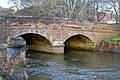
 Bridge over River Otter, at Otterton, Devon, UK.jpg 3,185 × 1,539; 3.68 MB
-
 Bridge over the Otter - geograph.org.uk - 1139270.jpg 640 × 426; 193 KB
-
 Bridge over the Otter at Otterton - geograph.org.uk - 956326.jpg 640 × 480; 92 KB
-
 Bridge over the river Otter - geograph.org.uk - 410103.jpg 480 × 640; 208 KB
-
 Budleigh Salterton 2.jpg 5,304 × 3,186; 12.16 MB
-
 Budleigh Salterton, Devon - geograph.org.uk - 721137.jpg 640 × 426; 100 KB
-

-
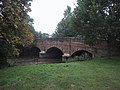
 Clamour Bridge - geograph.org.uk - 1112444.jpg 640 × 430; 102 KB
-
 Clamour Bridge - geograph.org.uk - 1139280.jpg 640 × 427; 191 KB
-

-
 Cows beside River Otter - geograph.org.uk - 190029.jpg 640 × 480; 94 KB
-
 Disused railway bridge - geograph.org.uk - 919495.jpg 640 × 425; 120 KB
-
 Fish Ladder at Otterton Devon - geograph.org.uk - 906185.jpg 640 × 480; 102 KB
-
 Fish pass.jpg 785 × 1,181; 373 KB
-
 Fish River Otter Devon.jpg 1,181 × 785; 497 KB
-
 Footbridge over River Otter Devon - geograph.org.uk - 906180.jpg 480 × 640; 102 KB
-
 Langford Bridge - geograph.org.uk - 1617517.jpg 640 × 480; 92 KB
-
 Ordnance Survey One-Inch Sheet 129 Chard & Axminster, Published 1919.jpg 11,648 × 8,475; 44.09 MB
-
 Ordnance Survey One-Inch Sheet 139 Sidmouth & Bridport, Published 1919.jpg 11,909 × 8,824; 10.44 MB
-
 Otter riverbank - geograph.org.uk - 189361.jpg 640 × 480; 114 KB
-
 River Otter - geograph.org.uk - 906174.jpg 640 × 480; 100 KB
-
 River Otter at Dotton - geograph.org.uk - 1164082.jpg 640 × 480; 54 KB
-
 River Otter at Dotton - geograph.org.uk - 185285.jpg 640 × 480; 91 KB
-
 River Otter at Fenny Bridges - geograph.org.uk - 174158.jpg 640 × 480; 113 KB
-
 River Otter at Harpford - geograph.org.uk - 180263.jpg 640 × 480; 102 KB
-
 River Otter at Newton Poppleford - geograph.org.uk - 1505656.jpg 640 × 480; 71 KB
-
 River Otter at Ottery St Mary - geograph.org.uk - 180357.jpg 640 × 480; 123 KB
-
 River Otter below Burnthouse Farm - geograph.org.uk - 185209.jpg 480 × 640; 134 KB
-
 River Otter in Winter - geograph.org.uk - 932835.jpg 640 × 480; 53 KB
-
 River Otter looking downstream - geograph.org.uk - 1112451.jpg 640 × 430; 56 KB
-
 River Otter looking upstream - geograph.org.uk - 1112448.jpg 640 × 430; 82 KB
-
 River Otter near Gosford - geograph.org.uk - 1030855.jpg 640 × 480; 89 KB
-
 River Otter near Harpford - geograph.org.uk - 179456.jpg 640 × 480; 102 KB
-

-
 River Otter, Gosford - geograph.org.uk - 195546.jpg 640 × 427; 254 KB
-
 River Otter, Gosford - geograph.org.uk - 195547.jpg 640 × 427; 168 KB
-
 River Otter, near Newton Poppleford - geograph.org.uk - 1088481.jpg 640 × 480; 84 KB
-

-
 St Saviour's Bridge, Ottery St Mary - geograph.org.uk - 1435665.jpg 640 × 473; 99 KB
-
 The Otter Valley at Dotton - geograph.org.uk - 1164053.jpg 640 × 480; 84 KB
-
 The Otter Valley near Harpford - geograph.org.uk - 1618873.jpg 640 × 480; 82 KB
-
 The power of The River Otter - geograph.org.uk - 919200.jpg 640 × 480; 130 KB
-
 The River Otter - geograph.org.uk - 46439.jpg 640 × 480; 115 KB
-
 The River Otter - geograph.org.uk - 919187.jpg 640 × 480; 123 KB
-
 The River Otter at Newton Poppleford - geograph.org.uk - 1069919.jpg 640 × 480; 110 KB
-
 Upottery, the river Otter - geograph.org.uk - 193188.jpg 640 × 427; 179 KB
-
 Upottery, the river Otter - geograph.org.uk - 206352.jpg 640 × 427; 270 KB
-
 Weir on River Otter - geograph.org.uk - 189345.jpg 640 × 480; 130 KB


