Category:Rapeseed fields in Wiltshire
Jump to navigation
Jump to search
Ceremonial counties of England: Bedfordshire · Berkshire · Buckinghamshire · Cambridgeshire · Cheshire · Cornwall · Cumbria · Derbyshire · Devon · Dorset · Durham · East Riding of Yorkshire · East Sussex · Essex · Gloucestershire · Greater London · Greater Manchester · Hampshire · Herefordshire · Hertfordshire · Kent · Leicestershire · Lincolnshire · Norfolk · North Yorkshire · Northamptonshire · Northumberland · Nottinghamshire · Oxfordshire · Rutland · Shropshire · Somerset · South Yorkshire · Staffordshire · Suffolk · Surrey · Warwickshire · West Sussex · West Yorkshire · Wiltshire · Worcestershire
City-counties:
Former historic counties:
Other former counties:
City-counties:
Former historic counties:
Other former counties:
Media in category "Rapeseed fields in Wiltshire"
The following 46 files are in this category, out of 46 total.
-

-

-
 Between Fovant Down and East Farm - geograph.org.uk - 434520.jpg 640 × 480; 104 KB
-
 Botley Down in late spring - geograph.org.uk - 861815.jpg 640 × 480; 108 KB
-
 Bridleway near Hannington, Swindon - geograph.org.uk - 418650.jpg 640 × 480; 117 KB
-

-
 Crop spraying, Faulston Farm - geograph.org.uk - 738914.jpg 640 × 453; 70 KB
-
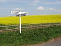 Direction Sign, Plough Farm. - panoramio.jpg 2,816 × 2,112; 3.32 MB
-

-

-

-
 Oil Seed Field - geograph.org.uk - 1275915.jpg 640 × 427; 90 KB
-
 Oil Seed Rape at Plough Farm. - panoramio.jpg 2,816 × 2,112; 3.72 MB
-
 Oil seed rape near Kingston Deverill - geograph.org.uk - 1387537.jpg 640 × 480; 140 KB
-
 Oil seed rape near West Lavington - geograph.org.uk - 1380746.jpg 640 × 481; 196 KB
-
 Oil-seed rape above Market Lavington - geograph.org.uk - 846513.jpg 640 × 480; 188 KB
-
 Oil-seed rape, Amesbury - geograph.org.uk - 478968.jpg 640 × 480; 147 KB
-
 Oilseed crop north of Aldbourne - geograph.org.uk - 1384772.jpg 640 × 480; 193 KB
-

-

-
 Oilseed rape flowers, near Shipley Bottom, Wiltshire (geograph 2372314).jpg 1,080 × 1,440; 540 KB
-
 Oilseed rape near Fonthill Bishop - geograph.org.uk - 792194.jpg 640 × 480; 85 KB
-

-
 Oilseed rape, Badbury, Swindon - geograph.org.uk - 802624.jpg 640 × 480; 132 KB
-
 Oilseed rape, Fiddler's Hill - geograph.org.uk - 1436975.jpg 640 × 480; 138 KB
-
 Oilseed rape, near Badbury, Swindon - geograph.org.uk - 802000.jpg 640 × 480; 159 KB
-
 Oilseed rape, near East Kennett - geograph.org.uk - 834725.jpg 640 × 480; 133 KB
-
 Oilseed rape, near East Kennett - geograph.org.uk - 834727.jpg 640 × 480; 169 KB
-
 Oilseed rape, near Rudge - geograph.org.uk - 1244638.jpg 640 × 480; 146 KB
-
 Oilseed rape, Pertwood - geograph.org.uk - 1401825.jpg 640 × 480; 146 KB
-
 Piglets amongst rapeseed (36189915965).jpg 5,472 × 3,648; 12.19 MB
-
 Poppies and oilseed rape - geograph.org.uk - 462151.jpg 640 × 427; 100 KB
-
 Poppies and oilseed rape, Bake Farm - geograph.org.uk - 1366850.jpg 480 × 640; 187 KB
-
 Rape and mature trees - geograph.org.uk - 811120.jpg 640 × 480; 87 KB
-
 Rape field - geograph.org.uk - 810968.jpg 640 × 480; 87 KB
-
 Rape field in chalk downland - geograph.org.uk - 811115.jpg 640 × 480; 92 KB
-
 Rape field north of Grittleton - geograph.org.uk - 810814.jpg 640 × 480; 107 KB
-
 Rape Seed growing on Salisbury Plain (476871878).jpg 3,008 × 2,000; 4.18 MB
-
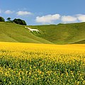
 Wiltshire White Horse - panoramio (2).jpg 1,200 × 800; 1.11 MB
-
 Wiltshire White Horse - panoramio (3).jpg 1,200 × 800; 1.04 MB
-
 Wiltshire White Horse - panoramio (4).jpg 3,456 × 3,456; 9.7 MB
-
 Wiltshire White Horse - panoramio.jpg 1,200 × 800; 870 KB
-
 Wylye Valley , Oilseed Rape Field - geograph.org.uk - 1324603.jpg 640 × 480; 50 KB
-
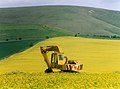 Yellow Machine - geograph.org.uk - 1657898.jpg 640 × 475; 98 KB
-
 Yellow, white and green - geograph.org.uk - 811112.jpg 640 × 480; 110 KB
-
 Oil-seed rape, Chute Forest - geograph.org.uk - 404302.jpg 640 × 480; 143 KB


.jpg)


.jpg)


.jpg)
.jpg)
.jpg)
.jpg)


