Category:Rail transport route maps of India
Jump to navigation
Jump to search
Subcategories
This category has the following 11 subcategories, out of 11 total.
R
Media in category "Rail transport route maps of India"
The following 16 files are in this category, out of 16 total.
-
 EastIndianRailways1850s.jpg 1,245 × 854; 411 KB
-
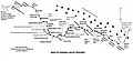
 Former Waltair division's statewise break-up.jpg 1,021 × 742; 303 KB
-
 Great Indian Peninsula Railway 1870.svg 1,636 × 1,866; 299 KB
-
 Gujarat Queen Route Map.png 800 × 635; 134 KB
-
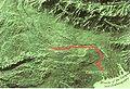
 Jasidih Dumka Rampurhat line.png 2,227 × 1,022; 87 KB
-
 Kangra valley Railway system map.jpg 1,900 × 866; 500 KB
-
 Krishna Express (ADB - TPTY) Route map.jpg 923 × 881; 315 KB
-
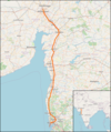 Map high-speed line Mumbai–Ahmedabad.png 765 × 913; 750 KB
-
 Map Kalka Mail route.svg 1,470 × 881; 1.47 MB
-
 Palace on Wheels- Map.jpg 704 × 472; 46 KB
-
 Potential HSR Lines in India 1.gif 892 × 1,000; 25 KB
-
 Potential HSR Lines in India 2.gif 892 × 1,000; 27 KB
-
 Rayalseema Express (HYB-TPTY) Route map.jpg 923 × 881; 333 KB
-
 Vande Bharat Express-bn.svg 1,486 × 1,734; 522 KB
-
 Vande Bharat Express.svg 1,486 × 1,734; 364 KB
-
 भारतीय-रेल दुरंत मानचित्र.gif 892 × 1,050; 23 KB


_Route_map.jpg)


_Route_map.jpg)


