Category:Rail transport maps of Japan
Jump to navigation
Jump to search
Countries of Asia: Afghanistan · Armenia‡ · Azerbaijan‡ · Bangladesh · Cambodia · People's Republic of China · Egypt‡ · Georgia‡ · India · Indonesia‡ · Iran · Israel · Japan · Kazakhstan‡ · Laos · Lebanon · Malaysia · Mongolia · Myanmar · North Korea · Pakistan · Philippines · Qatar · Russia‡ · Saudi Arabia · South Korea · Sri Lanka · Thailand · Turkey‡ · Turkmenistan · Uzbekistan
Limited recognition: Taiwan – Other territories: Hong Kong
‡: partly located in Asia
Limited recognition: Taiwan – Other territories: Hong Kong
‡: partly located in Asia
日本語: 日本の鉄道路線図。駅構内配線図はCategory:Rail track diagrams of train stations in Japanへ。
| NO WIKIDATA ID FOUND! Search for Rail transport maps of Japan on Wikidata | |
| Upload media |
Subcategories
This category has the following 5 subcategories, out of 5 total.
Media in category "Rail transport maps of Japan"
The following 200 files are in this category, out of 359 total.
(previous page) (next page)-

-
 1918 Toppan Printing Co. Map of Japanese Railways.png 6,668 × 8,999; 102.03 MB
-
 1968年の路線図.jpg 1,032 × 581; 88 KB
-
 Abukuma Express Linemap.png 2,009 × 2,160; 585 KB
-
 Aichi Loop Line Area Map.png 1,371 × 1,714; 356 KB
-
 All stops of keisei line 19690501.png 474 × 683; 28 KB
-
 Boyle proposed Nakasendo railway ja.png 861 × 617; 50 KB
-
 Changes of the the Station in the Murayama Reservoir.gif 1,515 × 743; 1.43 MB
-
 Chichibu Railway Linemap.svg 1,263 × 609; 315 KB
-
 Chikuho Rail.png 930 × 860; 269 KB
-
 Chikuho Railway.png 440 × 327; 67 KB
-
 Chōshi Electric Railway Linemap.svg 498 × 451; 245 KB
-
 CKK Chizu Line linemap.png 441 × 546; 55 KB
-
 Daibutsu Line Map.png 380 × 790; 38 KB
-
 Displays in Hanshin 5500 series train 01.jpg 3,072 × 2,304; 2.55 MB
-
 Echizen Railway Linemap.svg 1,534 × 863; 412 KB
-
 EizanRailway RouteMap.png 1,800 × 3,000; 184 KB
-
 Enshu Railway Linemap.svg 752 × 825; 642 KB
-
 EXPO70 Osaka subway ticket front.jpg 1,600 × 1,200; 947 KB
-
 Franz Baltzer's Grand Plan of Railway Network in Tokyo.png 2,091 × 2,278; 185 KB
-
 Fujikyu Corporation Linemap.svg 567 × 567; 316 KB
-
 Fukasaka tunnel route ja.png 797 × 1,022; 118 KB
-
 Fukui Railway Linemap.svg 835 × 907; 313 KB
-
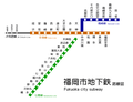 Fukuoka city subway.PNG 808 × 621; 71 KB
-
 Fukuoka subway.PNG 808 × 568; 68 KB
-
 Fukuoka.PNG 808 × 568; 68 KB
-
 Fukushima Rinkai Railway Main Line linemap EN.png 800 × 600; 48 KB
-
 Fukushima Rinkai Railway Main Line linemap JA.png 800 × 600; 80 KB
-
 Hakone Tozan Rail Line Kanagawa Prefecture Japan.png 1,056 × 816; 443 KB
-
 Hakone Tozan Railway Linemap.svg 2,097 × 1,117; 246 KB
-
 Hankyu Corporation Linemap.svg 2,533 × 1,725; 1.94 MB
-
 Hankyu Linemap Romaji.svg 2,533 × 1,725; 1.72 MB
-
 Hankyu map.svg 982 × 787; 114 KB
-
 Hankyu rail map.png 982 × 776; 212 KB
-
 HankyuMap(150dpi) 2010.png 2,627 × 1,976; 657 KB
-
 HankyuMap(150dpi).png 2,627 × 1,976; 724 KB
-
 Hanshin Electric Railway Linemap.svg 1,495 × 514; 843 KB
-
 Hanshin New Ticket Gate Introduction Map.jpg 750 × 319; 150 KB
-
 Hanshin railway map (English).png 3,805 × 928; 239 KB
-
 Hanshin railway map.png 3,336 × 837; 10.67 MB
-
 HanshinMap(150dpi).png 3,574 × 840; 297 KB
-
 Hanwa Electric Railway Linemap 1940.svg 1,748 × 1,686; 325 KB
-
 Hapi-Line Fukui Linemap.svg 1,453 × 1,768; 309 KB
-
 Heisei Chikuho Railway Linemap.svg 898 × 565; 560 KB
-
 Hiei LCD 20180317.jpg 4,608 × 3,456; 4.48 MB
-
 Hiei LCD indicatior 20180321 12.jpg 4,608 × 3,456; 7.98 MB
-
 Higashi-Shigi Cable Line-08.jpg 3,224 × 2,176; 4.13 MB
-
 Hitachinaka Seaside Railway Linemap.svg 859 × 548; 104 KB
-
 Hokuhoku Line linemap.svg 700 × 782; 13 KB
-
 Hokuriku Railroad Linemap 2.svg 904 × 743; 480 KB
-
 Hokuriku Railroad Linemap.svg 1,409 × 2,887; 468 KB
-
 Hokuso Line Route Map.jpg 2,338 × 1,654; 989 KB
-
 Hokusō Railway Linemap.svg 1,287 × 477; 337 KB
-
 Ichibata Electric Railway Linemap.svg 1,170 × 668; 287 KB
-
 Iga railway line.png 3,096 × 964; 124 KB
-
 Iga Railway Linemap.svg 717 × 1,257; 134 KB
-
 Iga Railway Network.svg 512 × 1,099; 73 KB
-
 Ikawa Line Linemap.svg 691 × 621; 319 KB
-
 IR Ishikawa Railway Linemap.svg 1,565 × 1,494; 235 KB
-
 Ir ishikawa railway map 2024.png 1,200 × 900; 185 KB
-
 Isahaya Station Sign (Shimabara Railway).jpg 4,001 × 3,001; 2.85 MB
-
 Itabashikuyakushomae-gate.JPG 1,022 × 562; 205 KB
-
 Iwate light railway map 1925.jpg 1,786 × 1,258; 1.07 MB
-
 Iyo Railway Linemap.svg 1,323 × 1,075; 487 KB
-
 IYORAILWAYTYPE3000LED.JPG 3,712 × 2,088; 2.97 MB
-
 Japan Mainline Railway Electrification Systems Map 日本本線鉄道電化地図.png 900 × 730; 50 KB
-
 JNR SystemMap 19641001.png 4,494 × 2,640; 19.37 MB
-
 Joetsu line plan on 1916.gif 525 × 525; 7 KB
-
 Jomo Electric Railway Linemap.svg 952 × 493; 122 KB
-
 Joshin Electric Railway Linemap.svg 1,008 × 558; 117 KB
-
 Jr nemuro line closure 2024-04-01.svg 540 × 540; 1.2 MB
-
 JR Rail en.svg 700 × 800; 77 KB
-
 JR Rail eo.svg 744 × 1,052; 79 KB
-
 JR Rail ja.svg 700 × 800; 78 KB
-
 JR Rail mk.svg 700 × 800; 100 KB
-
 JR Rail transcribed.svg 700 × 800; 77 KB
-
 JRE E721 interior route map 2016-10-09 (30039600834).jpg 5,000 × 3,333; 2.98 MB
-
 Kagoshima Kotsu Makurazaki Line map.png 500 × 700; 82 KB
-
 Kagoshima Nankai railway routemap.png 819 × 833; 210 KB
-
 Kanazawa Seaside Line map.png 1,116 × 1,574; 202 KB
-
 Kanazawa tram map 1919.svg 1,200 × 1,600; 122 KB
-
 Kanazawa tram map 1932.svg 1,200 × 1,600; 133 KB
-
 Kanazawa tram map 1937.svg 1,200 × 1,600; 134 KB
-
 Kanazawa tram map 1961.svg 1,200 × 1,600; 95 KB
-
 Kansei Railway Linemap 1907.svg 2,522 × 1,983; 618 KB
-
 Kanto Railway Linemap.svg 1,203 × 960; 337 KB
-
 Keifuku Electric Railroad (Fukui office) Linemap.svg 1,554 × 1,145; 338 KB
-
 Keihan Electric Railway Linemap.svg 1,989 × 2,103; 1.27 MB
-
 Keihan Otsu Line Linemap.svg 610 × 582; 449 KB
-
 KeihinTohokuLineStops2015.svg 2,640 × 1,400; 518 KB
-
 Keikyu Corporation Linemap.svg 1,428 × 3,478; 1.01 MB
-
 Keikyu Line Train Map.png 825 × 870; 60 KB
-
 Keikyu Toei Asakusa Keisei Network Map 2023.svg 6,219 × 5,687; 198 KB
-
 Keikyu-map.svg 512 × 106; 492 KB
-
 Keio Corporation Linemap.svg 1,899 × 634; 675 KB
-
 Keio Line Map 2013.svg 512 × 127; 577 KB
-
 Keio-Stationmap.svg 3,991 × 1,166; 611 KB
-
 Keisei 4Lines.png 244 × 760; 24 KB
-
 Keisei Electric Railway Linemap.svg 2,251 × 1,137; 1.26 MB
-
 Keisei map.svg 512 × 225; 445 KB
-
 Keisei Tsudanuma signboard.jpg 3,934 × 2,876; 4.89 MB
-
 Kita-Osaka Kyuko Railway Linemap.svg 1,761 × 1,585; 272 KB
-
 Kitakinki Tango Railway Linemap.svg 929 × 911; 289 KB
-
 Kitakyu-rosen.gif 439 × 710; 16 KB
-
 Kitaosakakyuko.png 1,195 × 576; 64 KB
-
 Kiwa Railway and Nanwa Railway Linemap 1904.svg 907 × 546; 155 KB
-
 Kobe Electric Railway Linemap.svg 1,500 × 1,402; 541 KB
-
 Kobe Electric Railway Map.png 2,681 × 913; 87 KB
-
 Kobe Kosoku Line.png 4,521 × 1,837; 148 KB
-
 KobeKosokuMap(150dpi).png 1,209 × 819; 105 KB
-
 KobePortLiner.png 500 × 590; 58 KB
-
 Koberinko, wadamisaki line.png 1,140 × 619; 64 KB
-
 Koberinko.gif 861 × 545; 9 KB
-
 KobeRokkoLiner.png 500 × 569; 293 KB
-
 KobeSubwayMap(150dpi).png 1,476 × 1,150; 195 KB
-
 Kominato Railway Linemap.svg 1,715 × 1,479; 258 KB
-
 Konan Railway Linemap.svg 690 × 809; 500 KB
-
 Kosagoe Station sign.jpg 4,608 × 3,273; 4.99 MB
-
 Koutsuannai3.jpg 816 × 745; 189 KB
-
 KRT Kashima-Jingu Station (50761398123).jpg 2,560 × 1,920; 346 KB
-
 KRT Linemap.svg 937 × 1,064; 234 KB
-
 KSER, KEER, TKER and JNR.svg 592 × 642; 425 KB
-
 KT-OC-KC-HS-Kujo-Map.png 1,653 × 907; 145 KB
-
 KT-OC-KC-HS-Kujo-Rail.png 2,773 × 987; 1.21 MB
-
 Kumamoto Electric Railway Station route map.jpg 3,104 × 5,520; 4.57 MB
-
 Kururi Line map osm.svg 655 × 655; 564 KB
-
 Kushirokaihatsufuto.png 580 × 430; 30 KB
-
 Kyoto Railway and Hankaku Railway Linemap 1907.svg 1,192 × 1,396; 323 KB
-
 Kyoto railway map.svg 774 × 958; 2.17 MB
-
 Kyoto railway map2.svg 774 × 958; 1.98 MB
-
 Kyoto Tango Railway Linemap.svg 929 × 911; 315 KB
-
 Kyusyu Tom.jpg 1,774 × 2,051; 358 KB
-
 Ligne Asa.png 1,024 × 724; 156 KB
-
 Ligne Nakamura.png 1,024 × 724; 157 KB
-
 Ligne Sukumo.png 1,024 × 724; 156 KB
-
 Linemap of Aoimori railway line 2011 Dec.svg 510 × 712; 14 KB
-
 Linemap of Atsumi Line.svg 2,317 × 1,432; 560 KB
-
 Linemap of Hokuetsu Express Corporation Hokuhoku Line.PNG 1,444 × 834; 65 KB
-
 Linemap of Hokuhoku Line with Stations.svg 1,923 × 1,134; 1.66 MB
-
 Linemap of Iwate ginga railway line.svg 510 × 712; 9 KB
-
 Linemap of JGR Kokuraura Line.svg 2,257 × 2,566; 148 KB
-
 Linemap of JGR Okura Line.svg 2,257 × 2,566; 148 KB
-
 Linemap of JNR Ashiya Line.svg 2,257 × 2,566; 153 KB
-
 Linemap of JNR Hitahikosan Line.svg 2,257 × 2,566; 222 KB
-
 Linemap of JNR Ita Line.svg 2,257 × 2,566; 176 KB
-
 Linemap of JNR Kamiyamada Line.svg 2,257 × 2,566; 140 KB
-
 Linemap of JNR Katsuki Line.svg 2,257 × 2,566; 146 KB
-
 Linemap of JNR Kobukuro Line.svg 2,257 × 2,566; 157 KB
-
 Linemap of JNR Miyada Line.svg 2,257 × 2,566; 158 KB
-
 Linemap of JNR Muroki Line.svg 2,257 × 2,566; 148 KB
-
 Linemap of JNR Soeda Line.svg 2,257 × 2,566; 142 KB
-
 Linemap of JNR Tagawa Line.svg 2,257 × 2,566; 183 KB
-
 Linemap of JNR Urushio Line.svg 2,257 × 2,566; 150 KB
-
 Linemap of JNR Yusubaru Line.svg 2,257 × 2,566; 153 KB
-
 Linemap of Katsuyama Eiheiji Line.svg 1,254 × 610; 298 KB
-
 Linemap of Mikuni Awara Line.svg 582 × 853; 283 KB
-
 Linemap of Myoko Haneuma Line with Stations.svg 1,220 × 1,503; 1.56 MB
-
 Linemap of Nihonkai Hisui Line with Stations.svg 1,651 × 899; 1.46 MB
-
 Linemap of Sagami Railway.PNG 1,392 × 628; 44 KB
-
 Linemap of Semboku Rapid Railway.png 836 × 1,326; 83 KB
-
 Linemap of Sendai Airport access Line.PNG 752 × 329; 15 KB
-
 Linemap of Sendai Airport Transit.svg 600 × 752; 16 KB
-
 Linemap of Shinano railway line.svg 394 × 678; 8 KB
-
 Linemap of Sobu Railway Kaijin Line.svg 819 × 651; 79 KB
-
 Linimo Linemap.svg 1,160 × 547; 194 KB
-
 Linimo-Tobukyuryo line.png 630 × 330; 25 KB
-
 Location of Kyobashi Sta.png 600 × 631; 146 KB
-
 Location of Okayama St ja.png 500 × 400; 99 KB
-
 Manchukuo Railmap jp.gif 1,089 × 1,308; 97 KB
-
 Map of Honshu Paper Kumano Plant Line and Kumanoji Branch Line.jpg 4,928 × 3,000; 7.99 MB
-
 Map of Randen in Ryoanji Station.JPG 3,264 × 2,448; 2.23 MB
-
 Map-hokusei.png 1,000 × 732; 179 KB
-
 Map-hokusei20060401.png 1,000 × 732; 180 KB
-
 Map-joshin.png 1,000 × 548; 107 KB
-
 Map-konan-konan.png 800 × 600; 111 KB
-
 Map-ogoya.png 663 × 800; 89 KB
-
 Matsuura Railway linemap.svg 876 × 736; 2.36 MB
-
 Minatomirai Line Map.svg 883 × 902; 306 KB
-
 Miyanojo Line map.png 500 × 700; 91 KB
-
 Mizuma Line map en.png 3,959 × 4,065; 715 KB
-
 Mizuma Line map ja.png 3,959 × 4,065; 669 KB
-
 Mizumatetudou rosenzu EN.GIF 270 × 320; 6 KB
-
 Mizumatetudou rosenzu JA.gif 270 × 320; 7 KB
-
 Mizumatetudou rosenzu JP.gif 270 × 320; 6 KB
-
 Mizushima Rinkai Railway Linemap.svg 870 × 1,116; 148 KB
-
 N3000 20121202-06.jpg 4,288 × 3,216; 1.06 MB
-
 Nagano Electric Railway Linemap.svg 1,307 × 1,697; 271 KB
-
 Nagoya city tram route map.PNG 910 × 960; 117 KB
-
 Nagoya Rinkai Railway Linemap.svg 1,091 × 1,719; 207 KB
-
 Nagoya Shiden Route Map 01.PNG 910 × 960; 58 KB
-
 Nagoya Shiden Route Map 02.png 910 × 960; 64 KB
-
 Nakasendo ando Tokaido railway map ja.png 863 × 615; 56 KB
-
 Naniwa Railway Linemap 1897.svg 1,014 × 490; 71 KB
-
 Nankai trunk line and Kouya line.gif 500 × 288; 17 KB
-
 Nankai9000 renovated LCD.jpg 3,699 × 2,774; 1.39 MB
-
 Nara Railway Linemap 1905.svg 399 × 917; 139 KB
-
 Niigata-area-rail.png 785 × 548; 15 KB
-
 Nippori-Toneri liner map ja.png 1,603 × 444; 59 KB
-
 Nippori-Toneri liner map Japanese.png 1,660 × 470; 71 KB
-
 Nishi-Nippon Railroad Linemap (Abandoned Lines).svg 1,360 × 2,280; 1.04 MB


_2010.png)
.png)


.jpg)


_Linemap.svg)


.png)


.png)


.svg)
.png)
.png)
.jpg)
.jpg)