Category:RAF Strubby
Jump to navigation
Jump to search
| Object location | | View all coordinates using: OpenStreetMap |
|---|
airport in Strubby, Lincolnshire  | |||||
| Upload media | |||||
| Instance of | |||||
|---|---|---|---|---|---|
| Location | |||||
| Operator | |||||
| Inception |
| ||||
| Dissolved, abolished or demolished date |
| ||||
| Elevation above sea level |
| ||||
 | |||||
Media in category "RAF Strubby"
The following 20 files are in this category, out of 20 total.
-
 Chipmunk 1.jpg 6,000 × 4,000; 2.55 MB
-
 Control Tower at Strubby airfield - geograph.org.uk - 1603363.jpg 640 × 480; 41 KB
-
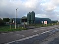
 Field and Hangar - geograph.org.uk - 233947.jpg 640 × 480; 95 KB
-
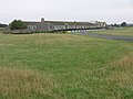
 Former Mess quarters at RAF Strubby - geograph.org.uk - 1603423.jpg 640 × 480; 57 KB
-
-

-

-
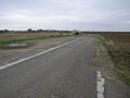 Perimeter Bridleway - geograph.org.uk - 233939.jpg 640 × 480; 78 KB
-
 Strubby Airfield - geograph.org.uk - 233941.jpg 640 × 480; 90 KB
-
 Strubby Airfield - geograph.org.uk - 3278434.jpg 1,024 × 768; 144 KB
-
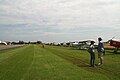
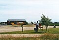
 Strubby airfield fly-in, July 2012 - geograph.org.uk - 3069803.jpg 640 × 427; 38 KB
-
 Strubby airfield fly-in, July 2012 - geograph.org.uk - 3069818.jpg 640 × 427; 46 KB
-
 Strubby airfield fly-in, July 2012 - geograph.org.uk - 3069832.jpg 640 × 427; 50 KB
-

-

-
 Strubby airfield, artists' club - geograph.org.uk - 3188980.jpg 640 × 434; 72 KB
-

-

-

-


