Category:Public transport maps of Osaka
Jump to navigation
Jump to search
Subcategories
This category has the following 4 subcategories, out of 4 total.
Media in category "Public transport maps of Osaka"
The following 30 files are in this category, out of 30 total.
-
 30000kei-ekishou-midousuji.jpg 934 × 663; 156 KB
-
 30000kei-tanimachi-lcd.jpg 746 × 534; 89 KB
-
 ALWEG-U-undStraßenbahnGleisplanOsaka2014.png 10,171 × 14,320; 5.66 MB
-
 Hankai Tram.jpg 817 × 595; 69 KB
-
 HanshinkanStraßenbahnNetzentwicklung.png 10,050 × 7,074; 3.2 MB
-
 JR Suita Station 2017 (38111757942).jpg 2,560 × 1,920; 606 KB
-
 Kanjousen.png 1,058 × 794; 66 KB
-
 Kyobashi Station Sign (Osaka Loop Line) 3.jpg 3,982 × 2,987; 2.69 MB
-

-
 LineMap OsakaKobe.png 810 × 320; 188 KB
-
 LineMap OsakaKyoto.png 560 × 720; 91 KB
-
 LineMap OsakaTakarazuka.png 450 × 450; 128 KB
-
 Midosuji Line Nakatsu station - panoramio.jpg 1,600 × 1,200; 778 KB
-
 Osaka Subway Map jp.png 1,052 × 744; 286 KB
-
 Osaka-shinai.PNG 420 × 520; 61 KB
-
 OsakaU-StraßenbahnNetzentwicklung.png 6,781 × 9,546; 4.47 MB
-
 Shin-Imamiya Station Sign (Osaka Loop Line) 2.jpg 4,017 × 3,013; 2.77 MB
-
 Shin-Osaka Station Sign (Midosuji Line).jpg 3,140 × 2,355; 1.19 MB
-
 Special provisions kinko osaka.gif 360 × 234; 14 KB
-
 StraßenbahnGleisplanSakai2014.png 3,861 × 6,998; 1.11 MB
-
 StraßenbahnGleisplanSakai2015.png 3,432 × 6,220; 1 MB
-
 StraßenbahnGleisplanSakai2018.png 3,432 × 6,220; 1,024 KB
-
 Subway-Yotsubashi Line.JPG 1,600 × 1,200; 608 KB
-
 Tengachaya Station Sign (Sakaisuji Line).jpg 3,976 × 2,982; 2.26 MB
-
 TokaidoLineBranches Osaka.png 1,000 × 1,000; 161 KB
-
 Tsuruhashi Station Sign (JR) 2.jpg 4,022 × 3,016; 2.87 MB
-
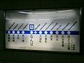
 Tsutsuishi-Imformation Station-201106.jpg 1,050 × 745; 67 KB
-
 View in Tennoji Station (Midosuji Line).jpg 4,019 × 3,015; 2.47 MB
-
 中央線 Subway Chuo Line.jpg 1,290 × 497; 108 KB
-
 關空快速 (15145208308).jpg 4,912 × 3,264; 14.38 MB


.jpg)

_3.jpg)


_2.jpg)
.jpg)


.jpg)

_2.jpg)

.jpg)
.jpg)