Category:Public transport maps of Norway
Jump to navigation
Jump to search
Countries of Europe: Austria · Azerbaijan‡ · Belarus · Belgium · Bosnia and Herzegovina · Bulgaria · Croatia · Czech Republic · Denmark · Estonia · Finland · France‡ · Georgia‡ · Germany · Greece · Hungary · Republic of Ireland · Italy · Kazakhstan‡ · Latvia · Liechtenstein · Lithuania · Luxembourg · Malta · Moldova · Netherlands‡ · Norway · Poland · Portugal‡ · Romania · Russia‡ · Serbia · Slovakia · Slovenia · Spain‡ · Sweden · Switzerland · Turkey‡ · Ukraine · United Kingdom
Specific status: Faroe Islands – Limited recognition: Kosovo
‡: partly located in Europe
Specific status: Faroe Islands – Limited recognition: Kosovo
‡: partly located in Europe
Subcategories
This category has the following 2 subcategories, out of 2 total.
B
- Tram maps of Bergen, Norway (4 F)
O
Media in category "Public transport maps of Norway"
The following 7 files are in this category, out of 7 total.
-
 HurtigrutenRoute.jpg 330 × 632; 27 KB
-
 Norges nasjonale transportnett.gif 700 × 709; 77 KB
-
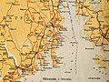
 Rutebok for Norge - Rutebokens Norgeskart - utsnitt Agder.jpg 3,648 × 2,736; 5.43 MB
-
 Rutebok for Norge - Rutebokens Norgeskart - utsnitt Vestfold.jpg 3,648 × 2,736; 8.4 MB
-
 Rutebok for Norge - Rutebokens Norgeskartt - utsnitt Kristiansund.jpg 3,648 × 2,736; 4.21 MB
-
 SIRI Status in Norway.png 2,876 × 1,200; 1.64 MB
-
 Trajet de l'Hurtigruten.svg 666 × 1,897; 558 KB


