Category:Public transport maps of Los Angeles
Jump to navigation
Jump to search
- 100 most populous cities of the United States
- 1–25
- Austin
- Boston
- Charlotte
- Chicago
- Columbus
- Dallas
- Denver
- El Paso
- Fort Worth
- Houston
- Indianapolis
- Jacksonville
- Los Angeles
- Nashville
- New York City
- Oklahoma City
- Philadelphia
- Phoenix
- Portland
- San Antonio
- San Diego
- San Francisco
- San Jose
- Seattle
- Washington, D.C.
- 26–50
- Albuquerque
- Arlington
- Atlanta
- Baltimore
- Bakersfield
- Colorado Springs
- Detroit
- Fresno
- Kansas City
- Las Vegas
- Long Beach
- Louisville
- Memphis
- Mesa
- Miami
- Milwaukee
- Minneapolis
- Oakland
- Omaha
- Raleigh
- Sacramento
- Tucson
- Tulsa
- Virginia Beach
- Wichita
- 51–75
- Anaheim
- Anchorage
- Aurora
- Cincinnati
- Cleveland
- Corpus Christi
- Durham
- Greensboro
- Henderson
- Honolulu
- Irvine
- Jersey City
- Lexington
- Lincoln
- Newark
- New Orleans
- Orlando
- Pittsburgh
- Plano
- Riverside
- Saint Paul
- Santa Ana
- St. Louis
- Stockton
- Tampa
- 76–100
- Baton Rouge
- Boise
- Buffalo
- Chandler
- Chesapeake
- Chula Vista
- Fort Wayne
- Fremont
- Garland
- Gilbert
- Glendale
- Irving
- Laredo
- Lubbock
- Madison
- Norfolk
- North Las Vegas
- Reno
- Richmond
- Santa Clarita
- Scottsdale
- St. Petersburg
- Spokane
- Toledo
- Winston-Salem
Subcategories
This category has the following 2 subcategories, out of 2 total.
L
- LACMTA Metro Rail maps (59 F)
P
- Pacific Electric maps (61 F)
Media in category "Public transport maps of Los Angeles"
The following 23 files are in this category, out of 23 total.
-
 315 of 'In Search of a Climate ... With ... illustrations, etc' (11305787956).jpg 1,952 × 1,090; 320 KB
-
 Alameda Corridor map.svg 86 × 114; 30 KB
-
 El Monte & Metro Silver Line Busway Map.pdf 2,100 × 1,275; 105 KB
-
 El Monte Busway Map.png 595 × 223; 19 KB
-
 ElMonteBuswayMap.png 757 × 550; 46 KB
-
 Harbor Gateway Transit Center.pdf 1,650 × 1,275; 266 KB
-
 Harbor Transitway Map of the Los Angeles County Metro System.png 423 × 752; 45 KB
-
 LA Harbor Transitway map.jpg 356 × 525; 67 KB
-
 LA Metro Silver Line June 2012 Information Cube.JPG 2,432 × 4,320; 3.39 MB
-
 LATL-map.jpg 1,118 × 1,500; 580 KB
-
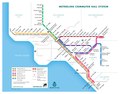
 Linea viola metropolitana di Los Angeles.png 1,726 × 1,048; 2.79 MB
-
 Los Angeles Metro Rapid 2009 schematic map.png 2,085 × 1,431; 533 KB
-
 LosAngeles-1941.png 3,000 × 2,217; 784 KB
-
 Map of the Metro Silver Line.png 5,420 × 4,263; 664 KB
-
 Metro Express System Map.pdf 2,100 × 1,275; 138 KB
-
 Metro Silver Line Extension to San Pedro.pdf 1,275 × 2,100; 16 KB
-
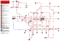
 Metrolink May 14 2018.pdf 1,668 × 1,295; 502 KB
-

-
 Purple Line Map of the Los Angeles County Metro System.png 610 × 306; 38 KB
-
 Relief map Pacific Electric Railway.jpg 6,432 × 3,216; 9.25 MB
-

-
 The PickUp service map (as of October 8, 2021).png 4,500 × 5,100; 3.05 MB
-
 The PickUp service map.png 4,500 × 3,000; 2.06 MB
.jpg)


.png)

_(14738065986).jpg)