Category:Public footpaths in Barton-upon-Humber
Jump to navigation
Jump to search
Subcategories
This category has the following 4 subcategories, out of 4 total.
H
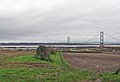
- Humber Bridge (footpath) (9 F)
V
Media in category "Public footpaths in Barton-upon-Humber"
The following 19 files are in this category, out of 19 total.
-

-
 Closed Footpath - geograph.org.uk - 305849.jpg 640 × 314; 86 KB
-
 Footpath to Barton - geograph.org.uk - 1222156.jpg 537 × 640; 193 KB
-
 Near Turton's Covert - geograph.org.uk - 412609.jpg 425 × 640; 131 KB
-
 Public Footpath near Turton's Covert - geograph.org.uk - 994252.jpg 640 × 425; 98 KB
-

-
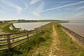
 The Humber Bank - geograph.org.uk - 373222.jpg 640 × 480; 125 KB
-
 The Old Footpath - geograph.org.uk - 754425.jpg 640 × 425; 69 KB
-
 The Old Footpath to South Ferriby - geograph.org.uk - 836793.jpg 640 × 427; 93 KB
-
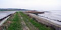
 The Old Humber Bank Path - geograph.org.uk - 1455262.jpg 640 × 425; 98 KB
-
 The Public Footpath to Dam Road - geograph.org.uk - 1040579.jpg 640 × 436; 72 KB
-
 The Seat at the End of the Path - geograph.org.uk - 569933.jpg 640 × 426; 121 KB
-
 The Track to Barton Hill Farm - geograph.org.uk - 1046343.jpg 480 × 640; 137 KB
-
 The Track to Deepdale - geograph.org.uk - 553667.jpg 640 × 426; 125 KB
-
 The Track to South Cliff Farm - geograph.org.uk - 299943.jpg 640 × 478; 115 KB
-
 View from Turton's Covert - geograph.org.uk - 412623.jpg 640 × 392; 111 KB
-
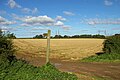
 Wheat Fields near Barton Hill Farm - geograph.org.uk - 1432453.jpg 640 × 480; 97 KB
-
 Winter Wheat near Barton Hill Farm - geograph.org.uk - 1496348.jpg 640 × 480; 368 KB
-
 Woody Path - geograph.org.uk - 305836.jpg 640 × 427; 176 KB


