Category:Portway
Jump to navigation
Jump to search
English: The Port Way was a Roman road running from London to Weymouth, via Silchester (Calleva Atrebatum), Old Sarum (Sorviodunum) and Dorchester (Durnovaria).
Roman road that ran from Silchester to Weymouth  | |||||
| Upload media | |||||
| Instance of | |||||
|---|---|---|---|---|---|
| Location | Hampshire, South East England, England | ||||
 | |||||
Media in category "Portway"
The following 13 files are in this category, out of 13 total.
-
 "Portway" Roman Road - geograph.org.uk - 98465.jpg 640 × 481; 24 KB
-
 Lane and farmland, Hannington - geograph.org.uk - 808415.jpg 640 × 480; 141 KB
-

-
 Old Sarum - panoramio (1).jpg 3,072 × 2,304; 3.04 MB
-
 Old Sarum - panoramio (2).jpg 3,072 × 2,304; 3.07 MB
-
 Old Sarum - panoramio.jpg 2,211 × 2,948; 2.92 MB
-
 Portway Roman Road at Clap Gate - geograph.org.uk - 98476.jpg 640 × 481; 79 KB
-
 Bridleway up onto Portway Roman Road - geograph.org.uk - 98468.jpg 640 × 481; 85 KB
-
 Portway - geograph.org.uk - 3186.jpg 640 × 480; 40 KB
-
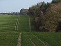 Portway and Caesar's Belt - geograph.org.uk - 302020.jpg 640 × 480; 114 KB
-
 Portway and Caesar's Belt - geograph.org.uk - 490853.jpg 483 × 640; 128 KB
-
 Portway to Old Sarum - geograph.org.uk - 84000.jpg 640 × 481; 54 KB
-
 Roman road to St Mary Bourne, Hants - geograph.org.uk - 392460.jpg 640 × 480; 163 KB


.jpg)
.jpg)


