Category:Ports and harbours in England
Jump to navigation
Jump to search
Countries of Europe: Albania · Austria · Azerbaijan‡ · Belarus · Belgium · Bosnia and Herzegovina · Bulgaria · Croatia · Cyprus‡ · Czech Republic · Denmark · Estonia · Finland · France‡ · Georgia‡ · Germany · Greece · Hungary · Iceland · Republic of Ireland · Italy · Kazakhstan‡ · Latvia · Lithuania · Malta · Moldova · Monaco · Montenegro · Netherlands‡ · North Macedonia · Norway · Poland · Portugal‡ · Romania · Russia‡ · Serbia · Slovakia · Slovenia · Spain‡ · Sweden · Switzerland · Turkey‡ · Ukraine · United Kingdom
Specific status: Faroe Islands · Bailiwick of Guernsey · Isle of Man · Jersey · Svalbard
‡: partly located in Europe
Specific status: Faroe Islands · Bailiwick of Guernsey · Isle of Man · Jersey · Svalbard
‡: partly located in Europe
Wikimedia category | |||||
| Upload media | |||||
| Instance of | |||||
|---|---|---|---|---|---|
| |||||
Subcategories
This category has the following 11 subcategories, out of 11 total.
+
C
D
L
M
P
W
Media in category "Ports and harbours in England"
The following 60 files are in this category, out of 60 total.
-
 Crossing the Test - geograph.org.uk - 166776.jpg 640 × 416; 83 KB
-
 England Southampton area location map.svg 170 × 147; 383 KB
-
 Former Great Western Railway harbour building - geograph.org.uk - 3133486.jpg 3,648 × 2,736; 5.97 MB
-

-
 Outer Harbour Wall Access Steps. - geograph.org.uk - 105553.jpg 480 × 640; 77 KB
-
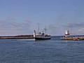 S.S. Balmoral entering North Harbour. - geograph.org.uk - 470273.jpg 640 × 480; 51 KB
-
 Small ships in Whitby harbour - panoramio.jpg 1,200 × 1,600; 262 KB
-
 Thomas Rowlandson - Plymouth Dock - Google Art Project.jpg 6,477 × 3,755; 7.76 MB
-
 Access Road to Amey Wharf - geograph.org.uk - 1143086.jpg 640 × 480; 50 KB
-
 Bullo Pill - geograph.org.uk - 552213.jpg 640 × 480; 55 KB
-

-
 Cambois Fishing Fleet^ - geograph.org.uk - 742398.jpg 640 × 480; 55 KB
-
 Chara trip to the seaside - geograph.org.uk - 82207.jpg 640 × 442; 62 KB
-
 Flat calm and blue - geograph.org.uk - 596042.jpg 640 × 427; 41 KB
-

-
 Floating Harbour, Bristol - geograph.org.uk - 240428.jpg 640 × 480; 99 KB
-
 Fowey Foreshore - geograph.org.uk - 293859.jpg 640 × 427; 87 KB
-
 From Town Pier to Whitehouse Pier - geograph.org.uk - 556408.jpg 640 × 428; 105 KB
-
 Harbour at Amble - geograph.org.uk - 69997.jpg 640 × 480; 106 KB
-
 Harbour Entrance - geograph.org.uk - 11904.jpg 640 × 480; 176 KB
-
 Harbour, near Walberswick - geograph.org.uk - 9773.jpg 640 × 480; 29 KB
-
 Harrington Harbour - geograph.org.uk - 32518.jpg 640 × 480; 99 KB
-
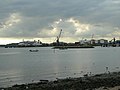
 Harwich International Port - geograph.org.uk - 411414.jpg 640 × 422; 95 KB
-
 Hayling Island from Langstone Mill - geograph.org.uk - 1233.jpg 640 × 480; 71 KB
-
 Hillhead Harbour - geograph.org.uk - 1418105.jpg 640 × 433; 100 KB
-

-
 Inner harbour, Amble - geograph.org.uk - 348613.jpg 640 × 480; 61 KB
-

-
 Launching Yacht. - geograph.org.uk - 496650.jpg 640 × 349; 54 KB
-
 Leaving Dover on Speedferry One - geograph.org.uk - 453935.jpg 480 × 640; 54 KB
-
 Look out - geograph.org.uk - 425184.jpg 640 × 480; 101 KB
-
 Maldon - the approach - geograph.org.uk - 261207.jpg 640 × 480; 61 KB
-

-
 Maryport Harbour - geograph.org.uk - 107160.jpg 640 × 454; 78 KB
-
 Maryport Harbour - geograph.org.uk - 40519.jpg 640 × 306; 56 KB
-
 Maryport Harbour continued - geograph.org.uk - 87811.jpg 640 × 314; 55 KB
-
 My boat and bungalow, Stanpit - geograph.org.uk - 251105.jpg 640 × 480; 72 KB
-
 Old Stop Lock, Totterdown Basin - geograph.org.uk - 182133.jpg 640 × 424; 109 KB
-
 Old Wharfage in West Looe - geograph.org.uk - 10991.jpg 480 × 640; 127 KB
-
 Outer Harbour Whitehaven - geograph.org.uk - 556644.jpg 640 × 482; 65 KB
-
 Paddy's Hole - geograph.org.uk - 329395.jpg 640 × 426; 64 KB
-
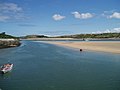 Padstow - geograph.org.uk - 487033.jpg 640 × 480; 62 KB
-
 Polkerris Harbour Wall - geograph.org.uk - 293600.jpg 640 × 426; 70 KB
-
 Poole , Poole Harbour and Sunseeker Boats - geograph.org.uk - 1778793.jpg 3,264 × 2,448; 2.24 MB
-
 Poole Docks from Baiter - geograph.org.uk - 342661.jpg 640 × 480; 77 KB
-
 Poole Harbour, stripy view - geograph.org.uk - 521816.jpg 640 × 429; 42 KB
-
 Poole harbour, sunset and reeds - geograph.org.uk - 620137.jpg 640 × 480; 49 KB
-
 Poole Harbour, the sun returns - geograph.org.uk - 521820.jpg 640 × 429; 65 KB
-
 Poole, view across Holes Bay channel - geograph.org.uk - 1406633.jpg 640 × 480; 65 KB
-
 Porlock Weir - geograph.org.uk - 34516.jpg 640 × 481; 127 KB
-
 Ports old and new - geograph.org.uk - 660288.jpg 640 × 480; 174 KB
-
 Ports panorama - geograph.org.uk - 660303.jpg 640 × 302; 197 KB
-
 Portwrinkle Harbour with sea fog - geograph.org.uk - 437757.jpg 640 × 480; 145 KB
-
 Queen's Dock, Whitehaven Harbour - geograph.org.uk - 88758.jpg 640 × 480; 88 KB
-

-
 River Haven sea bank - geograph.org.uk - 429883.jpg 640 × 477; 84 KB
-
 Ryde, harbour slipway - geograph.org.uk - 678796.jpg 640 × 480; 61 KB
-
 Ryde, the harbour - geograph.org.uk - 678792.jpg 640 × 480; 51 KB
-
 Safely tied up in the river - geograph.org.uk - 123559.jpg 480 × 640; 100 KB
-
 Scottish Trawlers - geograph.org.uk - 303297.jpg 640 × 480; 96 KB


