Category:Port of Kaohsiung
Jump to navigation
Jump to search
- 中文(臺灣):中華民國高雄市高雄港的媒體集。
| Object location | | View all coordinates using: OpenStreetMap |
|---|
port in Taiwan  | |||||
| Upload media | |||||
| Instance of | |||||
|---|---|---|---|---|---|
| Location | |||||
| Date of official opening |
| ||||
| Follows |
| ||||
| Replaces |
| ||||
| Different from | |||||
| official website | |||||
 | |||||
Subcategories
This category has the following 14 subcategories, out of 14 total.
- Maps of the Port of Kaohsiung (13 F)
B
- Banana Pier (warehouse) (10 F)
H
K
- Kaohsiung Customs Building (4 F)
- Kaohsiung Harbor Museum (3 F)
- Kaohsiung Port Terminal (17 F)
N
P
- Penghu (ship, 2023) (12 F)
Q
- Qianzhen Fishing Port (3 F)
S
T
Media in category "Port of Kaohsiung"
The following 104 files are in this category, out of 104 total.
-
 2010-01-24 從旗津輪渡站遠望漢來新世界中心及高雄85大樓.jpg 3,008 × 2,000; 2.33 MB
-
 2013-09-15 14.45.45 高雄旗津燈塔往高雄港望去.jpg 2,592 × 1,936; 1.22 MB
-
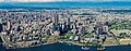
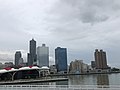
 20150103 Kaohsiung Skyline.jpg 4,608 × 3,456; 10.81 MB
-
 20160531 Kaohsiung Harbor Skyline.jpg 6,000 × 4,000; 10.44 MB
-
 20161019 Kaohsiung skyline.jpg 6,000 × 4,000; 11.21 MB
-
 2017 NSYSU stadium2.jpg 3,840 × 2,160; 1.97 MB
-
 2018 Kaohsiung, Taiwan Skyline.jpg 1,024 × 685; 195 KB
-
 85 Sky Tower from Former British Consulate 2013.jpg 4,512 × 3,000; 6.13 MB
-

-
 Asia New Bay Area 20160624.jpg 6,000 × 4,000; 12.12 MB
-
 Asia New Bay Area skyline panorama in Kaohsiung, Taiwan.jpg 853 × 455; 162 KB
-
 Birds eye view, Kaohsiung, Taiwan.JPG 640 × 480; 196 KB
-
 Building of Port of Kaohsiung, Taiwan International Ports Corporation, Ltd.JPG 4,000 × 3,000; 2.15 MB
-
 Cijin View of Kaohsiung, Taiwan Skyline 2017.jpg 6,000 × 4,000; 12.54 MB
-
 Cityscape of Kaohsiung, Taiwan 202303.jpg 3,000 × 2,000; 3.7 MB
-
-
 Cloudy Kaohsiung, Taiwan skyline 2016.jpg 6,000 × 4,000; 12.07 MB
-
 Coastal skyline of Kaohsiung, Taiwan 2013.jpg 3,240 × 2,160; 4.17 MB
-
 Coastal skyline of Kaohsiung, Taiwan 2016.jpg 6,000 × 4,000; 11.18 MB
-
 Ddm 2004 027 Kaohsiung Harbor.jpg 398 × 258; 63 KB
-
 Ddm 2004 028 Kaohsiung Harbor.jpg 400 × 267; 56 KB
-
 Dusk at Pier 2 001.jpg 3,264 × 2,448; 1.56 MB
-
 Eberhard Petzold - Auf einem Gastanker nach Kaoshiung.jpg 700 × 467; 82 KB
-
 Industry park of the harbor.jpg 3,008 × 2,000; 2.31 MB
-
 Jong Shyn Shipbuliding Group Factory in Kaohsiung Port.JPG 4,000 × 3,000; 2.5 MB
-
 Kaohsiung 1st port.JPG 639 × 435; 104 KB
-
 Kaohsiung 2nd port.JPG 639 × 435; 87 KB
-
 Kaohsiung banner.jpg 4,711 × 672; 2.12 MB
-
 Kaohsiung Cijin aerial view.jpg 2,560 × 1,024; 384 KB
-
 Kaohsiung City Port of Kaohsiung.JPG 4,320 × 3,240; 5.6 MB
-
 Kaohsiung cityscape (48769469433).jpg 4,032 × 3,024; 3.22 MB
-
 Kaohsiung Harbor and Cityscape 2018.jpg 4,160 × 3,120; 6.2 MB
-
 Kaohsiung Harbor From 85 Tower - panoramio.jpg 2,816 × 2,112; 817 KB
-
 Kaohsiung Harbor From Grand Hi-Lai - panoramio.jpg 1,265 × 313; 347 KB
-
 Kaohsiung harbor skyline 20130430.jpg 4,587 × 3,098; 4.89 MB
-
 Kaohsiung Harbor Skyline 2017.jpg 5,184 × 3,456; 4.59 MB
-
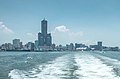
 Kaohsiung harbor skyline.jpg 1,280 × 853; 1,010 KB
-
 Kaohsiung Harbour 20160704.jpg 6,000 × 4,000; 12.2 MB
-
 Kaohsiung harbour skyline 2016.jpg 1,920 × 1,271; 781 KB
-
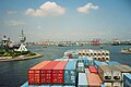
 Kaohsiung international container terminal.jpg 4,000 × 6,000; 5.75 MB
-
 Kaohsiung landscape skyline.jpg 3,840 × 2,160; 4.01 MB
-
 Kaohsiung night skyline 20130430.jpg 4,651 × 3,101; 5.1 MB
-
 Kaohsiung Port 高雄港 - panoramio.jpg 6,000 × 4,000; 4.84 MB
-
 Kaohsiung Skyline (10577006824).jpg 4,608 × 3,072; 7.82 MB
-
 Kaohsiung skyline (10577048014).jpg 4,608 × 3,072; 7.39 MB
-
 Kaohsiung skyline (7401992154).jpg 3,264 × 2,448; 3.31 MB
-
 Kaohsiung skyline (7402012248).jpg 3,264 × 2,448; 3.12 MB
-
 Kaohsiung skyline 2007.jpg 2,100 × 1,400; 1.68 MB
-
 Kaohsiung skyline 20130430.jpg 4,752 × 3,168; 7.59 MB
-
 Kaohsiung skyline 2017.jpg 3,000 × 1,789; 1.39 MB
-
 Kaohsiung Taiwan Floating-dock-Jong-Shyn-01.jpg 5,137 × 2,890; 9.22 MB
-
 Kaohsiung Taiwan skyline 2014.jpg 2,048 × 1,452; 619 KB
-
 Kaohsiung Taiwan Skyline 2019.jpg 3,772 × 2,832; 1.98 MB
-
 Kaohsiung Wikivoyage banner.jpg 3,608 × 516; 1.44 MB
-
 Kaohsiung's Asia New Bay Area.jpg 3,204 × 1,263; 1,001 KB
-
 Kaohsiung, Taiwan.jpg 800 × 600; 107 KB
-
 Kaohsiung-container-depot.jpg 1,000 × 643; 375 KB
-
 Kaohsiung-container-port.jpg 1,000 × 667; 380 KB
-
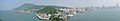
 Kaoshiung panorama.jpg 8,000 × 1,550; 1.93 MB
-
 Looking at Kaohsiung Harbour Skyline, Taiwan 2013.jpg 4,608 × 3,072; 7.25 MB
-
 Looking at Kaohsiung skyline 20170713.jpg 1,241 × 821; 959 KB
-
 Night skyline of Kaohsiung, Taiwan 2009.jpg 3,446 × 1,938; 1.47 MB
-
 North-West View of the Sky Tower 85 - panoramio.jpg 3,264 × 2,448; 3.68 MB
-
 Port of Kaohsiung 20130907-2.jpg 3,872 × 2,592; 3.24 MB
-
 Port of Kaohsiung 20130907.jpg 3,872 × 2,592; 2.98 MB
-
 Port of Kaohsiung 20141010-2.jpg 3,200 × 560; 663 KB
-
 Port of kaohsiung first harbor commercial area 2021.jpg 1,024 × 575; 128 KB
-
 Port of Kaohsiung skyline (16427182699).jpg 2,448 × 1,624; 1.03 MB
-
 Port of Kaohsiung Skyline 2016.jpg 4,928 × 3,264; 6.32 MB
-
 Port of Kaohsiung Skyline 2023.jpg 2,684 × 1,489; 1.04 MB
-
 Port of Kaohsiung, Taiwan Skyline 2017.jpg 6,000 × 4,000; 5.69 MB
-
 ROCN Xinbin Camp with 205 20130517.jpg 1,680 × 945; 235 KB
-
 Rubber Duck and Kaohsiung Skyline 20131012.jpg 5,616 × 3,744; 15.32 MB
-
 Ship Building - panoramio.jpg 2,816 × 2,112; 848 KB
-
 Shipping-container Kaohsiung Harbour.jpg 2,862 × 1,834; 4.42 MB
-
 Skyline of Kaohsiung from True Love Pier 2019.jpg 4,032 × 3,024; 3.48 MB
-
 Skyline of Kaohsiung Harbor 2014.jpg 2,763 × 1,842; 1.6 MB
-
 Sunset over the city centre of Kaohsiung, Taiwan.jpg 4,562 × 3,009; 2.96 MB
-
 Tai Hwa at Kaohsiung Harbour in Evening 20140508.jpg 2,560 × 1,440; 2.59 MB
-
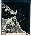 Takao bombing 2.jpg 1,024 × 1,182; 453 KB
-
 Takao bombing 3.jpg 1,365 × 1,280; 625 KB
-
 View of Kaohsiung harbor skyline 2016.jpg 6,016 × 4,000; 5.79 MB
-
 Welcome to Kaohsiung Harbor 2013-07-29.jpg 4,000 × 3,000; 2.06 MB
-
 中信造船集團-順嶸廠空拍圖.jpg 1,709 × 949; 432 KB
-
 原台灣省物資局高雄辦事處20170913.jpg 5,472 × 3,648; 5.37 MB
-
 原海員之家20170913.jpg 5,472 × 3,648; 5.54 MB
-
 從高雄燈塔俯看旗津和高雄.jpg 3,692 × 1,229; 981 KB
-
 新濱碼頭臺灣航業公司20220724.jpg 5,472 × 3,648; 11.88 MB
-
 新濱碼頭臺通公司20220724.jpg 3,648 × 5,472; 13.82 MB
-
 旗津TVC塔台.JPG 1,944 × 2,592; 612 KB
-
 英國領事館上面拍攝高雄港Kaohsiung Port - panoramio.jpg 1,024 × 768; 232 KB
-
 遠眺規模可觀的高雄港站及週邊舊港區鐵道線群與建物群.jpg 5,451 × 3,066; 12.6 MB
-
 重生的高雄港一港口安檢所.jpg 3,072 × 1,728; 1.04 MB
-
 高雄市忠烈祠及原高雄神社遺跡, 2019-09-02.jpg 5,569 × 3,713; 11.92 MB
-
 高雄市旗津區 遠望高雄市 - panoramio (1).jpg 3,264 × 2,448; 1.46 MB
-
 高雄市旗津區 遠望高雄市 - panoramio.jpg 3,264 × 2,448; 1.78 MB
-
 高雄港 2021年11月1日.jpg 7,500 × 5,000; 39.31 MB
-
 高雄港 Kaohsiung Harbour - panoramio.jpg 2,048 × 1,536; 431 KB
-
 高雄港全景 Kaohsiung Harbour - panoramio.jpg 2,816 × 2,112; 818 KB
-
 高雄港務警察總隊.jpg 2,592 × 1,944; 1.72 MB
-
 高雄港畔的咖啡廳 20070723.jpg 2,048 × 1,536; 652 KB
-
 高雄港站及週邊舊港區建物群.jpg 5,664 × 3,184; 3.41 MB
-
 高雄港第一船渠.jpg 3,072 × 1,728; 1.37 MB
-
 高雄港貨櫃起重機.jpg 4,160 × 2,340; 1.86 MB


.jpg)


.jpg)


.jpg)
.jpg)
.jpg)
.jpg)


.jpg)


.jpg)


