Category:Political maps of Champaign County, Ohio as of the 2000 United States Census
Jump to navigation
Jump to search
Media in category "Political maps of Champaign County, Ohio as of the 2000 United States Census"
The following 22 files are in this category, out of 22 total.
-
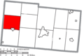
 Map of Champaign County Ohio Highlighting Adams Township.png 612 × 410; 19 KB
-
 Map of Champaign County Ohio Highlighting Christiansburg Village.png 612 × 410; 19 KB
-
 Map of Champaign County Ohio Highlighting Concord Township.png 612 × 410; 19 KB
-
 Map of Champaign County Ohio Highlighting Goshen Township.png 612 × 410; 19 KB
-
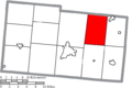
 Map of Champaign County Ohio Highlighting Harrison Township.png 612 × 410; 19 KB
-
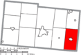
 Map of Champaign County Ohio Highlighting Jackson Township.png 612 × 410; 19 KB
-
 Map of Champaign County Ohio Highlighting Johnson Township.png 612 × 410; 19 KB
-
 Map of Champaign County Ohio Highlighting Mad River Township.png 612 × 410; 19 KB
-
 Map of Champaign County Ohio Highlighting Mechanicsburg Village.png 612 × 410; 19 KB
-
 Map of Champaign County Ohio Highlighting Mutual Village.png 612 × 410; 19 KB
-

-
 Map of Champaign County Ohio Highlighting Rush Township.png 612 × 410; 19 KB
-
 Map of Champaign County Ohio Highlighting Saint Paris Village.png 612 × 410; 19 KB
-
 Map of Champaign County Ohio Highlighting Salem Township.png 612 × 410; 19 KB
-
 Map of Champaign County Ohio Highlighting Union Township.png 612 × 410; 19 KB
-
 Map of Champaign County Ohio Highlighting Urbana City.png 612 × 410; 19 KB
-
 Map of Champaign County Ohio Highlighting Urbana Township.png 612 × 410; 19 KB
-
 Map of Champaign County Ohio Highlighting Wayne Township.png 612 × 410; 19 KB
-
 Map of Champaign County Ohio Highlighting Woodstock Village.png 612 × 410; 19 KB
-
 Map of Champaign County Ohio With Municipal and Township Labels.PNG 612 × 410; 34 KB
-
 Map of Champaign County, Ohio No Text, Municipalities Distinct.png 612 × 410; 19 KB
-
 Map of Champaign County, Ohio No Text.png 612 × 410; 18 KB


