Category:Political maps of Adams County, Ohio as of the 2000 United States Census
Jump to navigation
Jump to search
Media in category "Political maps of Adams County, Ohio as of the 2000 United States Census"
The following 25 files are in this category, out of 25 total.
-
 Map of Adams County Ohio Highlighting Bratton Township.png 494 × 654; 30 KB
-
 Map of Adams County Ohio Highlighting Brush Creek Township.png 494 × 654; 30 KB
-
 Map of Adams County Ohio Highlighting Cherry Fork Village.png 494 × 654; 30 KB
-
 Map of Adams County Ohio Highlighting Franklin Township.png 494 × 654; 30 KB
-
 Map of Adams County Ohio Highlighting Green Township.png 494 × 654; 30 KB
-
 Map of Adams County Ohio Highlighting Jefferson Township.png 494 × 654; 30 KB
-
 Map of Adams County Ohio Highlighting Liberty Township.png 494 × 654; 30 KB
-
 Map of Adams County Ohio Highlighting Manchester Township.png 494 × 654; 30 KB
-
 Map of Adams County Ohio Highlighting Manchester Village.png 494 × 654; 30 KB
-
 Map of Adams County Ohio Highlighting Meigs Township.png 494 × 654; 30 KB
-
 Map of Adams County Ohio Highlighting Monroe Township.png 494 × 654; 30 KB
-
 Map of Adams County Ohio Highlighting Oliver Township.png 494 × 654; 30 KB
-
 Map of Adams County Ohio Highlighting Peebles Village.png 494 × 654; 30 KB
-
 Map of Adams County Ohio Highlighting Rome Village.png 494 × 654; 30 KB
-
 Map of Adams County Ohio Highlighting Scott Township.png 494 × 654; 30 KB
-
 Map of Adams County Ohio Highlighting Seaman Village.png 494 × 654; 30 KB
-
 Map of Adams County Ohio Highlighting Sprigg Township.png 494 × 654; 30 KB
-
 Map of Adams County Ohio Highlighting Tiffin Township.png 494 × 654; 30 KB
-
 Map of Adams County Ohio Highlighting Wayne Township.png 494 × 654; 30 KB
-
 Map of Adams County Ohio Highlighting West Union Village.png 494 × 654; 30 KB
-
 Map of Adams County Ohio Highlighting Winchester Township.png 494 × 654; 30 KB
-
 Map of Adams County Ohio Highlighting Winchester Village.png 494 × 654; 30 KB
-
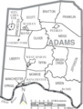 Map of Adams County Ohio With Municipal and Township Labels.PNG 494 × 654; 45 KB
-
 Map of Adams County, Ohio No Text, Municipalities Distinct.png 494 × 654; 30 KB
-
 Map of Adams County, Ohio No Text.png 494 × 654; 29 KB


