Category:Pigeon Island, Saint Lucia
Jump to navigation
Jump to search
| Object location | | View all coordinates using: OpenStreetMap |
|---|
islet in Saint Lucia  | |||||
| Upload media | |||||
| Instance of | |||||
|---|---|---|---|---|---|
| Location | Gros Islet Quarter, Saint Lucia | ||||
| Located in or next to body of water | |||||
| Width |
| ||||
| Length |
| ||||
| Area |
| ||||
 | |||||
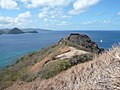
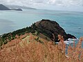
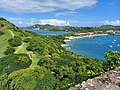
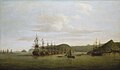
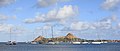
English: Pigeon Island (also known as Pigeon point) is an islet located alongside the northwestern coast of Saint Lucia island in the Caribbean Sea. It was artificially joined to the mainland in the 1970s by a man-made causeway. Site of Fort Rodney.
Media in category "Pigeon Island, Saint Lucia"
The following 41 files are in this category, out of 41 total.
-
 A View of Pigeon Island & Part of St. Lucia, 25 March 1780 GAC 819.jpg 1,658 × 972; 1.21 MB
-
 A view of Pigeon Island And part of St. Lucia, 1780 - BLL01016552895.jpg 1,024 × 627; 117 KB
-
 At the top of Pigeon Island.jpg 2,592 × 1,944; 2.24 MB
-
 Barracks, Pigeon Island, St. Lucia 3.jpg 3,264 × 2,448; 1.66 MB
-
 Barracks, Pigeon Island, St. Lucia 5.jpg 3,264 × 2,448; 1.64 MB
-
 Cannon on Pidgeon Point. - Flickr - gailhampshire.jpg 2,088 × 3,017; 1.93 MB
-
 Cannons at Fort Rodney, Pigeon Island, Santa Lucia (December 2008).jpg 3,264 × 2,448; 1.66 MB
-
 Canon canon.. (26963934646).jpg 4,368 × 2,912; 4.45 MB
-
 Fort Rodney, Pigeon Island, St. Lucia 4.jpg 3,264 × 2,448; 1.76 MB
-
 Fort Rodney, Pigeon Island, St. Lucia 5.jpg 3,264 × 2,448; 1.82 MB
-
 Lucia 079.jpg 576 × 432; 67 KB
-
 Musket Redoubt (39987376965).jpg 3,648 × 2,736; 4.21 MB
-
 Officers Mess, Pigeon Island, St. Lucia 2.jpg 3,264 × 2,448; 1.71 MB
-
 Pigeon Island - panoramio - georama (1).jpg 2,704 × 2,120; 2.83 MB
-
 Pigeon Island - panoramio - georama (2).jpg 2,949 × 2,239; 2.51 MB
-
 Pigeon Island - panoramio - georama (3).jpg 3,035 × 2,285; 1.89 MB
-
 Pigeon Island - panoramio - georama (4).jpg 3,050 × 2,292; 2.35 MB
-
 Pigeon Island - panoramio - georama.jpg 3,051 × 2,293; 2.62 MB
-
 Pigeon Island - panoramio.jpg 2,304 × 3,072; 3.29 MB
-
 Pigeon Island historical marker for Fort Rodney's redoubt.jpg 5,312 × 2,988; 6.23 MB
-
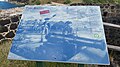 Pigeon Island historical marker for Fort Rodney.jpg 5,312 × 2,988; 7.7 MB
-
 Pigeon Island historical marker for WW II.jpg 5,312 × 2,988; 4.56 MB
-
 Pigeon Island, & Village of Gros Islet, St. Lucia. Engraved by J. Harris.jpg 1,603 × 1,244; 1.59 MB
-
 Pigeon Island, St. Lucia 6.jpg 3,264 × 2,448; 1.82 MB
-
 Pigeon Island, St. Lucia 7.jpg 3,264 × 2,448; 1.8 MB
-
 Pigeon Island.JPG 1,781 × 809; 522 KB
-
 Pigeon Island0.jpg 3,264 × 2,448; 1.66 MB
-
 Pigeon point - Saint Lucia.jpg 1,000 × 750; 163 KB
-
 Pigeon Point Fort Rodney St Lucia (146557337).jpeg 2,048 × 320; 149 KB
-
 Ridge Batterry, Pigeon Island, St. Lucia 3.jpg 3,264 × 2,448; 1.57 MB
-
 Rodger with Cannon at Fort Rodney (40173010614).jpg 5,472 × 3,648; 13.34 MB
-
 Royal Clipper and Tall Grass (40880824831).jpg 3,648 × 2,736; 2.56 MB
-
 Saint Lucia - View from Fort Rodney.jpg 4,624 × 3,468; 14.31 MB
-
 Dominic Serres - Barrington's action at St Lucia 1778 - ZBA2204.jpg 1,280 × 745; 145 KB
-
 Snooty Agouti, Pigeon Island.jpg 3,784 × 2,838; 2.85 MB
-
 St Croix Roadstead, Rodney Bay, St Lucia 2011 0652.jpg 5,184 × 3,456; 7.5 MB
-
 St Croix Roadstead, Rodney Bay, St Lucia, Pidgeon Island 2011 1085.jpg 4,628 × 1,983; 2.04 MB
-
 St. Lucia - Pigeon Island from Fort Rodney.jpg 3,918 × 2,889; 9.98 MB
-
 St. Lucia - Pigeon Island.jpg 4,000 × 3,000; 5.69 MB
-
 To The Lookout (40880823301).jpg 3,648 × 5,472; 15.07 MB
-
 West Indian tales of old (1915) (14781712385).jpg 2,192 × 1,556; 539 KB


.jpg)
.jpg)


.jpg)

.jpg)
.jpg)
.jpg)
.jpg)


.jpg)
.jpg)


.jpg)
_(14781712385).jpg)
.jpeg)