Category:Paulsgrove
Jump to navigation
Jump to search
place in Portsmouth, Hampshire, England  | |||||
| Upload media | |||||
| Instance of | |||||
|---|---|---|---|---|---|
| Part of | |||||
| Location | City of Portsmouth, Hampshire, South East England, England | ||||
 | |||||
Subcategories
This category has the following 28 subcategories, out of 28 total.
A
- Abbeydore Road, Paulsgrove (16 F)
B
- Birdlip Road, Paulsgrove (4 F)
- Bredenbury Crescent, Paulsgrove (15 F)
- Bromyard Crescent, Paulsgrove (14 F)
C
- Colesbourne Road, Paulsgrove (3 F)
- Collington Crescent, Paulsgrove (18 F)
- Credenhill Road, Paulsgrove (14 F)
D
- Dormington Road, Paulsgrove (10 F)
E
- Elkstone Road, Paulsgrove (20 F)
H
- Hillsley Road, Paulsgrove (9 F)
L
- Ledbury Road, Paulsgrove (8 F)
- Leominster Road, Paulsgrove (20 F)
- Ludlow Road, Paulsgrove (22 F)
M
- Mortimer Road, Paulsgrove (14 F)
N
- Nailsworth Road, Paulsgrove (7 F)
P
- Paulsgrove Baptist Church (5 F)
- Paulsgrove Carnival, Portsmouth (29 F)
- Paulsgrove Chalk Pit (16 F)
- St Paul's Church, Paulsgrove (6 F)
T
- Tarleton Road, Paulsgrove (8 F)
W
- Walford Road, Paulsgrove (13 F)
- Winchcombe Road, Paulsgrove (9 F)
- Woofferton Road, Paulsgrove (8 F)
Media in category "Paulsgrove"
The following 112 files are in this category, out of 112 total.
-
 "Oh, there it is" - geograph.org.uk - 1749550.jpg 640 × 480; 85 KB
-
 2016, a year on Geograph (Day 61) - geograph.org.uk - 4847056.jpg 640 × 480; 44 KB
-

-
 A group of stolen shopping trolleys, Paulsgrove.jpg 2,956 × 2,956; 9.96 MB
-

-
 A27 Southampton Road - geograph.org.uk - 5908288.jpg 1,024 × 684; 189 KB
-

-

-

-

-

-

-

-
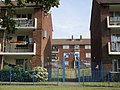
 Austin Court, Paulsgrove - geograph.org.uk - 780344.jpg 640 × 480; 73 KB
-
 B2177 Southwick Road - geograph.org.uk - 5803852.jpg 1,024 × 684; 182 KB
-
 Bathtub Garden at Beacon View Primary Academy.jpg 4,608 × 2,592; 9.36 MB
-
 Brown bin collection day on Newbolt Road - geograph.org.uk - 4113488.jpg 1,024 × 768; 203 KB
-
 Busy road scene near Port Solent - geograph.org.uk - 706517.jpg 640 × 480; 54 KB
-

-
 Chalk downland on Portsdown Hill - geograph.org.uk - 5099879.jpg 4,063 × 3,047; 3.17 MB
-
 Chest on Stand.jpg 4,608 × 3,456; 3.84 MB
-
-
 City of Portsmouth , M27 Motorway - geograph.org.uk - 5738944.jpg 6,000 × 4,000; 5.7 MB
-
 City of Portsmouth , M27 Motorway - geograph.org.uk - 5738945.jpg 6,000 × 4,000; 5.76 MB
-
 City of Portsmouth , M27 Motorway - geograph.org.uk - 5738947.jpg 6,000 × 4,000; 5 MB
-
 Co-op store Allaway Avenue - geograph.org.uk - 4113519.jpg 1,024 × 768; 149 KB
-
 Colin Jackson visits Paulsgrove - geograph.org.uk - 852148.jpg 640 × 480; 84 KB
-
 Decorative entrance to Rydal House - geograph.org.uk - 4113615.jpg 1,024 × 768; 232 KB
-
 Deerhurst Crescent - geograph.org.uk - 703866.jpg 640 × 480; 74 KB
-

-
 Entrance to Rapson Close - geograph.org.uk - 1615080.jpg 640 × 480; 50 KB
-
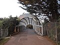
 Entrance to St Paul's - geograph.org.uk - 703812.jpg 640 × 480; 63 KB
-
-
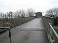
 Footbridge over the railway, Racecourse Lane - geograph.org.uk - 4176064.jpg 1,024 × 768; 184 KB
-

-
 Footpath to Beverston Road - geograph.org.uk - 703852.jpg 640 × 480; 73 KB
-
 Footpath to Cheltenham Road - geograph.org.uk - 4113501.jpg 1,024 × 768; 181 KB
-
 Garages behind Leominster Road - geograph.org.uk - 704019.jpg 640 × 480; 54 KB
-

-
 Goalmouth at Paulsgrove F.C. - geograph.org.uk - 1177157.jpg 480 × 640; 54 KB
-

-
 Harbour Lights Beefeater Restaurant, Former Pub.jpg 4,608 × 3,456; 4.45 MB
-
 Hatherley Road, Paulsgrove - geograph.org.uk - 780592.jpg 640 × 480; 58 KB
-
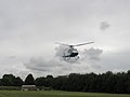 Helicopter taking off from PPS field - geograph.org.uk - 852129.jpg 640 × 480; 25 KB
-
 Hendy Ford Paulsgrove - geograph.org.uk - 705203.jpg 640 × 480; 62 KB
-
 Houses in Collington Crescent - geograph.org.uk - 5311492.jpg 640 × 360; 43 KB
-
-
 KFC Paulsgrove - geograph.org.uk - 705201.jpg 640 × 480; 53 KB
-
 KIA Motors on Southampton Road - geograph.org.uk - 4056885.jpg 1,500 × 999; 158 KB
-
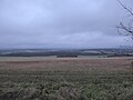
 Looking across Paulsgrove from Portsdown Hill - geograph.org.uk - 5099876.jpg 4,608 × 3,456; 3.97 MB
-

-

-

-
 Looking west from Southwick Road - geograph.org.uk - 6175620.jpg 7,199 × 4,584; 4.5 MB
-
 Ludlow Road - geograph.org.uk - 5311491.jpg 640 × 360; 44 KB
-
 M27 - geograph.org.uk - 4250108.jpg 640 × 378; 33 KB
-
 M27, Junction 12 - geograph.org.uk - 4250112.jpg 640 × 337; 39 KB
-

-

-
 Overlooking Portsmouth - panoramio.jpg 1,024 × 768; 295 KB
-
 Parade of shops in Allaway Avenue - geograph.org.uk - 5311556.jpg 640 × 360; 61 KB
-
 Paulsgrove Adventure Playground 3.jpg 4,608 × 3,456; 6.23 MB
-
 Paulsgrove Adventure Playground 4.jpg 4,608 × 3,456; 5.6 MB
-
 Paulsgrove and Wymering Healthy Living Centre - geograph.org.uk - 4113597.jpg 1,024 × 768; 214 KB
-
 Paulsgrove Library - geograph.org.uk - 607967.jpg 640 × 480; 68 KB
-
 Paulsgrove Overhead View.jpg 4,000 × 3,000; 5.39 MB
-
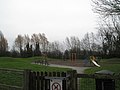
 Paulsgrove Playpark in the gloaming - geograph.org.uk - 1082114.jpg 640 × 480; 81 KB
-
 Paulsgrove Prefabs - geograph.org.uk - 703903.jpg 640 × 480; 54 KB
-
 Paulsgrove Primary School P1010029.JPG 3,072 × 2,304; 2.97 MB
-
 Paulsgrove Social Club - geograph.org.uk - 615287.jpg 640 × 480; 104 KB
-

-
 Pony by M27 Paulsgrove.jpg 4,608 × 3,456; 3.95 MB
-
 Portsdown Hill - geograph.org.uk - 4681966.jpg 4,000 × 3,000; 3.96 MB
-

-
 Portsmouth from Portsdown Hill - geograph.org.uk - 5099875.jpg 4,493 × 3,371; 2.48 MB
-
 Premier Inn, Paulsgrove - geograph.org.uk - 705195.jpg 640 × 480; 48 KB
-
 Pylon behind house in Lime Grove - geograph.org.uk - 780577.jpg 480 × 640; 56 KB
-
 Rothwell Close, Paulsgrove - geograph.org.uk - 703895.jpg 640 × 480; 59 KB
-
 Roundabout in Western Road - geograph.org.uk - 1177488.jpg 640 × 480; 58 KB
-

-
 Seat on Paulsgrove Rec - geograph.org.uk - 1177181.jpg 470 × 640; 50 KB
-

-

-
 Shrine to four friends - geograph.org.uk - 1812954.jpg 640 × 480; 106 KB
-
 Site of former Hillside Gospel Hall, Ludlow Road, Paulsgrove (August 2017).JPG 4,200 × 2,200; 1.76 MB
-

-

-

-
 Subway beneath the M27 - geograph.org.uk - 4113477.jpg 1,024 × 768; 217 KB
-

-
 The (White) Green, Paulsgrove - geograph.org.uk - 1144469.jpg 480 × 640; 51 KB
-
 The circus comes to Paulsgrove^ - geograph.org.uk - 1365595.jpg 640 × 480; 70 KB
-
 The Cross Keys Pub 2.jpg 3,780 × 2,126; 6.71 MB
-
 The Cross Keys pub.jpg 4,608 × 3,456; 5.62 MB
-
 The Cross Keys, Paulsgrove - geograph.org.uk - 703926.jpg 640 × 480; 70 KB
-
 The dug-out at Paulsgrove F.C. - geograph.org.uk - 1177159.jpg 640 × 480; 78 KB
-
 The Green. Paulsgrove - geograph.org.uk - 4113573.jpg 1,024 × 768; 176 KB
-
 The Green. Paulsgrove - geograph.org.uk - 4113583.jpg 1,024 × 768; 258 KB
-

-
 The new Co-Op, Paulsgrove - geograph.org.uk - 607958.jpg 640 × 480; 63 KB
-
 The Old House at Home former pub, Paulsgrove 2.jpg 4,608 × 3,456; 5.4 MB
-
-

-
 The view north-northeast from Portchester Castle (1) - geograph.org.uk - 5467453.jpg 3,872 × 2,592; 4.51 MB
-
 The view north-northeast from Portchester Castle (2) - geograph.org.uk - 5467461.jpg 3,872 × 2,592; 4.21 MB
-

-
 Track below James Callaghan Drive - geograph.org.uk - 5359859.jpg 1,024 × 768; 159 KB
-
 View across to Farmlea Road - geograph.org.uk - 707573.jpg 640 × 480; 39 KB
-

-
 View from Portsdown Hill - geograph.org.uk - 4682004.jpg 4,000 × 3,000; 4.1 MB
-
 View over Paulsgrove - geograph.org.uk - 5363683.jpg 1,024 × 768; 202 KB
-
 Looking over Portsmouth City - geograph.org.uk - 618193.jpg 640 × 480; 91 KB

_-_geograph.org.uk_-_4847056.jpg)


,_Southampton_Road,_Port_Solent,_Portsmouth_(May_2019).JPG)


.JPG)


_Green,_Paulsgrove_-_geograph.org.uk_-_1144469.jpg)


_-_geograph.org.uk_-_5467453.jpg)
_-_geograph.org.uk_-_5467461.jpg)


