Category:Passe du Boucarot
Jump to navigation
Jump to search
| Object location | | View all coordinates using: OpenStreetMap |
|---|
English: The passe du Boucarot (=Boucarot strait) is the mouth of the costal river "Boudigau" downstream the port of Capbreton.
Français : La passe du Boucarot correspond à l'embouchure du fleuve cotier "le Boudigau" en aval du port de Capbreton.
Media in category "Passe du Boucarot"
The following 31 files are in this category, out of 31 total.
-
 Plan schématique du port de Capbreton et de ses environs.jpg 960 × 720; 96 KB
-
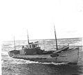
 1947-08 Chalutier Capbreton.jpg 1,861 × 1,257; 559 KB
-
 1949-07 Chalutier Capbreton.jpg 1,906 × 1,213; 765 KB
-
 1952-07 Chalutier Capbreton.jpg 1,294 × 1,165; 222 KB
-
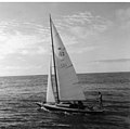
 1965-07-Voilier Estuaire-Sport (Capbreton).jpg 1,905 × 1,865; 956 KB
-
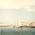
 1965-07-Voilier Requin (Capbreton).jpg 1,903 × 1,883; 878 KB
-
 1967-08 Voilier Requin (Capbreton).jpg 1,886 × 1,856; 880 KB
-
 1967-11 Effet de vague à l'escalier du canal.jpg 1,871 × 1,877; 747 KB
-
 1967-11 Vague passant sur le quai du canal du Boudigau.jpg 1,875 × 1,873; 974 KB
-
 1968-08 Baignade dans le canal de Capbreton.jpg 1,009 × 773; 170 KB
-
 1969-04 Effet de vagues à l'escalier du canal.jpg 1,874 × 1,856; 545 KB
-
 1971-07 Voilier rentrant au port de Capbreton.jpg 1,873 × 1,883; 957 KB
-
 1975-06 Fête de la mer 1.jpg 2,082 × 2,088; 1.24 MB
-
 1975-06 Fête de la mer 2.jpg 2,077 × 2,070; 656 KB
-
 1975-06 Fête de la mer 3.jpg 2,101 × 2,089; 1.45 MB
-
 Canal-d-Hossegor-1.JPG 4,288 × 2,848; 2.91 MB
-
 Canal-d-Hossegor-2.JPG 4,288 × 2,848; 2.84 MB
-
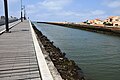
 Capbreton entrée port (3).jpg 3,828 × 2,490; 1.25 MB
-
 Catamaran sailboat homing into Capbreton.jpg 3,312 × 4,416; 1.09 MB
-
 Le Sirius entrant dans le port de Capbreton.jpg 2,816 × 2,112; 2 MB
-
 No mixing waters in Capbreton 1.jpg 4,416 × 3,312; 1.39 MB
-
 No mixing waters in Capbreton 2.jpg 3,312 × 4,416; 1.77 MB
-
 No mixing waters in Capbreton 3.jpg 4,416 × 3,312; 1.28 MB
-
 No mixing waters in Capbreton 4.jpg 4,416 × 3,312; 1.24 MB
-
 No mixing waters in Capbreton 5.jpg 4,416 × 3,312; 1.48 MB
-
 No mixing waters in Capbreton 6.jpg 4,416 × 3,312; 1.28 MB
-
 Phare bateau.JPG 3,512 × 2,400; 340 KB
-
 Plage Notre-Dame depuis Capbreton.jpg 2,816 × 2,112; 1.45 MB
-
 Sun siare catamaran homing into the marina of Capbreton.jpg 2,112 × 2,816; 1.33 MB
-
 Vague passant sur le quai du canal du Boudigau.jpg 2,112 × 2,816; 1.97 MB
-
 Voilier rentrant au port de Capbreton.jpg 3,840 × 2,160; 1.68 MB


.jpg)
.jpg)
.jpg)


.jpg)


