Category:Osterholzer Friedhof
Jump to navigation
Jump to search
| Object location | | View all coordinates using: OpenStreetMap |
|---|
cemetery in Osterholz, Germany  | |||||
| Upload media | |||||
| Instance of | |||||
|---|---|---|---|---|---|
| Location | Osterholz, Bremen-Ost, Bremen, Germany | ||||
| Street address |
| ||||
| Has part(s) |
| ||||
| Heritage designation | |||||
 | |||||
Der Osterholzer Friedhof is a protected cultural monument in the Free Hanseatic City of Bremen with the number 0969,T registered with the State Office for Monument Preservation. → Datenbankeintrag
Subcategories
This category has the following 2 subcategories, out of 2 total.
Media in category "Osterholzer Friedhof"
The following 63 files are in this category, out of 63 total.
-
 Annette Diemer - Schmiedeeisernes Tor 01.jpg 1,500 × 910; 945 KB
-
 Annette Diemer - Schmiedeeisernes Tor 02.jpg 1,500 × 928; 829 KB
-
 Annette Diemer - Schmiedeeisernes Tor 03.jpg 1,500 × 823; 813 KB
-
 Annette Diemer - Schmiedeeisernes Tor 04.jpg 1,500 × 1,045; 730 KB
-
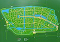 Bremen Osterholzer Friedhof Friedhofsplan 01.jpg 1,280 × 897; 428 KB
-
 Brunnen mit Taubenmotiv, Friedhof Osterholz, Kurt Lettow 1.jpg 3,000 × 3,320; 3.21 MB
-
 Brunnen mit Taubenmotiv, Friedhof Osterholz, Kurt Lettow 2.jpg 3,000 × 3,444; 3.46 MB
-
 EhrenanlageAuslaender.jpg 1,500 × 1,000; 1.18 MB
-
 EhrenanlageBombenopfer.jpg 1,500 × 1,000; 1.17 MB
-
 EhrenanlageNiederlande-detail.jpg 1,500 × 623; 525 KB
-
 EhrenanlageNiederlande-Stein-2.jpg 1,088 × 1,500; 950 KB
-
 EhrenanlageNiederlande-Stein.jpg 710 × 1,500; 383 KB
-
 EhrenanlageNiederlande.jpg 1,500 × 778; 824 KB
-
 EhrenanlageOpfer-KZ-gesamt.jpg 1,500 × 711; 821 KB
-
 EhrenanlageOpfer-KZ-Stein.jpg 1,500 × 785; 806 KB
-
 EhrenanlageSoldaten-Stein (2014).jpg 2,685 × 1,790; 2.3 MB
-
 EhrenanlageSoldaten-Stein.jpg 1,500 × 1,132; 906 KB
-
 EhrenanlageSoldaten1914-1918 1.jpg 1,500 × 809; 749 KB
-
 EhrenanlageSoldaten1914-1918 2.jpg 1,500 × 594; 783 KB
-
 EhrenanlageSoldatenOpferKZ-01.jpg 1,500 × 987; 999 KB
-
 EhrenanlageSoldatenOpferKZ-02.jpg 1,500 × 1,000; 1.14 MB
-
 Ehrenfeld für niederlaendische Kriegsopfer Osterholzer Friedhof.jpg 6,000 × 4,000; 15.73 MB
-
 EhrenmalSoldaten1914-1918 U51-1.jpg 1,500 × 736; 820 KB
-
 EhrenmalSoldaten1914-1918 U51-2.jpg 1,500 × 965; 945 KB
-
 Ereveld bremen.jpg 640 × 491; 110 KB
-
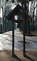
 Feuerglocke-01.jpg 1,500 × 916; 744 KB
-
 Feuerglocke-02.jpg 926 × 1,500; 806 KB
-
 Feuerglocke-03.jpg 993 × 1,500; 990 KB
-
 Feuerglocke-04.jpg 1,432 × 1,500; 890 KB
-
 Feuerglocke-05.jpg 1,497 × 1,500; 671 KB
-
 Grabmal-FriedrichDelius (1770-1823)-1.jpg 1,500 × 942; 684 KB
-
 Grabmal-FriedrichDelius (1770-1823)-2.jpg 1,500 × 1,455; 809 KB
-
 Grabmale der kriegszerstoerten Ansgariikirche-01-1.jpg 1,500 × 534; 314 KB
-
 Grabmale der kriegszerstoerten Ansgariikirche-01-2.jpg 1,500 × 722; 506 KB
-
 Grabmale der kriegszerstoerten Ansgariikirche-01-3.jpg 1,500 × 1,368; 937 KB
-
 Grabmale der kriegszerstoerten Ansgariikirche-01.jpg 1,500 × 1,173; 915 KB
-
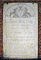 Grabstein Delius-1840.jpg 1,023 × 1,500; 835 KB
-
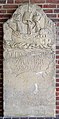 Grabstein Kramer-1795.jpg 742 × 1,500; 649 KB
-
 Grabstein Ulrichs-1825.jpg 1,127 × 1,500; 910 KB
-
 Grabstein-Duckwitz.jpg 1,500 × 993; 807 KB
-
 Grabstein-Freye.jpg 881 × 1,200; 435 KB
-
 Grabstein-GeorgDroste.jpg 881 × 1,500; 820 KB
-
 Grabstein-GottfriedReinholdTreviranus.jpg 1,500 × 1,099; 1.13 MB
-
 Grabstein-KurtGoessel.jpg 1,000 × 1,500; 954 KB
-
 Grabstein-SophiaChristianaThalmann.jpg 789 × 1,500; 793 KB
-
 Haupt-und-Suedkapelle-Osterholzer-Friedhof-20090720-IMG 0049-52a-k.jpg 3,073 × 800; 884 KB
-
 Haupt-und-Suedkapelle-Osterholzer-Friedhof-20090720-IMG 0049-52a-kk.jpg 1,537 × 400; 256 KB
-
 KunsthandwerkerBrunnen-1.jpg 1,500 × 900; 764 KB
-
 KunsthandwerkerBrunnen-2.jpg 1,500 × 1,020; 1 MB
-
 KunsthandwerkerBrunnen-3.jpg 1,005 × 1,500; 850 KB
-
 Osterholzer-Friedhof-Suedkapelle-Eingang-20090720-IMG 0044-k.jpg 1,067 × 800; 397 KB
-
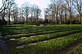
 OsterholzerFriedhof 05.jpg 1,500 × 792; 1.07 MB
-
 OsterholzerFriedhof-Belegfeld Freye 1906.png 599 × 607; 355 KB
-
 OsterholzerFriedhof-Ehrenstrasse-Freye 1906.png 406 × 413; 183 KB
-
 OsterholzerFriedhof-Hauptplan-Freye 1906.png 1,048 × 572; 648 KB
-
 OsterholzerFriedhof-Teich im Urnenfeld-Freye 1906.png 415 × 407; 189 KB
-
 OsterholzerFriedhofHaupteingang-Nebengeb-links.jpg 1,500 × 732; 681 KB
-
 OsterholzerFriedhofHaupteingang.jpg 1,500 × 674; 900 KB
-
 PforteEhrenanlage-1.jpg 1,264 × 1,500; 1.09 MB
-
 PforteEhrenanlage-2.jpg 1,000 × 1,500; 1.07 MB
-

-
 ZweiTrauerndeFrauen-1.jpg 1,037 × 1,499; 951 KB
-
 ZweiTrauerndeFrauen-2.jpg 1,020 × 1,500; 842 KB


.jpg)


-1.jpg)
-2.jpg)


