Category:Ordnance Survey 1st series 1:2500
Jump to navigation
Jump to search
The Ordnance Survey 1st Series of 1:2500 maps were for selected cities in Britain and their surrounding area. They were published in the late 19th century, mostly in the 1870s. At the 1:2500 scale, the full size map image shows 25 meters of the real world in 1 centimeter of image. At this scale it is easy to identify detailed arrangements of houses, paths and local landmarks.
Subcategories
This category has the following 22 subcategories, out of 22 total.
C
L
S
W
Media in category "Ordnance Survey 1st series 1:2500"
The following 5 files are in this category, out of 5 total.
-
 OS Edition1 1864 25inch map of Lordship Lane N17 and N22.png 3,631 × 679; 1.3 MB
-
 Parts of OS Edition 1 1880 25in Derbyshire Sheet 50.png 2,135 × 4,000; 4.03 MB
-
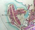 Portsmouth point OS25 inch to mile1858.PNG 1,480 × 1,266; 3.39 MB
-
 Talbot Street electricity power station, Nottingham.png 838 × 454; 783 KB
-
 Tarbat ness lighthouse OS map 25inch Rosshire XXX.7 1880.jpeg 8,050 × 5,800; 3.2 MB


