Category:OpenStreetMap maps of Paris 4e arrondissement
Jump to navigation
Jump to search
Media in category "OpenStreetMap maps of Paris 4e arrondissement"
The following 21 files are in this category, out of 21 total.
-
 4e Arrondissement, Paris, France - Open Street Map.png 1,028 × 1,009; 1.35 MB
-
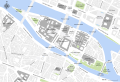
 4th arrondissement of Paris - OSM 2020.svg 1,542 × 1,516; 1.04 MB
-
 Buildings, Place des Vosges, Paris - OSM 2021.svg 512 × 463; 171 KB
-
 Canal Saint-Martin, Paris - OSM 2022.svg 1,694 × 2,206; 7.59 MB
-
 Fountains of the place Louis-Lépine, OSM 2017.svg 2,540 × 1,788; 52 KB
-
 Hôtel de Sully plan - OSM 2017.svg 512 × 500; 40 KB
-
 Hôtels particuliers, Place des Vosges, Paris - OSM 2021.svg 512 × 463; 171 KB
-
 Map of the 4th arrondissement of Paris - OSM 2020.svg 1,542 × 1,516; 1.06 MB
-
 Map of Île de la Cité - OpenStreetMap 2015.svg 2,000 × 1,050; 678 KB
-
 Map of Île de la Cité with monuments - OpenStreetMap 2015.svg 2,401 × 1,637; 564 KB
-
 Map of Île Saint-Louis - OpenStreetMap 2015.svg 2,154 × 1,793; 252 KB
-
 Paris - Île de la Cité 2011.svg 2,670 × 1,841; 5.05 MB
-
 Paris IV emplacement eglise Saint-Jean-en-Greve rwk.jpg 365 × 334; 157 KB
-
 Paris IV porte du Chaume emplacement sur carte actuelle.jpg 387 × 318; 113 KB
-
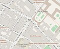
 Paris, Place des Vosges - OpenStreetMap 2017.svg 512 × 512; 23 KB
-
 Paris, Place des Vosges - OpenStreetMap.svg 366 × 350; 516 KB
-
 Place des Vosges, Paris - OSM 2021.svg 2,100 × 1,900; 174 KB
-
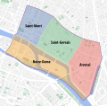 Quarters of the 4th arrondissement of Paris - OSM 2020.svg 1,542 × 1,516; 1.05 MB
-
 Île de la Cité and Île Saint-Louis - OSM 2021.svg 2,260 × 1,271; 1.26 MB
-
 Île Saint-Louis - OpenStreetMap 1.svg 644 × 580; 1.66 MB
-
 Île Saint-Louis - OSM 2021.svg 2,000 × 1,100; 541 KB


