Category:Olney, Maryland
Jump to navigation
Jump to search
census-designated place and unincorporated area in Montgomery County, Maryland, United States   | |||||
| Upload media | |||||
| Instance of | |||||
|---|---|---|---|---|---|
| Location | Montgomery County, Maryland | ||||
| Inception |
| ||||
| Population |
| ||||
| Area |
| ||||
| Elevation above sea level |
| ||||
| Different from | |||||
| official website | |||||
 | |||||
Subcategories
This category has the following 12 subcategories, out of 12 total.
B
F
- Falling Green (6 F)
M
- Maryland Route 928 (3 F)
O
- Olney Indoor Swim Center (15 F)
- Olney Library (3 F)
R
- Road signs for Olney, Maryland (10 F)
- Roads in Olney, Maryland (25 F)
S
W
- Washington Christian Academy (4 F)
Media in category "Olney, Maryland"
The following 21 files are in this category, out of 21 total.
-

-

-

-

-

-
 Church of Jesus Christ of Latter-day Saints - Olney, Maryland.jpg 4,608 × 3,456; 3.27 MB
-
 Faith Presbyterian Church - Olney, Maryland.jpg 4,075 × 3,137; 1.86 MB
-

-

-
-

-

-

-
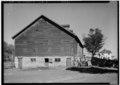
 Home of Sec. Ickes, Olney, MD LCCN2016873737.jpg 10,106 × 8,044; 9.88 MB
-

-
 Olney - MD108 at Village Center Dr - WfNE.jpg 4,000 × 3,000; 6.59 MB
-
 Our Lady of Good Counsel High School.jpg 3,420 × 1,756; 4.72 MB
-

-
-

-
 Soccer at freeman fields.jpg 2,272 × 1,704; 1.57 MB


_in_Olney,_Montgomery_County,_Maryland.jpg)