Category:Old rail transport maps of Germany
Jump to navigation
Jump to search
Subcategories
This category has only the following subcategory.
Media in category "Old rail transport maps of Germany"
The following 60 files are in this category, out of 60 total.
-

-

-

-

-
-
 Bahnkarte Deutschland 1849.jpg 4,646 × 3,766; 17.31 MB
-
 Bahnkarte Deutschland 1861.jpg 4,878 × 3,792; 19.41 MB
-
 Bahnkarte Deutschland 1899.jpg 4,710 × 3,622; 17.63 MB
-
 Berliner Ringbahn1885.jpg 922 × 557; 266 KB
-
 Brockhaus' Konversations-Lexikon (1892) (14594513108).jpg 1,624 × 2,478; 1.05 MB
-
 Kgl. Eisenbahn-Direction Bromberg postcard.jpg 800 × 530; 280 KB
-
 Chemins de fer. Alsace, Lorraine, Palatinat - btv1b531215635.jpg 8,134 × 10,552; 11.15 MB
-
 Coeln-Minden aus Bahnkarte Deutschland 1849.png 1,500 × 1,000; 3.03 MB
-
 Deutsches Reich Eisenbahnen.jpg 2,286 × 1,776; 3.56 MB
-
 Deutschland und anliegende Länder, zur Übersicht der Eisenbahnen und Hauptstrassen.jpg 5,526 × 4,537; 7.31 MB
-

-
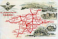 Eisenbahndirektion-cassel.jpg 792 × 526; 431 KB
-

-
 Eisenbahnkarte Deutschland 1908-Wm05514a.jpg 5,732 × 4,488; 10.15 MB
-
 Führer durch Greifswald - 1886 - N022.jpg 4,961 × 4,033; 3.14 MB
-

-
 Karte der Eisenbahnen Deutschlands um 1857.jpg 400 × 383; 86 KB
-

-

-
 KglWestEB.jpg 917 × 1,270; 596 KB
-
 Lange diercke sachsen deutschland fischsonderzugverkehr.jpg 1,258 × 1,221; 757 KB
-
 Lange diercke sachsen deutschland verkehr.jpg 2,563 × 1,719; 3.59 MB
-
 LASB K Hellwig 0311.jpg 8,325 × 11,467; 9.89 MB
-
 Luxuszüge 1910.jpg 2,362 × 2,480; 780 KB
-
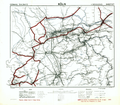 Map of the German railways, Sheet 27 Köln, May 1945 (148034558).png 6,764 × 5,935; 45.96 MB
-
 Map of the German railways, Sheet 28 Kassel, May 1945 (148034560).png 6,341 × 5,734; 45.57 MB
-
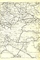
 Map of the German railways, Sheet 35 Koblenz, May 1945 (148034562).png 4,056 × 3,557; 22.66 MB
-
 Map of the German railways, Sheet 36 Frankfurt (Main), May 1945 (148034564).png 3,716 × 3,402; 19.1 MB
-
 Map of the German railways, Sheet 43 Saarbrücken, May 1945 (148034566).png 4,743 × 4,172; 25.04 MB
-
 Map of the German railways, Sheet 44 Karlsruhe, May 1945 (148034568).png 4,068 × 3,578; 21.37 MB
-
 Meyers b5 s0442a.jpg 2,048 × 1,619; 620 KB
-
 Militärische Eisenbahnkarte für Deutschland. .. - btv1b53085902q.jpg 8,352 × 7,024; 10.51 MB
-
 Mosty nad Regaliczką - plan.png 452 × 427; 363 KB
-

-

-

-

-
 Post- und Eisenbahnkarte von Deutschland und den benachbarten Laendern.jpg 8,564 × 6,912; 21.14 MB
-
 Post- und Reisekarte von Deutschland 1854.jpg 400 × 310; 64 KB
-
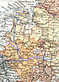
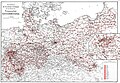
 Post- und Verwaltungs-Karte der Provinz Brandenburg 1850.jpg 400 × 413; 26 KB
-
 Rail map of Baden and Württemberg 1861.jpg 708 × 801; 789 KB
-
 Railway map Wroclaw and neighbouring 1849.jpg 565 × 565; 407 KB
-
 Reise-bzwEisenbahnkarte Deutschland1896.jpg 3,811 × 3,004; 6.4 MB
-
 Roell-1912 Karte der Badischen Eisenbahnen.jpg 1,950 × 2,950; 637 KB
-
 Roell-1912 Karte der Bayerischen Eisenbahnen.jpg 3,905 × 3,840; 1.74 MB
-
 Roell-1912 Karte der Preussischen Eisenbahnen.jpg 5,203 × 3,583; 4.41 MB
-
 Roell-1912 Karte der Sächsischen Eisenbahnen.jpg 3,314 × 2,295; 1.81 MB
-
 Roell-1912 Karte der Württembergischen Eisenbahnen.jpg 2,175 × 2,449; 1.41 MB
-
 Sektion 17.jpg 3,400 × 2,338; 3.13 MB
-

-
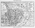 Stadtplan-2-Bahnhöfe.jpg 1,200 × 973; 425 KB
-
 Übersichtskarte des Reichsbahdirektionsbezirks Stettin. Zustand 1928.djvu 8,000 × 5,675; 827 KB
-
 Uebersichts Karte der Eisenbahnen Deutschlands - bearbeitet im Reichs-Eisenbahn-Amt - btv1b53239388t.jpg 17,656 × 13,866; 51.62 MB
-
 Uebersichts-Karte der Eisenbahn Deutschlands - btv1b532394473.jpg 17,666 × 13,870; 53.97 MB
-
 Uebersichts-Karte der Eisenbahnen Deutschlands - bearbeitet im Reichs-Eisenbalm-Amt - btv1b53060659f.jpg 17,774 × 13,974; 45.45 MB
.jpg)
.jpg)
.jpg)
.jpg)
.jpg)


_(14594513108).jpg)


_-_von_Rudolf_Gross..._-_btv1b84683875.jpg)


_13_196_1_Die_Eisenbahnen_von_Magdeburg_nach_Braunschweig_und_Halberstadt_und_von_Braunschweig_nach_Harzburg.png)


_-_von_W._Liebenow..._-_btv1b53085900t.jpg)


.png)
.png)
.png)
,_May_1945_(148034564).png)
.png)
.png)


