Category:Old maps showing the West Side Line below 20th St.
Jump to navigation
Jump to search
TIFF versions are available for most of the Bromley, Dripps, Perris, Robinson, and Sanborn maps in this category, at the categories for their respective atlases. They are omitted here to avoid duplication.
Note: This category is sorted by year.
Media in category "Old maps showing the West Side Line below 20th St."
The following 70 files are in this category, out of 70 total.
-
 Perris Manhattan V. 1 Plate 08 publ. 1852.jpg 5,883 × 4,273; 5.4 MB
-
 Perris Manhattan V. 3 Plate 37 publ. 1853.jpg 5,798 × 4,229; 4.31 MB
-
 Perris Manhattan V. 1 Plate 008 publ. 1857.jpg 5,783 × 4,335; 4.42 MB
-
 Perris Manhattan V. 1 title page and volume key (small) publ. 1857.jpg 2,442 × 1,754; 1.24 MB
-
 Perris Manhattan V. 1 title page and volume key publ. 1857.jpg 5,991 × 4,356; 7.84 MB
-
 Perris Manhattan V. 2 title page and volume key publ. 1857.jpg 6,038 × 4,386; 6.95 MB
-
 Perris Manhattan V. 4 Plate 061 publ. 1859.jpg 5,694 × 4,400; 4.86 MB
-
 Dripps Manhattan Sheet 03 publ. 1867 (crop 2).jpg 732 × 871; 1,020 KB
-
 Dripps Manhattan Sheet 03 publ. 1867.jpg 4,554 × 5,626; 37.77 MB
-
 Dripps Manhattan Sheet 05 publ. 1867.jpg 5,400 × 4,353; 32.69 MB
-
 Dripps Manhattan Sheet 06 publ. 1867.jpg 4,274 × 5,371; 26.56 MB
-
 1879 Christopher Street Ferry.jpg 1,249 × 1,785; 784 KB
-
 Bromley Manhattan and Bronx Plate 03 publ. 1879.jpg 9,035 × 5,796; 16.54 MB
-
 Part of ward 9, Atlas of the entire city of New York. G.W. Bromley 1879.jpg 11,742 × 7,029; 16.42 MB
-

-
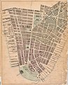
 EB9 New York - City - lower part.jpg 2,713 × 3,914; 2.66 MB
-
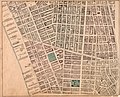
 DwntwnNYC1885.jpeg 2,127 × 3,031; 3.51 MB
-
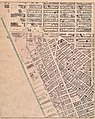
 Robinson Manhattan and Bronx Plate 03 publ. 1885.jpg 5,213 × 3,798; 6.58 MB
-
 Robinson Manhattan and Bronx Plate 10 publ. 1885.jpg 5,808 × 3,914; 7.87 MB
-
 Robinson Manhattan and Bronx Plate 11 publ. 1885.jpg 5,964 × 3,946; 8.51 MB
-
 Bromley Manhattan Plate 04 publ. 1891.jpg 6,441 × 4,421; 8.42 MB
-
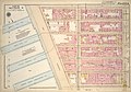
 Robinson V. 4 Plate 07 publ. 1893.jpg 6,552 × 4,483; 7.4 MB
-
 Sanborn Manhattan V. 1 Plate 17 right half publ. 1894.jpg 4,961 × 6,657; 4.36 MB
-
 Bromley Manhattan V. 1 Plate 10 publ. 1899.jpg 6,572 × 4,443; 7.76 MB
-
 Bromley Manhattan V. 2 outline and volume index publ. 1899.jpg 6,394 × 4,536; 6.74 MB
-
 Bromley Manhattan V. 2 Plate 06 publ. 1899.jpg 6,601 × 4,537; 6.64 MB
-
 Sanborn Manhattan V. 1 Plate 041 publ. 1905.jpg 4,303 × 6,396; 4.62 MB
-
 Sanborn Manhattan V. 1 Plate 043 publ. 1905.jpg 4,297 × 6,441; 3.32 MB
-
 Sanborn Manhattan V. 1 Plate 044 publ. 1905.jpg 4,254 × 6,426; 3.58 MB
-
 Bromley Manhattan Plate 04 publ. 1911.jpg 5,873 × 3,974; 8.83 MB
-
 Bromley Manhattan Battery – 14th St. index and explanations publ. 1916.jpg 5,574 × 3,996; 6.21 MB
-
 Bromley Manhattan Plate 010 publ. 1916.jpg 5,592 × 3,842; 6.8 MB
-
 Bromley Manhattan Plate 021 publ. 1916.jpg 5,867 × 3,833; 8.21 MB
-
 Bromley Manhattan Plate 034 publ. 1916.jpg 5,500 × 3,956; 7.46 MB
-
 Bromley Manhattan Plate 036 publ. 1916.jpg 5,686 × 3,829; 6.82 MB
-
 Bromley Manhattan Plate 038 publ. 1916.jpg 5,715 × 3,972; 5.56 MB
-
 Bromley Manhattan Plate 041 publ. 1916.jpg 5,662 × 3,982; 5.67 MB
-
 Bromley Manhattan V. 2 Plate 06 publ. 1920.jpg 6,584 × 4,629; 7.83 MB
-
 Bromley Manhattan complete Plate 010 publ. 1921–23.jpg 8,012 × 5,519; 12.64 MB
-
 Bromley Manhattan complete Plate 021 publ. 1921–23.jpg 8,342 × 5,595; 13.54 MB
-
 Bromley Manhattan complete Plate 034 publ. 1921–23.jpg 8,039 × 5,657; 13.01 MB
-
 Bromley Manhattan complete Plate 036 publ. 1921–23.jpg 8,245 × 5,579; 11.32 MB
-
 Bromley Manhattan complete Plate 038 publ. 1921–23.jpg 7,984 × 5,580; 10.4 MB
-
 Bromley Manhattan complete Plate 041 publ. 1921–23.jpg 8,027 × 5,590; 10.87 MB
-
 Bromley Manhattan Plate 010 publ. 1925.jpg 8,410 × 5,829; 12.77 MB
-
 Bromley Manhattan Plate 021 publ. 1925.jpg 8,629 × 5,918; 13.84 MB
-
 Bromley Manhattan Plate 034 publ. 1925.jpg 8,378 × 6,058; 14.16 MB
-
 Bromley Manhattan Plate 036 publ. 1925.jpg 8,469 × 5,920; 11.81 MB
-
 Bromley Manhattan Plate 038 publ. 1925.jpg 8,437 × 5,924; 11.17 MB
-
 Bromley Manhattan Plate 041 publ. 1925.jpg 8,406 × 6,013; 11.12 MB
-
 Bromley Manhattan Plate 010 publ. 1927.jpg 8,010 × 5,444; 12.09 MB
-
 Bromley Manhattan Plate 021 publ. 1927.jpg 8,365 × 5,601; 13.53 MB
-
 Bromley Manhattan Plate 34 publ. 1927.jpg 7,904 × 5,702; 13.13 MB
-
 Bromley Manhattan Plate 36 publ. 1927.jpg 8,247 × 5,767; 10.43 MB
-
 Bromley Manhattan Plate 38 publ. 1927.jpg 7,931 × 5,633; 9.36 MB
-
 Bromley Manhattan Plate 41 publ. 1927.jpg 7,997 × 5,648; 9.16 MB
-
 Bromley Manhattan section index, Battery to 14th St., publ. 1927.jpg 7,903 × 5,633; 10.31 MB
-
 Bromley Manhattan Plate 010 publ. 1930.jpg 8,493 × 5,860; 12.65 MB
-
 Bromley Manhattan Plate 021 publ. 1930.jpg 8,775 × 6,034; 13.39 MB
-
 Bromley Manhattan Plate 036 publ. 1930.jpg 8,582 × 5,885; 13.75 MB
-
 Bromley Manhattan Plate 038 publ. 1930.jpg 8,438 × 5,953; 12.95 MB
-
 Bromley Manhattan Plate 041 publ. 1930.jpg 8,453 × 5,936; 11.04 MB
-
 Bromley Manhattan section index Battery to 14th St. publ. 1930.jpg 8,455 × 5,967; 12.18 MB
-
 Bromley Manhattan Plate 021 publ. 1955–56.jpg 8,760 × 5,954; 14.98 MB
-
 Bromley Manhattan Plate 034 publ. 1955–56.jpg 8,353 × 6,065; 10.76 MB
-
 Bromley Manhattan Plate 036 publ. 1955–56.jpg 8,772 × 6,057; 10.84 MB
-
 Bromley Manhattan Plate 038 publ. 1955–56.jpg 8,397 × 5,951; 10.17 MB
-
 Bromley Manhattan Plate 041 publ. 1955–56.jpg 8,389 × 5,937; 10.59 MB
-
 Bromley Manhattan and Bronx Plate 10 publ. 1879.jpg 8,998 × 5,846; 16.09 MB
-
 Perris Manhattan V. 1 Plate 017 publ. 1857.jpg 5,649 × 4,503; 4.82 MB


_publ._1857.jpg)


.jpg)


.jpg)


