Category:Old maps of the Chesapeake Bay
Jump to navigation
Jump to search
Subcategories
This category has the following 2 subcategories, out of 2 total.
1
- La Virginea Pars (12 F)
Media in category "Old maps of the Chesapeake Bay"
The following 128 files are in this category, out of 128 total.
-

-

-
 Drawing, map (BM 1906,0509.1.2).jpg 2,500 × 2,043; 703 KB
-
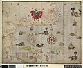
 Smith's 1612 Map of the Chesapeake (5a9d329b-1dd8-b71b-0baa-faa28a9fda80).jpg 2,000 × 1,543; 1.22 MB
-
-
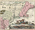 1662 1725 Neobelgii Allard Ottens³.jpg 3,319 × 2,839; 8.31 MB
-
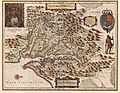
 Ogilby - Nova Terrae-Mariae tabula.jpg 5,882 × 4,832; 2.87 MB
-
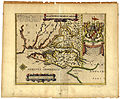
 1707-Leiden.jpg 1,400 × 2,024; 580 KB
-

-
 A Plan of the entrance of Chesapeak Bay, with James and York rivers (2675178594).jpg 2,000 × 1,579; 2.38 MB
-
 Chart of the entrance to Chesapeake Bay (NYPL b15261288-434994).jpg 2,690 × 2,415; 1.25 MB
-
 Chart of the entrance to Chesapeake Bay - E. Blunt delt.; Hooker sculpsit. NYPL433661.tiff 2,316 × 2,115; 18.69 MB
-
 Chart of the entrance to Chesapeake Bay.) NYPL434994.tiff 4,400 × 4,668; 58.77 MB
-

-

-

-

-

-

-

-

-

-

-

-

-

-

-

-

-

-

-

-

-

-

-
-

-
 A new and accurate chart of the Bay of Chesapeak including Delaware Bay (3046378650).jpg 1,607 × 2,000; 3.1 MB
-

-
-
 Admiralty Chart No 266 Barnegat Inlet to Chesapeake Bay, Published 1923. Large Corrections 1935.jpg 11,061 × 16,214; 44.87 MB
-
 Admiralty Chart No 266 Great Egg Harbour to Albemarle Sound, Published 1862.jpg 8,131 × 11,783; 12.59 MB
-
 Admiralty Chart No 2843 Chesapeake Bay Entrance, Published 1914, Large Corrections 1961.jpg 16,477 × 11,330; 56.3 MB
-
 Admiralty Chart No 2843 Chesapeake Bay Entrance, Published 1914.jpg 16,260 × 10,917; 73.18 MB
-
 Admiralty Chart No 2843b Chesapeake Bay Sheet 2, Published 1861, Large Corrections 1886.jpg 16,214 × 10,896; 47.21 MB
-
 Admiralty Chart No 2843c Chesapeake Bay Sheet 3, Published 1861, Large Corrections 1908.jpg 16,266 × 10,897; 55.79 MB
-
 Admiralty Chart No 2843d Chesapeake Bay Sheet 4, Published 1861, Large Corrections 1886 (composite).jpg 16,734 × 11,553; 58.31 MB
-
 Admiralty Chart No 2843d Chesapeake Bay Sheet 4, Published 1861, Large Corrections 1886.jpg 16,184 × 10,875; 59.27 MB
-
 Admiralty Chart No 2843e Chesapeake Bay Sheet 5, Published 1861, Large Corrections 1890.jpg 16,263 × 10,903; 75.31 MB
-
 Admiralty Chart No 2843f Chesapeake Bay Sheet 6, Published 1861, Large Corrections 1890.jpg 16,194 × 10,951; 53.24 MB
-

-
-

-

-

-

-
 Assateague Island National Seashore, Assateague State Park LOC 2001621461.jpg 4,256 × 2,620; 1.34 MB
-
 Assateague Island National Seashore, Assateague State Park LOC 2001621461.tif 4,256 × 2,620; 31.9 MB
-

-

-

-

-

-

-

-

-

-

-

-

-

-

-

-

-

-

-
 Assateague Island National Seashore. LOC 75692111.jpg 11,176 × 3,606; 6.18 MB
-
 Assateague Island National Seashore. LOC 75692111.tif 11,176 × 3,606; 115.3 MB
-

-

-

-

-

-

-

-

-

-

-

-

-

-
 Assateague Island, campground map and regulations LOC 99466197.jpg 8,495 × 2,588; 2.03 MB
-
 Assateague Island, campground map and regulations LOC 99466197.tif 8,495 × 2,588; 62.9 MB
-
 Assateague LOC 84697421.tif 9,936 × 4,293; 122.04 MB
-
 Assateague LOC 85691226.jpg 9,866 × 4,257; 8.58 MB
-
 Assateague LOC 85691226.tif 9,866 × 4,257; 120.16 MB
-
 Augustin Heřman's map of the Chesapeake Bay.jpg 817 × 686; 43 KB
-
 Augustine Herrman 1670 Map Virginia Maryland.jpg 3,202 × 2,551; 1.61 MB
-
 Augustine Herrman 1670 Map Virginia Maryland.tiff 12,805 × 10,204; 373.86 MB
-
 Chart of the entrance to Chesapeake Bay (NYPL b15337576-433661).jpg 3,510 × 2,541; 1.66 MB
-

-
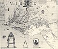
 Capt John Smith's map of Virginia 1624.jpg 2,520 × 1,944; 1.02 MB
-
-

-
 Carte de la Virginie, du Maryland et de letat de Delaware (4578767503).jpg 4,748 × 3,164; 6.3 MB
-
 Chesapeakebay.jpg 800 × 640; 146 KB
-
 Delaware and Maryland LOC 2017593515.jpg 4,422 × 3,554; 2.43 MB
-
 Detail of 1608 Smith Map showing the Patawomeck River.jpg 1,240 × 733; 388 KB
-
 Forest and stream (1886) (14595335409).jpg 1,774 × 4,264; 565 KB
-
 Hampton Roads page 1266.jpg 754 × 722; 358 KB
-
 Map of Chesapeake Bay George Alsop 1666.jpg 2,018 × 1,464; 329 KB
-

-
 Nautical Chart of Chesapeake Bay from its Head to Potomac River - NARA - 7369034 (page 1).jpg 11,728 × 9,120; 10.22 MB
-
-
 Nova Virginiae tabvla. NYPL434464.tiff 4,147 × 3,228; 38.3 MB
-
 The harbor of Annapolis (NYPL b14950964-433902).jpg 5,851 × 4,896; 4.34 MB
-
 The harbor of Annapolis (NYPL b14950964-1260097).jpg 5,867 × 5,104; 4.79 MB
-

-

-

-
-
 The BL King’s Topographical Collection - NOVA VIRGINIÆ TABVLA.jpg 4,000 × 3,125; 3.31 MB
-
 US Coast Survey 1855 Upper Chesapeake Bay Finlay site ANNOTATED.jpg 1,456 × 2,028; 2.85 MB
-
 Virginia and Maryland - By H. Moll, geographer. NYPL434002.tiff 3,832 × 4,891; 53.67 MB
-
 Virginia and Maryland - By H. Moll, geographer. NYPL483696.tiff 3,700 × 4,502; 47.66 MB
-
-

-

.jpg)
.jpg)
.jpg)
.jpg)


.jpg)
.jpg)
.jpg)


.jpg)


)%27_(11089042385).jpg)
.jpg)
_of_Maryland_together_with_a_collection_of_historical_(14778836422).jpg)
.jpg)


.jpg)


.jpg)


.jpg)
.jpg)
.jpg)


_(14595335409).jpg)


.jpg)
.jpg)
.jpg)
.jpg)
.jpg)


.jpg)
.jpg)
.jpg)
_-_Geographicus_-_ChesapeakeBay3part-uscs-1857.jpg)