Category:Old maps of the Bay of Biscay
Jump to navigation
Jump to search
Subcategories
This category has only the following subcategory.
Media in category "Old maps of the Bay of Biscay"
The following 42 files are in this category, out of 42 total.
-

-
 Bodleian Libraries, Map of the Bay of Biscay.jpg 1,000 × 675; 168 KB
-
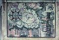
 Golfo de Biscaia no atlas de Guillaume Brouscon (1540-1560).jpg 3,303 × 4,672; 9.24 MB
-
 Bay of Biscay RMG F1416.tiff 6,496 × 5,483; 101.9 MB
-
-
-

-
 Bordeaux-P1080803.jpg 4,312 × 2,192; 3.26 MB
-
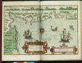
 A large chart of the bay of Biscay - Mount & Page - btv1b53153193h.jpg 6,182 × 7,762; 5.54 MB
-
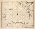
 Bay of Biscay - Mount & Page - btv1b531531922 (1 of 2).jpg 6,350 × 7,360; 5.27 MB
-
 Bordeaux-P1080802.jpg 4,216 × 2,856; 3.95 MB
-
 Baai von Bourneuf.jpg 1,810 × 2,133; 1.01 MB
-
 Mündung der Loire.jpg 5,500 × 4,865; 2.91 MB
-
 A chart of the bay of BISCAY from the Isle Ouessant to Cape Finisterre NYPL1640595.tiff 7,230 × 5,428; 112.28 MB
-
 A chart of the sea coast from ENGLAND to the STREIGHTS NYPL1640593.tiff 7,230 × 5,428; 112.28 MB
-
 A large chart of the BAY OF BISCAY NYPL1640602.tiff 5,428 × 7,230; 112.28 MB
-
 039 Portulan de Guillaume Brouscon 1548.JPG 3,072 × 2,304; 2.96 MB
-
 Carte réduite du golphe de Gascogne (2de éd. ) - par Mr Bellin - btv1b530528940.jpg 11,678 × 7,822; 10.43 MB
-
 British Channel Bay of Biscay Chart 1780.jpg 9,041 × 6,638; 15.7 MB
-

-
 Plan of Rochfort & Rochel with the Islands of Res, Oleron, Aix, &c (BM 1871,1209.133).jpg 2,039 × 2,500; 1.09 MB
-
 A new and improved Mercator's chart of the Bay - W. Heather - btv1b53153705z.jpg 7,942 × 9,666; 7.46 MB
-
 A new and improved Mercator's chart of the Bay - W. Heather - btv1b53153706d.jpg 8,112 × 10,354; 8.92 MB
-
 Bay of Biscay - W. Heather - btv1b53153704h.jpg 7,904 × 9,608; 7.59 MB
-

-
 Bay of Biscay with the Soundings of Périgny - Mount & Page - btv1b531538846.jpg 11,777 × 11,375; 15.02 MB
-
 Bay of Biscay with the Soundings of Périgny - Sayer & Bennett - btv1b53153903t (1 of 2).jpg 12,700 × 9,482; 15.44 MB
-

-
 Carta esferica del golfo de Gascuna - btv1b53009533s.jpg 11,242 × 7,838; 9.9 MB
-
 Carta esferica del Golfo de Gascuna - W. Heather - btv1b53153713g.jpg 11,108 × 7,686; 8.01 MB
-

-
 Archives des missions scientifiques et littéraires (1882) (19565694808).jpg 2,664 × 3,678; 2.64 MB
-

-
 Admiralty Chart No 1104 Bay of Biscay, Published 1888.jpg 10,383 × 8,256; 9.45 MB
-

-

-

-

-

-
 Admiralty Chart No 1104 Bay of Biscay, Published 1953.jpg 12,245 × 8,361; 22.3 MB
-
 Admiralty Chart No 1343 Plans in the Bay of Biscay, Published 1961.jpg 16,199 × 11,064; 62.93 MB
-
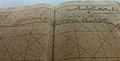
 Stevenson 1911 atlasofportolanc00magg 0023 XI Bay of Biscay.jpg 2,932 × 3,790; 1.06 MB


.jpg)
.jpg)
,_NG-501-33.jpg)


.jpg)


_-_par_Mr_Bellin_-_btv1b530528940.jpg)

.jpg)
.jpg)


.jpg)
.jpg)


.jpg)
_(19565694808).jpg)
.jpg)

.jpg)
.jpg)
.jpg)
_(14577683039).jpg)


