Category:Old maps of Toledo, Ohio
Jump to navigation
Jump to search
Subcategories
This category has the following 25 subcategories, out of 25 total.
S
T
- Toledo, Lucas County, Ohio, 1868 (14 F)
Media in category "Old maps of Toledo, Ohio"
The following 43 files are in this category, out of 43 total.
-
 Lucas County Ohio map by Riley, 1855.jpg 7,708 × 5,363; 7.58 MB
-

-
 Albert Ruger - View of Toledo - 1876 - 001.jpg 5,999 × 3,126; 6.24 MB
-
 City of Toledo, Ohio aerial map, 1870 - DPLA - 9282501b3e8e4770d53f8febe0b33463.jpg 9,000 × 5,951; 9.59 MB
-

-
 Indian Land Grants 234.png 497 × 617; 72 KB
-
 OH Toledo 520140 1900 62500.jpg 2,482 × 3,051; 1.45 MB
-

-

-

-

-

-

-

-
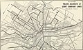
 The Commercial and financial chronicle (1911) (14782172205).jpg 4,336 × 2,682; 3.22 MB
-
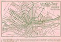
 The Commercial and financial chronicle (1911) (14801972813).jpg 4,336 × 2,646; 3.22 MB
-

-

-

-

-

-

-
 Toledo, Ohio 1876. LOC 73694517.jpg 8,320 × 4,824; 7.17 MB
-
 Toledo, Ohio historical map, 1837 - DPLA - df6f33c57d49e29914bd2290329bd6c8.jpg 8,999 × 6,662; 5.83 MB
-
 Toledo, Ohio historical map, 1851 - DPLA - 2a97ecbfa5027f7afa9ee0c3fa213b49.jpg 4,369 × 3,748; 1.13 MB
-
 Toledo, Ohio historical map, 1852 - DPLA - a05414c9c3bde7ea6f5dc7ee77203245.jpg 9,000 × 6,149; 6.71 MB
-
 Toledo, Ohio historical map, 1857 - DPLA - 1f82e2a77b9a07c432ced2ea3e65c03a.jpg 6,652 × 5,949; 4.62 MB
-
 Toledo, Ohio historical map, 1866 - DPLA - fb2c754ced61f0e0b630ac1e76d3d56f.jpg 4,297 × 4,865; 3.96 MB
-
 Toledo, Ohio historical map, 1872 - DPLA - a8985ab18644e5ee4fa456b0374305d8.jpg 4,778 × 5,237; 3.87 MB
-
 Toledo, Ohio historical map, 1894 - DPLA - 51f51d82a1f43f8bfc3b2c61c8741f8b.jpg 5,369 × 4,488; 1.65 MB
-
 Toledo, Ohio historical map, 1894 - DPLA - 6fc72ae4f86e172c9f5504ea8410ed12.jpg 10,863 × 8,273; 11.55 MB
-
 Toledo, Ohio historical map, 1898 - DPLA - a09f97cefa151c850425ef72fe7c423d.jpg 9,000 × 5,989; 6.32 MB
-
 Toledo, Ohio historical map, 1898 - DPLA - b591257224f9f2cfcf011aa86f9c0a77.jpg 9,000 × 5,484; 12.01 MB
-
 Toledo, Ohio historical map, 1904 - DPLA - 4212bb95d7dbed1bf7127a3fc1d86055.jpg 9,000 × 6,384; 6.98 MB
-
 Toledo, Ohio historical map, 1912 - DPLA - e3ec5b522026f9a4bb8abb886693e0df.jpg 8,999 × 5,957; 4.51 MB
-
 Toledo, Ohio historical map, 1913 - DPLA - c9ada3a256b8aea558843fd7fe4b0b1f.jpg 9,000 × 7,034; 5.03 MB
-
 Toledo, Ohio historical map, 1920 - DPLA - 9dc1a19e961f6416c72b70c89f642da0 (page 1).jpg 6,536 × 9,000; 11.36 MB
-
 Toledo, Ohio historical map, 1920 - DPLA - 9dc1a19e961f6416c72b70c89f642da0 (page 2).jpg 6,546 × 9,000; 9.78 MB
-
 Toledo, Ohio historical map, ca. 1870 - DPLA - 58e0f186c6abf31f824eb6b0e723c29b.jpg 3,563 × 4,387; 2.78 MB
-
 Toledo, Ohio historical map, circa 1868 - DPLA - 9fdbf333a7ff19578b29fea27b2fc80a.jpg 3,460 × 4,298; 2.82 MB
-
 Toledo, Ohio, 1876 WDL9586.png 1,766 × 1,024; 3.17 MB
-

-

_-_Lucas_County_-_Toledo_-_ED_99-1_to_590_-_NARA_-_26421334.jpg)


_(14782172205).jpg)
_(14801972813).jpg)


.jpg)
.jpg)
.jpg)


.jpg)
.jpg)


.jpg)