Category:Old maps of St. Augustine, Florida
Jump to navigation
Jump to search
Subcategories
This category has only the following subcategory.
Media in category "Old maps of St. Augustine, Florida"
The following 39 files are in this category, out of 39 total.
-

-
 (1737) Delineatio munimenti et Portus S.AUGUSTINI by Homann Heirs.jpg 1,146 × 1,128; 1.41 MB
-
 110 of 'Old Saint Augustine. A story of three centuries' (11181336633).jpg 2,080 × 1,326; 614 KB
-

-
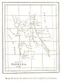
 FAIRBANKS(1858) p030 Map of Florida in 1565.jpg 1,321 × 1,653; 602 KB
-
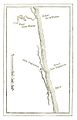
 FAIRBANKS(1858) p074 Map of the mouth of St. Johnes River.jpg 1,077 × 703; 456 KB
-
 REYNOLDS(1885) p031 Fort Caroline.jpg 800 × 1,248; 255 KB
-
 REYNOLDS(1885) p040 San Augustin.jpg 796 × 1,243; 293 KB
-
 REYNOLDS(1885) p049 Fort Marion.jpg 795 × 1,244; 264 KB
-
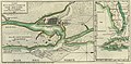
 REYNOLDS(1885) p110 St. Augustine, the CAPITAL of EAST FLORIDA.jpg 1,735 × 1,292; 1.21 MB
-
 REYNOLDS(1885) p154 FORT MARION, GROUND PLAN.jpg 1,181 × 1,193; 460 KB
-
 RUIDIAZ(1893) 1.211 LA FLORIDA EN EL AÑO 1565.jpg 1,017 × 1,347; 551 KB
-

-

-

-

-
 Mapstaug.jpg 590 × 517; 463 KB
-
 Mitchell Map-excerpt03.jpg 2,188 × 1,600; 872 KB
-

-
 Old map of harbor.png 1,221 × 1,024; 2.56 MB
-
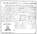 Plan of Fort Picolata.jpg 4,148 × 3,847; 2.52 MB
-
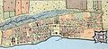
 Plan of St. Augustin in East Florida, 1783.jpg 900 × 641; 229 KB
-
 Plan of the Town and Harbour of St. Augustine, 1762.jpg 700 × 497; 118 KB
-
 Plan of Town and Harbour of St. Augustine.jpg 609 × 419; 65 KB
-
 Plano de la ciudad y puerto de San Agustin de la Florida, 1783.jpg 3,910 × 1,922; 5.09 MB
-
 Plano de la ciudad y puerto de San Agustin de la Florida, 1783.tif 4,488 × 2,347; 30.16 MB
-
 Plano del Sitio de la Florida 1740.jpg 2,636 × 1,592; 2.23 MB
-

-

-
 Saint Augustine Map, 1589 WDL3936.png 1,221 × 1,024; 2.58 MB
-
 St Augustine 1589.jpg 6,520 × 4,998; 13.7 MB
-
 St. Augustine Map 1763.jpg 464 × 213; 80 KB
-

-
 StAugustine1702Siege.jpg 1,100 × 555; 197 KB
-
 The seat of war in the West Indies 1740.jpg 7,522 × 6,504; 11.88 MB
-
 Thomas Jeffrey's Map St. Augustine.jpg 465 × 337; 84 KB
-
 View of the city of St. Augustine, Fla. (2674663334).jpg 2,000 × 1,442; 1.96 MB
-
 View of the Town and Castle of St. Augustine.jpg 580 × 1,000; 382 KB
-
 Williams map 1837.jpg 500 × 400; 45 KB
.jpg)
_Delineatio_munimenti_et_Portus_S.AUGUSTINI_by_Homann_Heirs.jpg)
.jpg)

_p030_Map_of_Florida_in_1565.jpg)
_p074_Map_of_the_mouth_of_St._Johnes_River.jpg)
_p031_Fort_Caroline.jpg)
_p040_San_Augustin.jpg)
_p049_Fort_Marion.jpg)
_p110_St._Augustine,_the_CAPITAL_of_EAST_FLORIDA.jpg)
_p154_FORT_MARION,_GROUND_PLAN.jpg)
_1.211_LA_FLORIDA_EN_EL_A%C3%91O_1565.jpg)


.jpg)


_is_on_the_Mainland_of_Florida,_but_the_Sea_Coast_is_More_Low-Lying_and_thus_Torn_Away_and_Rendered_Island-Like_WDL202.png)


.jpg)

