Category:Old maps of Normandy
Jump to navigation
Jump to search
Old maps of the Duchy of Normandy and of the Norman Province (before the creation in 1790 of the five French departments in Normandy).
Use the appropriate category for maps showing all or a large part of Duchy and Province of Normandy. See subcategories for smaller areas:
| If the map shows | Category to use |
|---|---|
| Duchy and Province of Normandy on a recently created map | Category:Maps of Normandy or its subcategories |
| Duchy and Province of Normandy on a map created more than 70 years ago | Category:Old maps of Normandy or its subcategories |
| the history of Duchy and Province of Normandy on a recently created map | Category:Maps of the history of Normandy or its subcategories |
| the history of Duchy and Province of Normandy on a map created more than 70 years ago | Category:Old maps of the history of Normandy or its subcategories |
Subcategories
This category has the following 4 subcategories, out of 4 total.
*
Media in category "Old maps of Normandy"
The following 183 files are in this category, out of 183 total.
-
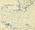
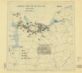
 (August 1, 1944), HQ Twelfth Army Group situation map. LOC 2004629095.jpg 6,682 × 5,971; 4.45 MB
-
 (August 1, 1944), HQ Twelfth Army Group situation map. LOC 2004629095.tif 6,682 × 5,971; 114.15 MB
-
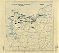
 (August 10, 1944), HQ Twelfth Army Group situation map. LOC 2004629104.jpg 6,738 × 5,981; 4.24 MB
-
 (August 10, 1944), HQ Twelfth Army Group situation map. LOC 2004629104.tif 6,738 × 5,981; 115.3 MB
-
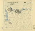
 (August 11, 1944), HQ Twelfth Army Group situation map. LOC 2004629105.jpg 6,686 × 5,984; 4.25 MB
-
 (August 11, 1944), HQ Twelfth Army Group situation map. LOC 2004629105.tif 6,686 × 5,984; 114.47 MB
-
 (August 12, 1944), HQ Twelfth Army Group situation map. LOC 2004629106.jpg 6,686 × 5,984; 4.15 MB
-
 (August 12, 1944), HQ Twelfth Army Group situation map. LOC 2004629106.tif 6,686 × 5,984; 114.47 MB
-
 (August 13, 1944), HQ Twelfth Army Group situation map. LOC 2004629107.jpg 6,686 × 5,984; 4.6 MB
-
 (August 13, 1944), HQ Twelfth Army Group situation map. LOC 2004629107.tif 6,686 × 5,984; 114.47 MB
-
 (August 14, 1944), HQ Twelfth Army Group situation map. LOC 2004629108.jpg 6,686 × 5,984; 4.67 MB
-
 (August 14, 1944), HQ Twelfth Army Group situation map. LOC 2004629108.tif 6,686 × 5,984; 114.47 MB
-
 (August 15, 1944), HQ Twelfth Army Group situation map. LOC 2004629109.jpg 6,686 × 5,984; 4.46 MB
-
 (August 15, 1944), HQ Twelfth Army Group situation map. LOC 2004629109.tif 6,686 × 5,984; 114.47 MB
-
 (August 16, 1944), HQ Twelfth Army Group situation map. LOC 2004629110.jpg 6,686 × 5,984; 4.52 MB
-
 (August 16, 1944), HQ Twelfth Army Group situation map. LOC 2004629110.tif 6,686 × 5,984; 114.47 MB
-
 (August 17, 1944), HQ Twelfth Army Group situation map. LOC 2004629111.jpg 6,686 × 5,984; 4.57 MB
-
 (August 17, 1944), HQ Twelfth Army Group situation map. LOC 2004629111.tif 6,686 × 5,984; 114.47 MB
-
 (August 18, 1944), HQ Twelfth Army Group situation map. LOC 2004629112.jpg 6,686 × 5,984; 3.88 MB
-
 (August 18, 1944), HQ Twelfth Army Group situation map. LOC 2004629112.tif 6,686 × 5,984; 114.47 MB
-
 (August 19, 1944), HQ Twelfth Army Group situation map. LOC 2004629113.jpg 6,686 × 5,984; 3.85 MB
-
 (August 19, 1944), HQ Twelfth Army Group situation map. LOC 2004629113.tif 6,686 × 5,984; 114.47 MB
-
 (August 2, 1944), HQ Twelfth Army Group situation map. LOC 2004629096.jpg 6,682 × 5,971; 4.41 MB
-
 (August 2, 1944), HQ Twelfth Army Group situation map. LOC 2004629096.tif 6,682 × 5,971; 114.15 MB
-
 (August 20, 1944), HQ Twelfth Army Group situation map. LOC 2004629114.jpg 6,686 × 5,984; 3.59 MB
-
 (August 20, 1944), HQ Twelfth Army Group situation map. LOC 2004629114.tif 6,686 × 5,984; 114.47 MB
-
 (August 21, 1944), HQ Twelfth Army Group situation map. LOC 2004629115.jpg 6,686 × 5,984; 4.03 MB
-
 (August 21, 1944), HQ Twelfth Army Group situation map. LOC 2004629115.tif 6,686 × 5,984; 114.47 MB
-
 (August 22, 1944), HQ Twelfth Army Group situation map. LOC 2004629116.jpg 5,893 × 6,137; 4.27 MB
-
 (August 22, 1944), HQ Twelfth Army Group situation map. LOC 2004629116.tif 5,893 × 6,137; 103.47 MB
-
 (August 23, 1944), HQ Twelfth Army Group situation map. LOC 2004629117.jpg 5,893 × 6,137; 4.54 MB
-
 (August 23, 1944), HQ Twelfth Army Group situation map. LOC 2004629117.tif 5,893 × 6,137; 103.47 MB
-
 (August 24, 1944), HQ Twelfth Army Group situation map. LOC 2004629118.jpg 6,682 × 5,971; 4.32 MB
-
 (August 24, 1944), HQ Twelfth Army Group situation map. LOC 2004629118.tif 6,682 × 5,971; 114.15 MB
-
 (August 3, 1944), HQ Twelfth Army Group situation map. LOC 2004629097.jpg 6,682 × 5,971; 4.31 MB
-
 (August 3, 1944), HQ Twelfth Army Group situation map. LOC 2004629097.tif 6,682 × 5,971; 114.15 MB
-
 (August 4, 1944), HQ Twelfth Army Group situation map. LOC 2004629098.jpg 6,682 × 5,971; 3.78 MB
-
 (August 4, 1944), HQ Twelfth Army Group situation map. LOC 2004629098.tif 6,682 × 5,971; 114.15 MB
-
 (August 5, 1944), HQ Twelfth Army Group situation map. LOC 2004629099.jpg 6,738 × 5,981; 3.98 MB
-
 (August 5, 1944), HQ Twelfth Army Group situation map. LOC 2004629099.tif 6,738 × 5,981; 115.3 MB
-
 (August 6, 1944), HQ Twelfth Army Group situation map. LOC 2004629100.jpg 6,738 × 5,981; 4.14 MB
-
 (August 6, 1944), HQ Twelfth Army Group situation map. LOC 2004629100.tif 6,738 × 5,981; 115.3 MB
-
 (August 7, 1944), HQ Twelfth Army Group situation map. LOC 2004629101.jpg 6,738 × 5,981; 4.1 MB
-
 (August 7, 1944), HQ Twelfth Army Group situation map. LOC 2004629101.tif 6,738 × 5,981; 115.3 MB
-
 (August 8, 1944), HQ Twelfth Army Group situation map. LOC 2004629102.jpg 6,738 × 5,981; 4.09 MB
-
 (August 8, 1944), HQ Twelfth Army Group situation map. LOC 2004629102.tif 6,738 × 5,981; 115.3 MB
-
 (August 9, 1944), HQ Twelfth Army Group situation map. LOC 2004629103.jpg 6,738 × 5,981; 4.04 MB
-
 (August 9, 1944), HQ Twelfth Army Group situation map. LOC 2004629103.tif 6,738 × 5,981; 115.3 MB
-
 (July 1, 1944), HQ Twelfth Army Group situation map. LOC 2004629064.jpg 6,682 × 5,971; 3.95 MB
-
 (July 1, 1944), HQ Twelfth Army Group situation map. LOC 2004629064.tif 6,682 × 5,971; 114.15 MB
-
 (July 10, 1944), HQ Twelfth Army Group situation map. LOC 2004629073.jpg 6,682 × 5,971; 3.95 MB
-
 (July 10, 1944), HQ Twelfth Army Group situation map. LOC 2004629073.tif 6,682 × 5,971; 114.15 MB
-
 (July 11, 1944), HQ Twelfth Army Group situation map. LOC 2004629074.jpg 6,682 × 5,971; 4.02 MB
-
 (July 11, 1944), HQ Twelfth Army Group situation map. LOC 2004629074.tif 6,682 × 5,971; 114.15 MB
-
 (July 12, 1944), HQ Twelfth Army Group situation map. LOC 2004629075.jpg 6,682 × 5,971; 3.98 MB
-
 (July 12, 1944), HQ Twelfth Army Group situation map. LOC 2004629075.tif 6,682 × 5,971; 114.15 MB
-
 (July 13, 1944), HQ Twelfth Army Group situation map. LOC 2004629076.jpg 6,682 × 5,971; 4.04 MB
-
 (July 13, 1944), HQ Twelfth Army Group situation map. LOC 2004629076.tif 6,682 × 5,971; 114.15 MB
-
 (July 14, 1944), HQ Twelfth Army Group situation map. LOC 2004629077.jpg 6,682 × 5,971; 4.05 MB
-
 (July 14, 1944), HQ Twelfth Army Group situation map. LOC 2004629077.tif 6,682 × 5,971; 114.15 MB
-
 (July 15, 1944), HQ Twelfth Army Group situation map. LOC 2004629078.jpg 6,682 × 5,971; 4.01 MB
-
 (July 15, 1944), HQ Twelfth Army Group situation map. LOC 2004629078.tif 6,682 × 5,971; 114.15 MB
-
 (July 16, 1944), HQ Twelfth Army Group situation map. LOC 2004629079.jpg 6,682 × 5,971; 3.96 MB
-
 (July 16, 1944), HQ Twelfth Army Group situation map. LOC 2004629079.tif 6,682 × 5,971; 114.15 MB
-
 (July 17, 1944), HQ Twelfth Army Group situation map. LOC 2004629080.jpg 6,682 × 5,971; 4.04 MB
-
 (July 17, 1944), HQ Twelfth Army Group situation map. LOC 2004629080.tif 6,682 × 5,971; 114.15 MB
-
 (July 18, 1944), HQ Twelfth Army Group situation map. LOC 2004629081.jpg 6,682 × 5,971; 3.84 MB
-
 (July 18, 1944), HQ Twelfth Army Group situation map. LOC 2004629081.tif 6,682 × 5,971; 114.15 MB
-
 (July 19, 1944), HQ Twelfth Army Group situation map. LOC 2004629082.jpg 6,682 × 5,971; 4.02 MB
-
 (July 19, 1944), HQ Twelfth Army Group situation map. LOC 2004629082.tif 6,682 × 5,971; 114.15 MB
-
 (July 2, 1944), HQ Twelfth Army Group situation map. LOC 2004629065.jpg 6,682 × 5,971; 4.32 MB
-
 (July 2, 1944), HQ Twelfth Army Group situation map. LOC 2004629065.tif 6,682 × 5,971; 114.15 MB
-
 (July 20, 1944), HQ Twelfth Army Group situation map. LOC 2004629083.jpg 6,682 × 5,971; 3.91 MB
-
 (July 20, 1944), HQ Twelfth Army Group situation map. LOC 2004629083.tif 6,682 × 5,971; 114.15 MB
-
 (July 21, 1944), HQ Twelfth Army Group situation map. LOC 2004629084.jpg 6,682 × 5,971; 4.15 MB
-
 (July 21, 1944), HQ Twelfth Army Group situation map. LOC 2004629084.tif 6,682 × 5,971; 114.15 MB
-
 (July 22, 1944), HQ Twelfth Army Group situation map. LOC 2004629085.jpg 6,682 × 5,971; 4.1 MB
-
 (July 22, 1944), HQ Twelfth Army Group situation map. LOC 2004629085.tif 6,682 × 5,971; 114.15 MB
-
 (July 23, 1944), HQ Twelfth Army Group situation map. LOC 2004629086.jpg 6,682 × 5,971; 3.86 MB
-
 (July 23, 1944), HQ Twelfth Army Group situation map. LOC 2004629086.tif 6,682 × 5,971; 114.15 MB
-
 (July 24, 1944), HQ Twelfth Army Group situation map. LOC 2004629087.jpg 6,682 × 5,971; 3.85 MB
-
 (July 24, 1944), HQ Twelfth Army Group situation map. LOC 2004629087.tif 6,682 × 5,971; 114.15 MB
-
 (July 25, 1944), HQ Twelfth Army Group situation map. LOC 2004629088.jpg 6,682 × 5,971; 3.77 MB
-
 (July 25, 1944), HQ Twelfth Army Group situation map. LOC 2004629088.tif 6,682 × 5,971; 114.15 MB
-
 (July 26, 1944), HQ Twelfth Army Group situation map. LOC 2004629089.jpg 6,682 × 5,971; 4.13 MB
-
 (July 26, 1944), HQ Twelfth Army Group situation map. LOC 2004629089.tif 6,682 × 5,971; 114.15 MB
-
 (July 27, 1944), HQ Twelfth Army Group situation map. LOC 2004629090.jpg 6,682 × 5,971; 4.66 MB
-
 (July 27, 1944), HQ Twelfth Army Group situation map. LOC 2004629090.tif 6,682 × 5,971; 114.15 MB
-
 (July 28, 1944), HQ Twelfth Army Group situation map. LOC 2004629091.jpg 6,682 × 5,971; 4.57 MB
-
 (July 28, 1944), HQ Twelfth Army Group situation map. LOC 2004629091.tif 6,682 × 5,971; 114.15 MB
-
 (July 29, 1944), HQ Twelfth Army Group situation map. LOC 2004629092.jpg 6,682 × 5,971; 4.48 MB
-
 (July 29, 1944), HQ Twelfth Army Group situation map. LOC 2004629092.tif 6,682 × 5,971; 114.15 MB
-
 (July 3, 1944), HQ Twelfth Army Group situation map. LOC 2004629066.jpg 6,682 × 5,971; 3.78 MB
-
 (July 3, 1944), HQ Twelfth Army Group situation map. LOC 2004629066.tif 6,682 × 5,971; 114.15 MB
-
 (July 30, 1944), HQ Twelfth Army Group situation map. LOC 2004629093.jpg 6,682 × 5,971; 4.13 MB
-
 (July 30, 1944), HQ Twelfth Army Group situation map. LOC 2004629093.tif 6,682 × 5,971; 114.15 MB
-
 (July 31, 1944), HQ Twelfth Army Group situation map. LOC 2004629094.jpg 6,682 × 5,971; 4.44 MB
-
 (July 31, 1944), HQ Twelfth Army Group situation map. LOC 2004629094.tif 6,682 × 5,971; 114.15 MB
-
 (July 4, 1944), HQ Twelfth Army Group situation map. LOC 2004629067.jpg 6,682 × 5,971; 4.23 MB
-
 (July 4, 1944), HQ Twelfth Army Group situation map. LOC 2004629067.tif 6,682 × 5,971; 114.15 MB
-
 (July 5, 1944), HQ Twelfth Army Group situation map. LOC 2004629068.jpg 6,682 × 5,971; 4.13 MB
-
 (July 5, 1944), HQ Twelfth Army Group situation map. LOC 2004629068.tif 6,682 × 5,971; 114.15 MB
-
 (July 6, 1944), HQ Twelfth Army Group situation map. LOC 2004629069.jpg 6,682 × 5,971; 4.19 MB
-
 (July 6, 1944), HQ Twelfth Army Group situation map. LOC 2004629069.tif 6,682 × 5,971; 114.15 MB
-
 (July 7, 1944), HQ Twelfth Army Group situation map. LOC 2004629070.jpg 6,682 × 5,971; 4.27 MB
-
 (July 7, 1944), HQ Twelfth Army Group situation map. LOC 2004629070.tif 6,682 × 5,971; 114.15 MB
-
 (July 8, 1944), HQ Twelfth Army Group situation map. LOC 2004629071.jpg 6,682 × 5,971; 4.13 MB
-
 (July 8, 1944), HQ Twelfth Army Group situation map. LOC 2004629071.tif 6,682 × 5,971; 114.15 MB
-
 (July 9, 1944), HQ Twelfth Army Group situation map. LOC 2004629072.jpg 6,682 × 5,971; 3.97 MB
-
 (July 9, 1944), HQ Twelfth Army Group situation map. LOC 2004629072.tif 6,682 × 5,971; 114.15 MB
-
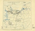
 (June 10, 1944), HQ Twelfth Army Group situation map. LOC 2004629043.jpg 6,682 × 5,971; 3.96 MB
-
 (June 10, 1944), HQ Twelfth Army Group situation map. LOC 2004629043.tif 6,682 × 5,971; 114.15 MB
-
 (June 11, 1944), HQ Twelfth Army Group situation map. LOC 2004629044.jpg 6,682 × 5,971; 3.92 MB
-
 (June 11, 1944), HQ Twelfth Army Group situation map. LOC 2004629044.tif 6,682 × 5,971; 114.15 MB
-
 (June 12, 1944), HQ Twelfth Army Group situation map. LOC 2004629045.jpg 6,682 × 5,971; 3.97 MB
-
 (June 12, 1944), HQ Twelfth Army Group situation map. LOC 2004629045.tif 6,682 × 5,971; 114.15 MB
-
 (June 13, 1944), HQ Twelfth Army Group situation map. LOC 2004629046.jpg 6,682 × 5,971; 3.94 MB
-
 (June 13, 1944), HQ Twelfth Army Group situation map. LOC 2004629046.tif 6,682 × 5,971; 114.15 MB
-
 (June 14, 1944), HQ Twelfth Army Group situation map. LOC 2004629047.jpg 6,682 × 5,971; 3.93 MB
-
 (June 14, 1944), HQ Twelfth Army Group situation map. LOC 2004629047.tif 6,682 × 5,971; 114.15 MB
-
 (June 15, 1944), HQ Twelfth Army Group situation map. LOC 2004629048.jpg 6,682 × 5,971; 4.03 MB
-
 (June 15, 1944), HQ Twelfth Army Group situation map. LOC 2004629048.tif 6,682 × 5,971; 114.15 MB
-
 (June 16, 1944), HQ Twelfth Army Group situation map. LOC 2004629049.jpg 6,682 × 5,971; 3.97 MB
-
 (June 16, 1944), HQ Twelfth Army Group situation map. LOC 2004629049.tif 6,682 × 5,971; 114.15 MB
-
 (June 17, 1944), HQ Twelfth Army Group situation map. LOC 2004629050.jpg 6,682 × 5,971; 3.96 MB
-
 (June 17, 1944), HQ Twelfth Army Group situation map. LOC 2004629050.tif 6,682 × 5,971; 114.15 MB
-
 (June 18, 1944), HQ Twelfth Army Group situation map. LOC 2004629051.jpg 6,682 × 5,971; 4 MB
-
 (June 18, 1944), HQ Twelfth Army Group situation map. LOC 2004629051.tif 6,682 × 5,971; 114.15 MB
-
 (June 19, 1944), HQ Twelfth Army Group situation map. LOC 2004629052.jpg 6,682 × 5,971; 3.85 MB
-
 (June 19, 1944), HQ Twelfth Army Group situation map. LOC 2004629052.tif 6,682 × 5,971; 114.15 MB
-
 (June 20, 1944), HQ Twelfth Army Group situation map. LOC 2004629053.jpg 6,682 × 5,971; 4.03 MB
-
 (June 20, 1944), HQ Twelfth Army Group situation map. LOC 2004629053.tif 6,682 × 5,971; 114.15 MB
-
 (June 21, 1944), HQ Twelfth Army Group situation map. LOC 2004629054.jpg 6,682 × 5,971; 4.07 MB
-
 (June 21, 1944), HQ Twelfth Army Group situation map. LOC 2004629054.tif 6,682 × 5,971; 114.15 MB
-
 (June 22, 1944), HQ Twelfth Army Group situation map. LOC 2004629055.jpg 6,682 × 5,971; 3.97 MB
-
 (June 22, 1944), HQ Twelfth Army Group situation map. LOC 2004629055.tif 6,682 × 5,971; 114.15 MB
-
 (June 23, 1944), HQ Twelfth Army Group situation map. LOC 2004629056.jpg 6,682 × 5,971; 4.26 MB
-
 (June 23, 1944), HQ Twelfth Army Group situation map. LOC 2004629056.tif 6,682 × 5,971; 114.15 MB
-
 (June 24, 1944), HQ Twelfth Army Group situation map. LOC 2004629057.jpg 6,682 × 5,971; 4.25 MB
-
 (June 24, 1944), HQ Twelfth Army Group situation map. LOC 2004629057.tif 6,682 × 5,971; 114.15 MB
-
 (June 25, 1944), HQ Twelfth Army Group situation map. LOC 2004629058.jpg 6,682 × 5,971; 4.13 MB
-
 (June 25, 1944), HQ Twelfth Army Group situation map. LOC 2004629058.tif 6,682 × 5,971; 114.15 MB
-
 (June 26, 1944), HQ Twelfth Army Group situation map. LOC 2004629059.jpg 6,682 × 5,971; 3.96 MB
-
 (June 26, 1944), HQ Twelfth Army Group situation map. LOC 2004629059.tif 6,682 × 5,971; 114.15 MB
-
 (June 27, 1944), HQ Twelfth Army Group situation map. LOC 2004629060.jpg 6,682 × 5,971; 4.14 MB
-
 (June 27, 1944), HQ Twelfth Army Group situation map. LOC 2004629060.tif 6,682 × 5,971; 114.15 MB
-
 (June 28, 1944), HQ Twelfth Army Group situation map. LOC 2004629061.jpg 6,682 × 5,971; 4.2 MB
-
 (June 28, 1944), HQ Twelfth Army Group situation map. LOC 2004629061.tif 6,682 × 5,971; 114.15 MB
-
 (June 29, 1944), HQ Twelfth Army Group situation map. LOC 2004629062.jpg 6,682 × 5,971; 4.1 MB
-
 (June 29, 1944), HQ Twelfth Army Group situation map. LOC 2004629062.tif 6,682 × 5,971; 114.15 MB
-
 (June 30, 1944), HQ Twelfth Army Group situation map. LOC 2004629063.jpg 6,682 × 5,971; 4.03 MB
-
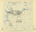
 (June 6, 1944), HQ Twelfth Army Group situation map. LOC 2004629028.jpg 6,682 × 5,971; 4.32 MB
-
 (June 6, 1944), HQ Twelfth Army Group situation map. LOC 2004629028.tif 6,682 × 5,971; 114.15 MB
-
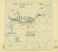
 (June 7, 1944), HQ Twelfth Army Group situation map. LOC 2004629027.jpg 6,682 × 5,971; 4.16 MB
-
 (June 7, 1944), HQ Twelfth Army Group situation map. LOC 2004629027.tif 6,682 × 5,971; 114.15 MB
-
 (June 8, 1944), HQ Twelfth Army Group situation map. LOC 2004629025.jpg 6,682 × 5,971; 4.27 MB
-
 (June 8, 1944), HQ Twelfth Army Group situation map. LOC 2004629025.tif 6,682 × 5,971; 114.15 MB
-
 (June 9, 1944), HQ Twelfth Army Group situation map. LOC 2004629042.jpg 6,682 × 5,971; 4.11 MB
-
 (June 9, 1944), HQ Twelfth Army Group situation map. LOC 2004629042.tif 6,682 × 5,971; 114.15 MB
-
 1771 Bonne Map of Normandy, France - Geographicus - Normandie-bonne-1771.jpg 3,500 × 2,533; 2.94 MB
-
 163 of 'Danske minder i Normandiet ... Med tre kårt' (11244605073).jpg 2,176 × 1,325; 474 KB
-
-
 429 of 'Tinchebray et sa région au Bocage Normand' (11165011643).jpg 1,900 × 2,167; 618 KB
-
 Admiralty Chart No 2602 Port de Cherbourg, Published 1858.jpg 16,051 × 10,887; 45.79 MB
-
 Admiralty Chart No 2602 Rade de Cherbourg, Published 1930.jpg 12,157 × 8,321; 36.91 MB
-
 Atlante Veneto Volume 2 019.jpg 10,282 × 7,392; 8.79 MB
-
 Bocage country - 1944.png 630 × 668; 405 KB
-
 Carte Perche.jpg 1,524 × 1,202; 688 KB
-
 Cartenormandie1758.jpg 507 × 369; 192 KB
-
 CDF Paris-Rouen carte.jpg 2,346 × 1,416; 2.27 MB
-

-
 D-Day the 6th of June - Normandy 1944 LOC 94681943.jpg 14,649 × 5,568; 9.95 MB
-
 D-Day the 6th of June - Normandy 1944 LOC 94681943.tif 14,649 × 5,568; 233.36 MB
-
 PaysdHoulme.jpg 1,376 × 866; 447 KB
-

-
 Normandie - Normandy.jpg 3,600 × 2,700; 1.67 MB
-
 Doyennevaucelles.JPG 449 × 396; 92 KB
-
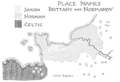 PSM V51 D318 Place names of brittany and normandy.png 1,630 × 1,109; 417 KB
-
 Sketch of the environs of Shelbyville, Wartrace & Normandy, Tennessee LOC 99448857.jpg 3,886 × 2,438; 1.11 MB
-
 Sketch of the environs of Shelbyville, Wartrace & Normandy, Tennessee LOC 99448857.tif 3,886 × 2,438; 27.11 MB
-
-
 Sketch of the environs of Shelbyville, Wartrace & Normandy, Tennessee LOC 99448858.tif 5,638 × 3,646; 58.81 MB
-
 Tessier1864.jpg 1,200 × 820; 248 KB
,_HQ_Twelfth_Army_Group_situation_map._LOC_2004629095.jpg)
,_HQ_Twelfth_Army_Group_situation_map._LOC_2004629104.jpg)
,_HQ_Twelfth_Army_Group_situation_map._LOC_2004629105.jpg)
,_HQ_Twelfth_Army_Group_situation_map._LOC_2004629106.jpg)
,_HQ_Twelfth_Army_Group_situation_map._LOC_2004629107.jpg)
,_HQ_Twelfth_Army_Group_situation_map._LOC_2004629108.jpg)
,_HQ_Twelfth_Army_Group_situation_map._LOC_2004629109.jpg)
,_HQ_Twelfth_Army_Group_situation_map._LOC_2004629110.jpg)
,_HQ_Twelfth_Army_Group_situation_map._LOC_2004629111.jpg)
,_HQ_Twelfth_Army_Group_situation_map._LOC_2004629112.jpg)
,_HQ_Twelfth_Army_Group_situation_map._LOC_2004629113.jpg)
,_HQ_Twelfth_Army_Group_situation_map._LOC_2004629096.jpg)
,_HQ_Twelfth_Army_Group_situation_map._LOC_2004629114.jpg)
,_HQ_Twelfth_Army_Group_situation_map._LOC_2004629115.jpg)
,_HQ_Twelfth_Army_Group_situation_map._LOC_2004629116.jpg)
,_HQ_Twelfth_Army_Group_situation_map._LOC_2004629117.jpg)
,_HQ_Twelfth_Army_Group_situation_map._LOC_2004629118.jpg)
,_HQ_Twelfth_Army_Group_situation_map._LOC_2004629097.jpg)
,_HQ_Twelfth_Army_Group_situation_map._LOC_2004629098.jpg)
,_HQ_Twelfth_Army_Group_situation_map._LOC_2004629099.jpg)
,_HQ_Twelfth_Army_Group_situation_map._LOC_2004629100.jpg)
,_HQ_Twelfth_Army_Group_situation_map._LOC_2004629101.jpg)
,_HQ_Twelfth_Army_Group_situation_map._LOC_2004629102.jpg)
,_HQ_Twelfth_Army_Group_situation_map._LOC_2004629103.jpg)
,_HQ_Twelfth_Army_Group_situation_map._LOC_2004629064.jpg)
,_HQ_Twelfth_Army_Group_situation_map._LOC_2004629073.jpg)
,_HQ_Twelfth_Army_Group_situation_map._LOC_2004629074.jpg)
,_HQ_Twelfth_Army_Group_situation_map._LOC_2004629075.jpg)
,_HQ_Twelfth_Army_Group_situation_map._LOC_2004629076.jpg)
,_HQ_Twelfth_Army_Group_situation_map._LOC_2004629077.jpg)
,_HQ_Twelfth_Army_Group_situation_map._LOC_2004629078.jpg)
,_HQ_Twelfth_Army_Group_situation_map._LOC_2004629079.jpg)
,_HQ_Twelfth_Army_Group_situation_map._LOC_2004629080.jpg)
,_HQ_Twelfth_Army_Group_situation_map._LOC_2004629081.jpg)
,_HQ_Twelfth_Army_Group_situation_map._LOC_2004629082.jpg)
,_HQ_Twelfth_Army_Group_situation_map._LOC_2004629065.jpg)
,_HQ_Twelfth_Army_Group_situation_map._LOC_2004629083.jpg)
,_HQ_Twelfth_Army_Group_situation_map._LOC_2004629084.jpg)
,_HQ_Twelfth_Army_Group_situation_map._LOC_2004629085.jpg)
,_HQ_Twelfth_Army_Group_situation_map._LOC_2004629086.jpg)
,_HQ_Twelfth_Army_Group_situation_map._LOC_2004629087.jpg)
,_HQ_Twelfth_Army_Group_situation_map._LOC_2004629088.jpg)
,_HQ_Twelfth_Army_Group_situation_map._LOC_2004629089.jpg)
,_HQ_Twelfth_Army_Group_situation_map._LOC_2004629090.jpg)
,_HQ_Twelfth_Army_Group_situation_map._LOC_2004629091.jpg)
,_HQ_Twelfth_Army_Group_situation_map._LOC_2004629092.jpg)
,_HQ_Twelfth_Army_Group_situation_map._LOC_2004629066.jpg)
,_HQ_Twelfth_Army_Group_situation_map._LOC_2004629093.jpg)
,_HQ_Twelfth_Army_Group_situation_map._LOC_2004629094.jpg)
,_HQ_Twelfth_Army_Group_situation_map._LOC_2004629067.jpg)
,_HQ_Twelfth_Army_Group_situation_map._LOC_2004629068.jpg)
,_HQ_Twelfth_Army_Group_situation_map._LOC_2004629069.jpg)
,_HQ_Twelfth_Army_Group_situation_map._LOC_2004629070.jpg)
,_HQ_Twelfth_Army_Group_situation_map._LOC_2004629071.jpg)
,_HQ_Twelfth_Army_Group_situation_map._LOC_2004629072.jpg)
,_HQ_Twelfth_Army_Group_situation_map._LOC_2004629043.jpg)
,_HQ_Twelfth_Army_Group_situation_map._LOC_2004629044.jpg)
,_HQ_Twelfth_Army_Group_situation_map._LOC_2004629045.jpg)
,_HQ_Twelfth_Army_Group_situation_map._LOC_2004629046.jpg)
,_HQ_Twelfth_Army_Group_situation_map._LOC_2004629047.jpg)
,_HQ_Twelfth_Army_Group_situation_map._LOC_2004629048.jpg)
,_HQ_Twelfth_Army_Group_situation_map._LOC_2004629049.jpg)
,_HQ_Twelfth_Army_Group_situation_map._LOC_2004629050.jpg)
,_HQ_Twelfth_Army_Group_situation_map._LOC_2004629051.jpg)
,_HQ_Twelfth_Army_Group_situation_map._LOC_2004629052.jpg)
,_HQ_Twelfth_Army_Group_situation_map._LOC_2004629053.jpg)
,_HQ_Twelfth_Army_Group_situation_map._LOC_2004629054.jpg)
,_HQ_Twelfth_Army_Group_situation_map._LOC_2004629055.jpg)
,_HQ_Twelfth_Army_Group_situation_map._LOC_2004629056.jpg)
,_HQ_Twelfth_Army_Group_situation_map._LOC_2004629057.jpg)
,_HQ_Twelfth_Army_Group_situation_map._LOC_2004629058.jpg)
,_HQ_Twelfth_Army_Group_situation_map._LOC_2004629059.jpg)
,_HQ_Twelfth_Army_Group_situation_map._LOC_2004629060.jpg)
,_HQ_Twelfth_Army_Group_situation_map._LOC_2004629061.jpg)
,_HQ_Twelfth_Army_Group_situation_map._LOC_2004629062.jpg)
,_HQ_Twelfth_Army_Group_situation_map._LOC_2004629063.jpg)
,_HQ_Twelfth_Army_Group_situation_map._LOC_2004629028.jpg)
,_HQ_Twelfth_Army_Group_situation_map._LOC_2004629027.jpg)
,_HQ_Twelfth_Army_Group_situation_map._LOC_2004629025.jpg)
,_HQ_Twelfth_Army_Group_situation_map._LOC_2004629042.jpg)

.jpg)
.jpg)
.jpg)


