Category:Old maps of Houston Street (Manhattan)
Jump to navigation
Jump to search
Historical maps including Houston Street (Manhattan, New York City) from The New York Public Library Digital Collections website.
TIFF versions of these maps are available at the categories for their respective atlases. They are omitted here to avoid duplication.
Note: This category is sorted by year.
Subcategories
This category has the following 2 subcategories, out of 2 total.
Media in category "Old maps of Houston Street (Manhattan)"
The following 12 files are in this category, out of 12 total.
-
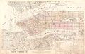 Robinson Manhattan and Bronx south half of volume key publ. 1885.jpg 5,773 × 3,727; 7.96 MB
-
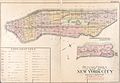
 Bromley Manhattan outline and index map publ. 1891.jpg 6,503 × 4,382; 8.42 MB
-
 Bromley Manhattan V. 1 outline and volume index publ. 1899.jpg 6,467 × 4,633; 8.68 MB
-
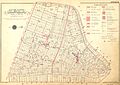
 Sanborn Manhattan V. 3 fire system publ. 1904.jpg 4,431 × 6,615; 6.7 MB
-
 Bromley Manhattan outline and index map publ. 1911.jpg 5,573 × 3,855; 6.89 MB
-
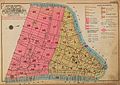
 Bromley Manhattan Battery – 14th St. index and explanations publ. 1916.jpg 5,574 × 3,996; 6.21 MB
-
 Bromley Manhattan complete, section index Battery to 14th St. publ. 1921–23.jpg 7,975 × 5,679; 11.68 MB
-
 Lower Manhattan North River Ferry slips 1921–23 (cropped).jpg 1,088 × 1,007; 396 KB
-
 Bromley Manhattan section index, Battery to 14th St., publ. 1925.jpg 8,223 × 5,934; 13.3 MB
-
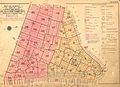
 Bromley Manhattan section index, Battery to 14th St., publ. 1927.jpg 7,903 × 5,633; 10.31 MB
-
 Bromley Manhattan section index Battery to 14th St. publ. 1930.jpg 8,455 × 5,967; 12.18 MB
-
 Bromley Manhattan section index Battery to 14th Street publ. 1955–56.jpg 8,326 × 5,868; 11.05 MB


.jpg)


