Category:Old maps of Chile
Jump to navigation
Jump to search
Countries of South America: Argentina · Bolivia · Brazil · Chile · Colombia · Ecuador · Guyana · Paraguay · Peru · Suriname · Trinidad and Tobago‡ · Uruguay · Venezuela
Other territories: Aruba · Bonaire · Curaçao · Falkland Islands · French Guiana · South Georgia and the South Sandwich Islands
‡: partly located in South America
Other territories: Aruba · Bonaire · Curaçao · Falkland Islands · French Guiana · South Georgia and the South Sandwich Islands
‡: partly located in South America
Subcategories
This category has the following 16 subcategories, out of 16 total.
Pages in category "Old maps of Chile"
This category contains only the following page.
Media in category "Old maps of Chile"
The following 46 files are in this category, out of 46 total.
-

-
 417 of 'Temperate Chile. A progressive Spain. (With a map.)' (11249980694).jpg 1,928 × 5,659; 2.54 MB
-

-
 A map of Paraguay and surrounding area, illustrating where c Wellcome V0010837.jpg 3,021 × 2,624; 3.16 MB
-

-
 Admiralty Chart No 1301 Plans on the Coast of Chile, Published 1892, New Edition 1912.jpg 10,805 × 13,391; 50.42 MB
-

-
 Bahia de Arauco.png 1,012 × 649; 827 KB
-
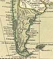
 Buenos-Ayres, Chili et Patagonie (33743098993).jpg 5,390 × 7,429; 23.78 MB
-
 Camino Valdivia a Villarrica en Atlas de Claudio Gay.jpg 4,032 × 3,024; 2.77 MB
-

-
 Carte de la province de Santiago (Chili) - btv1b8441256j.jpg 6,514 × 3,971; 4.67 MB
-

-
 Chile en 1903.jpg 700 × 3,508; 2.97 MB
-

-
 Chile, South America, 1808 - Laurie & Whittle.jpg 715 × 881; 551 KB
-
 Chile, Terra del Fuego &c. Bowen, Emanuel, 1747.jpg 8,314 × 6,872; 34.86 MB
-
 Comarca Desierta de Patagonia, Chile Moderno según Juan de la Cruz Cano y Olmedilla, 1775.jpg 4,048 × 5,402; 17.23 MB
-
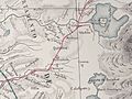
 Croquis de la Puna de Atacama.jpg 714 × 1,024; 336 KB
-
 Departamentos de Tacna y de Arica, 1895.jpg 511 × 707; 212 KB
-
 DESCRIPCION DE LA PROVINCIA DE CHILE 13.jpg 4,000 × 2,980; 1.26 MB
-
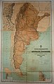 Latzina Map of Argentina 1882.jpg 2,194 × 3,404; 5.84 MB
-
 Lwsam 1808.jpg 554 × 733; 178 KB
-
 Límite entre Chile y Argentina según Uti Possedetis en 1810 y tratado de límites de 1865.jpg 5,312 × 10,639; 8.8 MB
-
 Map of Argentina by Francisco Latzina, 1882.jpg 1,355 × 2,000; 2.59 MB
-
 Map of bolivia1811.jpg 396 × 500; 57 KB
-
 Map of Chile, Mallet.jpg 600 × 800; 109 KB
-
 Map.rep.arg.1883.jpg 4,413 × 3,569; 1.94 MB
-
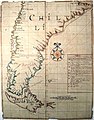 Mapa de Chile de 1671.jpg 640 × 816; 532 KB
-
 Mapa de la guerra de Arauco, Tomas Lopez de Vargas, 1777.jpg 3,431 × 4,809; 1.63 MB
-
 Mapa de las costas patagónicas de Nicolás del Campo de 1786.jpg 1,854 × 2,830; 1.09 MB
-
 Mapa de las provincias de Chile en 1920.jpg 1,570 × 2,048; 845 KB
-
 Mapa del Norte Grande de Chile a finales del siglo XIX.jpg 564 × 564; 93 KB
-

-

-
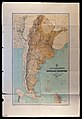 Mapa geográfico de la Repùblica Argentina, 1882.jpg 3,341 × 4,868; 2.07 MB
-
 Mapa jeografico de la Puna de Atacama.jpg 1,920 × 2,000; 4.27 MB
-
 Patagonia, New Chili in 1808 - Laurie & Whittle (cropped).jpg 506 × 556; 241 KB
-
 Pl. XI (23368684626).jpg 5,104 × 2,199; 4.64 MB
-
 Plano Pitrvfqvén 1935. Asociación de Aseguradores de Chile.png 1,516 × 1,080; 2.66 MB
-
 Provincia de Cuyo, Reino de Chile según Juan de la Cruz Cano y Olmedilla, 1775.jpg 1,171 × 1,798; 2.09 MB
-
 Puna de Atacama Mapa 1892 (recorte).jpg 1,219 × 1,594; 2.37 MB
-
 Reino de Chile según Juan de la Cruz Cano y Olmedilla, 1775.jpg 6,009 × 7,925; 38.79 MB
-
 Santiago, capital of the Kingdom of Chili, 1744 by Emanuel Bowen.jpg 449 × 474; 127 KB
-
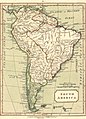 South America, 1808 - Laurie & Whittle.jpg 1,339 × 1,855; 2.28 MB
-

.jpg)
.jpg)


.jpg)


_-_btv1b8441256j.jpg)
.jpg)


.jpg)
.jpg)


.jpg)


_in_A_New_and_Accurate_Map_of_Chili,_Terra_Magellanica,_Terra_del_Fuego_%26c._1744_by_Emanuel_Bowen.jpg)
%27_(11249980694).jpg)