Category:Noordwestpunt Lighthouse
Jump to navigation
Jump to search
| Object location | | View all coordinates using: OpenStreetMap |
|---|
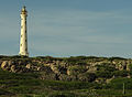
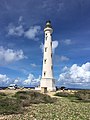
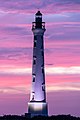
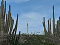
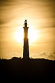
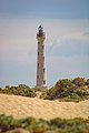
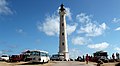
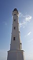
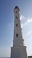
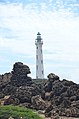
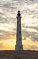
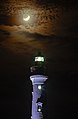
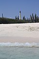
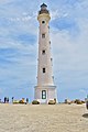
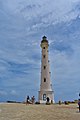
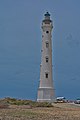
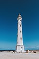
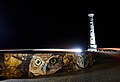
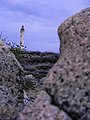
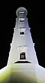
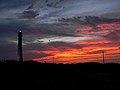
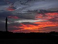
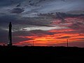
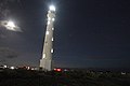
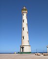
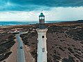
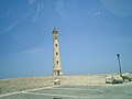
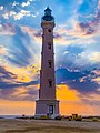
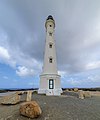
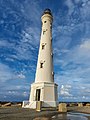
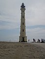
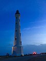
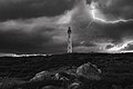
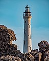
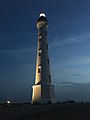
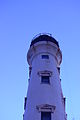
English: Noordwestpunt Lighthouse, also known as California and Hudishibana. Located about 1 km (0.6 mi) southeast of the northern point of the island.
|
This is a category about a monument in Aruba identified by the ID 02-002
|
lighthouse on the island of Aruba   | |||||
| Upload media | |||||
| Instance of | |||||
|---|---|---|---|---|---|
| Made from material | |||||
| Location | Noord, Aruba | ||||
| Located in or next to body of water | |||||
| Street address |
| ||||
| Heritage designation |
| ||||
| Service entry |
| ||||
| Inception |
| ||||
| Significant event |
| ||||
| Height |
| ||||
 | |||||
Media in category "Noordwestpunt Lighthouse"
The following 200 files are in this category, out of 228 total.
(previous page) (next page)-
 "California" Lighthouse, Aruba - panoramio - Vlad Podvorny.jpg 1,600 × 1,067; 264 KB
-
 "California" Lighthouse, Aruba - panoramio.jpg 1,600 × 1,067; 505 KB
-
 A lit up California Lighthouse, Aruba.jpg 3,413 × 5,012; 2.63 MB
-
 Aerial Photo of the California LIghthouse (Horizontal).jpg 6,784 × 4,646; 38.65 MB
-
 Aerial Photo of the California LIghthouse (Vertical).jpg 5,587 × 7,449; 44.62 MB
-
 Aruba - California Lighthouse in the Sun.jpg 2,448 × 3,264; 2.03 MB
-
 Aruba California Lighthouse (2891413214).jpg 1,886 × 1,377; 719 KB
-
 Aruba California lighthouse.jpg 3,024 × 4,032; 2.88 MB
-
 Aruba Lighthouse at sunset 01.jpg 5,472 × 3,648; 1.35 MB
-
 Aruba Lighthouse at sunset 02.jpg 5,472 × 3,648; 1.5 MB
-
 Aruba Lighthouse at sunset 05.jpg 5,472 × 3,648; 1.91 MB
-
 Aruba Lighthouse in pink.jpg 3,648 × 5,472; 2.57 MB
-
 Aruba Lighthouse w new moon.jpg 5,472 × 3,648; 1.72 MB
-
 Aruba Sunrise around California Lighthouse.11.jpg 720 × 1,280; 26 KB
-
 Aruba Sunrise around California Lighthouse.12.jpg 720 × 1,280; 21 KB
-
 Aruba Sunrise around California Lighthouse.13.jpg 720 × 1,280; 33 KB
-
 Aruba Sunrise around California Lighthouse.9.jpg 720 × 1,280; 26 KB
-
 Aruba Sunrise around California Lighthouse.jpg 720 × 1,280; 34 KB
-
 Aruba's California Lighthouse.jpg 4,624 × 3,468; 7.22 MB
-
 Aruba's Ligthouse.jpg 4,624 × 3,468; 7.27 MB
-
 ARUBA-california-lighthouse.jpg 807 × 1,215; 337 KB
-
 ArubaLighthouse.jpg 523 × 960; 87 KB
-
 Aruban California Lighthouse.jpg 3,122 × 4,715; 2.6 MB
-
 Bista bunita.jpg 1,280 × 1,920; 1.88 MB
-
 Black & white California lighthouse.jpg 1,088 × 1,632; 619 KB
-
 Cactus y El Faro California de Aruba, 2017.jpg 3,648 × 5,472; 6.96 MB
-
 Cal Light House Aua.jpg 720 × 960; 42 KB
-
 Cali Lighthouse, Aruba.jpg 4,405 × 3,456; 4.56 MB
-
 California Light House (25062007888).jpg 5,184 × 2,840; 2.01 MB
-
 California Light House (28444535449).jpg 5,184 × 2,859; 1.75 MB
-
 California Light House (45229796374).jpg 4,863 × 2,492; 1.96 MB
-
 California Light House - 24209264327.jpg 3,456 × 5,184; 2.2 MB
-
 California Light house 1.JPG 3,456 × 4,608; 5.33 MB
-
 California Lighthouse (1).jpg 3,168 × 4,752; 1.8 MB
-
 California lighthouse (Aruba) - 1.jpg 2,988 × 5,312; 2.4 MB
-
 California lighthouse (Aruba) - 2.jpg 2,988 × 5,312; 2.39 MB
-
 California lighthouse (Aruba) - 3.jpg 2,988 × 5,312; 2.41 MB
-
 California Lighthouse 1.jpg 3,264 × 4,928; 5.02 MB
-
 California lighthouse 1916.jpg 2,848 × 4,272; 610 KB
-
 California Lighthouse 1A.jpg 3,264 × 4,928; 5.35 MB
-
 California Lighthouse 2 Aruba.jpg 1,243 × 2,048; 416 KB
-
 California Lighthouse 2.jpg 1,499 × 2,048; 640 KB
-
 California Lighthouse 3.jpg 4,928 × 3,264; 5.77 MB
-
 California Lighthouse 4.jpg 3,264 × 4,928; 5.77 MB
-
 California Lighthouse 5.jpg 3,264 × 4,928; 5.77 MB
-
 California Lighthouse @ Early Morning.jpg 3,540 × 5,341; 9.3 MB
-
 California Lighthouse @ Morning Last Shot.jpg 3,164 × 4,698; 8.51 MB
-
 California Lighthouse @ Morning Phases.jpg 3,394 × 5,398; 7.88 MB
-
 California Lighthouse @ Morning with Sun behind.jpg 3,629 × 5,585; 8.4 MB
-
 California Lighthouse @ Night Close Crescent Moon.jpg 3,564 × 5,441; 6.96 MB
-
 California Lighthouse @ Night Full View Waxing Crescent Moon.jpg 3,591 × 5,575; 8.2 MB
-
 California Lighthouse @ Night Medium Shot Waxing Crescent Moon.jpg 3,533 × 5,417; 10.01 MB
-
 California Lighthouse @ Night Waxing Crescent Moon.jpg 3,691 × 5,048; 8.3 MB
-
 California Lighthouse @ Sunrise.jpg 3,583 × 5,374; 8.78 MB
-
 California lighthouse and nature.jpg 4,000 × 3,000; 4.84 MB
-
 California Lighthouse Aruba 2.jpg 4,437 × 2,958; 2.96 MB
-
 California Lighthouse Aruba 2013.jpg 2,112 × 2,816; 722 KB
-
 California Lighthouse Aruba 23 july 2020.jpg 5,184 × 3,456; 8.02 MB
-
 California lighthouse Aruba Arashi beach 1.jpg 2,592 × 3,888; 2.9 MB
-
 California lighthouse Aruba Arashi beach 2.jpg 3,364 × 1,187; 694 KB
-
 California Lighthouse Aruba Black & White.jpg 3,024 × 4,032; 3.56 MB
-
 California Lighthouse Aruba by Night.jpg 5,407 × 3,605; 8.96 MB
-
 California Lighthouse Aruba Minimalist Photography.jpg 5,395 × 3,648; 7.24 MB
-
 California Lighthouse Aruba Monument.jpg 1,536 × 2,048; 750 KB
-
 California Lighthouse Aruba on a Cloudy day.jpg 1,365 × 2,048; 2.44 MB
-
 California Lighthouse Aruba West Indies.jpg 636 × 912; 439 KB
-
 California Lighthouse Aruba, CN.jpg 3,899 × 5,847; 16.87 MB
-
 California Lighthouse Aruba.jpg 1,519 × 2,048; 495 KB
-
 California lighthouse Aruba.jpg 1,200 × 1,600; 424 KB
-
 California lighthouse aruba`s sunset.jpg 4,608 × 3,456; 5.15 MB
-
 California Lighthouse at Night.jpg 3,456 × 4,608; 2.46 MB
-
 California Lighthouse at night.jpg 1,417 × 1,088; 662 KB
-
 California Lighthouse at sunset pt 1.jpg 6,960 × 4,640; 3.55 MB
-
 California Lighthouse at sunset pt.2.jpg 6,960 × 4,640; 7.8 MB
-
 California Lighthouse at sunset.jpg 828 × 1,300; 825 KB
-
 California lighthouse Aua.jpg 6,409 × 4,273; 14.69 MB
-
 California lighthouse beautiful.jpg 3,653 × 2,738; 3.32 MB
-
 California lighthouse beauty rocks.jpg 4,000 × 3,000; 6.09 MB
-
 California lighthouse beauty.jpg 4,608 × 2,592; 2.46 MB
-
 California Lighthouse Brakins 01.jpg 4,000 × 6,000; 2.23 MB
-
 California Lighthouse Brakins 02.jpg 4,000 × 6,000; 2.21 MB
-
 California Lighthouse Brakins 03.jpg 6,000 × 4,000; 1.49 MB
-
 California Lighthouse Brakins 04.jpg 4,000 × 6,000; 1.83 MB
-
 California Lighthouse Brakins 05.jpg 4,000 × 6,000; 2.43 MB
-
 California lighthouse branch.jpg 2,990 × 3,987; 5.71 MB
-
 California lighthouse branches.jpg 3,000 × 4,000; 7.52 MB
-
 California Lighthouse by Day.jpg 3,648 × 5,472; 13.59 MB
-
 California lighthouse cactus.jpg 3,456 × 4,608; 3 MB
-
 California lighthouse colorful.jpg 4,608 × 3,456; 5.21 MB
-
 California lighthouse contrast.jpg 2,893 × 3,857; 4.35 MB
-
 California lighthouse far away.jpg 3,000 × 4,000; 5.2 MB
-
 California Lighthouse Frontal with Shoco Murals @ Night.jpg 5,733 × 3,900; 1.71 MB
-
 California lighthouse green vegetation.jpg 2,929 × 3,905; 4.38 MB
-
 California lighthouse Hudishibana.JPG 2,816 × 2,112; 2.03 MB
-
 California Lighthouse in Aruba.jpg 4,288 × 2,848; 5.56 MB
-
 California lighthouse in the rocks.jpg 3,000 × 4,000; 4.97 MB
-
 California Lighthouse Monument.jpg 750 × 996; 187 KB
-
 California lighthouse natural rocks formation.jpg 3,000 × 4,000; 6.96 MB
-
 California Lighthouse Night 2.jpg 2,043 × 3,744; 951 KB
-
 California Lighthouse Night 3.jpg 2,160 × 3,840; 310 KB
-
 California Lighthouse Night 4.jpg 2,104 × 3,744; 1.25 MB
-
 California Lighthouse Noordwestpunt Lighthouse Faro Northwestern Aruba.jpg 3,240 × 4,320; 2.7 MB
-
 California Lighthouse of Aruba.jpg 1,200 × 1,600; 152 KB
-
 California lighthouse on the distance.jpg 3,456 × 4,608; 2.68 MB
-
 California lighthouse on.jpg 3,000 × 4,000; 2.59 MB
-
 California lighthouse orange sunset.jpg 4,000 × 3,000; 3.81 MB
-
 California Lighthouse Restoration.jpg 4,000 × 6,000; 4.17 MB
-
 California lighthouse rocks.jpg 4,000 × 3,000; 5.55 MB
-
 California lighthouse slab 226 20121114 bt chumley bear cruise.jpg 471 × 600; 182 KB
-
 California lighthouse smart phone.jpg 4,000 × 3,000; 6.84 MB
-
 California lighthouse stunning.jpg 3,919 × 2,940; 4.53 MB
-
 California Lighthouse Sunset One.jpg 6,240 × 4,160; 1.9 MB
-
 California Lighthouse Sunset Two.jpg 5,867 × 3,734; 2.01 MB
-
 California lighthouse sunset.jpg 4,000 × 3,000; 4.54 MB
-
 California Lighthouse with bright sky lights.jpg 1,596 × 1,052; 1,015 KB
-
 California Lighthouse x Star filled sky.jpg 3,181 × 4,771; 7.72 MB
-
 California Lighthouse, Aruba (4901988814).jpg 2,560 × 1,920; 172 KB
-
 California Lighthouse, Aruba, 23 july 2020 2.jpg 5,184 × 3,456; 7.96 MB
-
 California Lighthouse, Aruba, 23 july 2020.jpg 5,184 × 3,456; 7.78 MB
-
 California Lighthouse, Aruba.jpg 1,200 × 1,600; 398 KB
-
 California Lighthouse, Aruban Monument.jpg 3,024 × 4,032; 1.94 MB
-
 California Lighthouse.jpg 1,383 × 2,048; 482 KB
-
 California lighthouse.jpg 3,456 × 4,608; 2.86 MB
-
 California lighthouse1.JPG 3,888 × 5,184; 4.98 MB
-
 California lighthouse2.JPG 3,888 × 5,184; 4.92 MB
-
 CaliforniaLight.jpg 837 × 1,024; 170 KB
-
 CaliforniaLightFar.jpg 1,024 × 768; 263 KB
-
 Close up drone photo of the California Lighthouse.jpg 7,421 × 5,566; 40.9 MB
-
 Coconut Husk Shells at Noordwestpunt Lighthouse Faro Base Wall.jpg 3,240 × 4,320; 3.15 MB
-
 Commanders Graves, Hato, Noord.jpg 3,648 × 4,864; 8.21 MB
-
 Cotton candy skies on a lovely saturday afternoon at California Lighthouse, Aruba.jpg 3,036 × 5,174; 2.78 MB
-
 Detalle de El Faro California de Aruba, 2017.jpg 5,431 × 3,621; 7.53 MB
-
 EL FARO BLANCO CALÇIFORNIA LIGHTUOUSE 06 SET 2003 - panoramio.jpg 1,600 × 1,200; 554 KB
-
 El Faro California de Aruba, 2017.jpg 5,472 × 3,648; 6.54 MB
-
 Faro Blanco 9 sept 2022.jpg 2,565 × 3,848; 5.17 MB
-
 Faro Blanco at sunset.jpg 2,872 × 3,829; 1,018 KB
-
 Faro blanco detail 9 sept 22.jpg 3,598 × 2,399; 4.47 MB
-
 Faro Blanco in pink.jpg 5,472 × 3,648; 864 KB
-
 Faro Blanco.jpg 2,674 × 4,022; 3.75 MB
-
 Faro California, punto extremo norte y oeste de Aruba..jpg 3,145 × 1,985; 1.53 MB
-
 Fraters van Tilburg bij de vuurtoren van Westpunt.jpg 1,919 × 1,157; 198 KB
-
 Fraters van Tilburg bij vuurtoren California.jpg 1,919 × 1,445; 335 KB
-
 Iconically shining for others to find their way to paradise for over a century.jpg 3,750 × 5,000; 6.21 MB
-
 Inbound2298769151577628194.jpg 664 × 800; 94 KB
-
 Inbound6087476596051790976.jpg 600 × 800; 52 KB
-
 Inbound6899905786502339499.jpg 600 × 800; 109 KB
-
 Lichthouse 2.jpg 1,571 × 2,048; 650 KB
-
 Light to safety.jpg 3,888 × 5,184; 6.05 MB
-
 Lighthouse after the sun sets.jpg 1,200 × 1,800; 893 KB
-
 Lighthouse aruba island.jpg 1,178 × 1,473; 484 KB
-
 Lighthouse arubaa.jpg 1,303 × 1,629; 323 KB
-
 Lighthouse arubas.jpg 1,064 × 1,330; 383 KB
-
 Lighthouse at dawn.jpg 1,200 × 1,800; 1.01 MB
-
 Lighthouse in Aruba 1.jpg 3,082 × 4,608; 1.97 MB
-
 Lighthouse in Aruba 2.jpg 4,549 × 3,453; 2.51 MB
-
 Lighthouse in Aruba.jpg 3,218 × 4,417; 3.07 MB
-
 Lighthouse in beauty in blue.jpg 771 × 1,028; 67 KB
-
 Lighthouse in the blue.jpg 3,024 × 4,032; 2.54 MB
-
 Lighthouse on Hudishibana next to Sasarawichi.jpg 4,608 × 3,456; 3.3 MB
-
 Lighthouse with Bad Weather.jpg 6,527 × 4,352; 15.84 MB
-
 Lighthouse with cactus.JPG 3,000 × 4,000; 4.31 MB
-
 Lighthouse-aruba.jpg 807 × 1,175; 195 KB
-
 LighthouseArubaHHarsveld 01.jpg 2,304 × 3,456; 3.12 MB
-
 Lighthousee.jpg 1,440 × 1,799; 206 KB
-
 Lights and ..lighthouse.jpg 771 × 1,028; 112 KB
-
 Liighthouse.jpg 1,392 × 1,739; 307 KB
-
 Long EXP. Of California Lighthouse.jpg 2,839 × 4,258; 9.86 MB
-
 Look into the light.JPG 4,016 × 6,016; 4.2 MB
-
 NataleeHollowaySearch.jpg 2,592 × 1,944; 946 KB
-
 Natural sunlight.jpg 2,897 × 4,346; 795 KB
-
 Near sunset at California Lighthouse.jpg 6,960 × 4,640; 3.33 MB
-
 Panorama Lighthouse day.jpg 6,725 × 3,717; 9.55 MB
-
 Panorama Lighthouse night.jpg 7,018 × 3,561; 6.77 MB
-
 Panoramic sunrise-California Lighthouse.jpg 720 × 1,280; 13 KB
-
 Pink sky over Faro Blanco.jpg 5,472 × 3,648; 1.37 MB
-
 RG Lighthouse 01.jpg 3,168 × 4,752; 1.48 MB
-
 RG Lighthouse 02.jpg 3,168 × 4,752; 1.44 MB
-
 RG Lighthouse 03.jpg 4,896 × 6,528; 2.27 MB
-
 RG Lighthouse 04.jpg 4,896 × 6,528; 4.44 MB
-
 RG Lighthouse 05.jpg 4,032 × 3,024; 1.23 MB
-
 RG Lighthouse 06.jpg 3,024 × 4,032; 1.97 MB
-
 RG Lighthouse 07.jpg 3,024 × 4,032; 1.92 MB
-
 RG Lighthouse 08.jpg 2,448 × 3,264; 1.33 MB
-
 RG Lighthouse 09.jpg 2,448 × 3,264; 1.38 MB
-
 RG Lighthouse 10.jpg 2,448 × 3,264; 1.56 MB
-
 RG Lighthouse 11.jpg 2,448 × 3,264; 1.6 MB
-
 RG Lighthouse 12.jpg 2,448 × 3,264; 1.39 MB
-
 RG Lighthouse 13.jpg 3,024 × 4,032; 1.72 MB
-
 RG Lighthouse 14.jpg 3,024 × 4,032; 1.7 MB
-
 RG Lighthouse 15.jpg 3,024 × 4,032; 1.89 MB
-
 RG Lighthouse 16.jpg 3,024 × 4,032; 1.9 MB
-
 RG Lighthouse 17.jpg 3,024 × 4,032; 1.91 MB
-
 RG Lighthouse 18.jpg 3,024 × 4,032; 1.92 MB
-
 RG Lighthouse 19.jpg 3,024 × 4,032; 1.98 MB
-
 RG Lighthouse 20.jpg 3,024 × 4,032; 1.92 MB
-
 RG Lighthouse 21.jpg 3,024 × 4,032; 1.75 MB
-
 RG Lighthouse 22.jpg 3,024 × 4,032; 1.94 MB
-
 RG Lighthouse 23.jpg 3,024 × 4,032; 1.79 MB
-
 RG Lighthouse 24.jpg 3,024 × 4,032; 2.2 MB
-
 RG Lighthouse 25.jpg 3,024 × 4,032; 1.79 MB


.jpg)
.jpg)

.jpg)


.jpg)
.jpg)
.jpg)


.jpg)
_-_1.jpg)
_-_2.jpg)
_-_3.jpg)


.jpg)


Categories:
- Lighthouses in Aruba by name
- Cultural heritage monuments in Aruba
- Noord (Aruba)
- Lighthouses built in 1916
- Lighthouses by height, 21 to 30 meters
- Stone lighthouses
- Unpainted lighthouses
- Lighthouses by range, 15 to 19 nm
- Landfall lights
- Lighthouse equipment by Barbier, Bénard et Turenne
- Visitor attractions in Aruba