Category:Nichtarguer
Jump to navigation
Jump to search
| Object location | | View all coordinates using: OpenStreetMap |
|---|
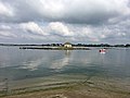
island in Morbihan, France .jpg) | |||||
| Upload media | |||||
| Instance of | |||||
|---|---|---|---|---|---|
| Location | Q110802611, Belz, canton of Belz | ||||
| Located in or next to body of water | |||||
| Diameter |
| ||||
| Elevation above sea level |
| ||||
 | |||||
Media in category "Nichtarguer"
The following 28 files are in this category, out of 28 total.
-
 20110828 Ile de Saint Cado (11).jpg 1,600 × 1,200; 259 KB
-
 20110828 Ile de Saint Cado (12).jpg 1,600 × 1,200; 253 KB
-
 20110828 Ile de Saint Cado (14).jpg 1,600 × 1,200; 290 KB
-
 20110828 Ile de Saint Cado (15).jpg 1,600 × 1,200; 330 KB
-
 20110828 Ile de Saint Cado (16).jpg 1,200 × 1,600; 363 KB
-
 20110828 Ile de Saint Cado (25).jpg 1,200 × 1,600; 263 KB
-
 20110828 Ile de Saint Cado (9).jpg 1,600 × 1,200; 341 KB
-
 A saint cado bar asturias2.JPG 782 × 610; 54 KB
-
 Bateaux Saint-Cado 1913.jpg 1,033 × 605; 227 KB
-
 FranceBretagneBelzNichtarguer.jpg 2,675 × 1,584; 2.42 MB
-
 Ile de Saint-Cado, Morbihan.jpg 3,264 × 2,448; 2.21 MB
-
 La Nature Bretonne (136089523).jpeg 2,048 × 1,245; 1.3 MB
-
 Nichtarguer by Ster an Intel.jpg 3,264 × 2,448; 978 KB
-
 Saint cado - panoramio (3).jpg 4,000 × 3,000; 2 MB
-
 Saint cado - panoramio (6).jpg 4,000 × 3,000; 1.94 MB
-
 Saint cado - panoramio.jpg 4,000 × 3,000; 1.99 MB
-
 Saint-Cado (50151589531).jpg 4,683 × 3,268; 1.9 MB
-
 Saint-Cado-voilier.jpg 1,944 × 2,592; 2.12 MB
-
 Seule Sur Son île (69139273).jpeg 2,048 × 1,536; 917 KB
-
 Vue sur la maisonnette de l'Ile de Saint-Cado, Morbihan.jpg 2,448 × 3,264; 2.07 MB
-
 Îlot Nichtarguer (02).jpg 4,288 × 3,216; 803 KB
-
 Îlot Nichtarguer (06).jpg 3,216 × 4,288; 958 KB
-
 Îlot Nichtarguer (07).jpg 4,608 × 3,456; 1.01 MB
-
 Îlot Nichtarguer (08).jpg 4,608 × 3,456; 950 KB
-
 Îlot Nichtarguer (09).jpg 4,288 × 3,216; 628 KB
-
 Îlot Nichtarguer (10).jpg 4,608 × 3,456; 781 KB
-
 ÎlotNichtarguerMai2019a.jpg 4,032 × 3,024; 4.12 MB
-
 ÎlotNichtarguerMai2019b.jpg 4,032 × 3,024; 5.73 MB
.jpg)
.jpg)
.jpg)
.jpg)
.jpg)
.jpg)


.jpeg)

.jpg)
.jpg)

.jpg)

.jpeg)

.jpg)
.jpg)
.jpg)
.jpg)
.jpg)
.jpg)

