Category:New Lipchis Way
Jump to navigation
Jump to search
The New Lipchis Way is a 38 miles (61 km) long distance footpath which runs from Liphook in Hampshire to West Wittering in West Sussex, England.

Long-distance footpath in Hampshire and West Sussex, England  | |||||
| Upload media | |||||
| Instance of | |||||
|---|---|---|---|---|---|
| Location | Hampshire, South East England, England | ||||
| Terminus | |||||
| |||||
Subcategories
This category has the following 13 subcategories, out of 13 total.
H
I
L
M
O
- Old Town Hall, Midhurst (7 F)
S
- Spread Eagle Hotel, Midhurst (6 F)
- Stedham Bridge (16 F)
- Stedham Mill (24 F)
- Swan Inn, Midhurst (5 F)
T
- The Trundle (53 F)
W
- Woolbeding Bridge (11 F)
Media in category "New Lipchis Way"
The following 37 files are in this category, out of 37 total.
-
 "Richmond" approaching Hunston Bridge - geograph.org.uk - 758787.jpg 640 × 480; 74 KB
-

-

-
 Bridge over dismantled railway at Todham Rough 01.jpg 4,000 × 3,000; 5.95 MB
-
 Bridge over dismantled railway at Todham Rough 02.jpg 4,000 × 3,000; 6.11 MB
-
 Bridge over dismantled railway at Todham Rough 03.jpg 4,000 × 3,000; 4.33 MB
-
 Bridge over dismantled railway at Todham Rough 04.jpg 4,000 × 3,000; 4.15 MB
-
 Bridge over dismantled railway at Todham Rough 05.jpg 4,000 × 3,000; 4.86 MB
-
 Bridge over dismantled railway at Todham Rough 06.jpg 4,000 × 3,000; 4.63 MB
-
 Bridge over dismantled railway at Todham Rough 07.jpg 4,000 × 3,000; 4.73 MB
-
 Chichester Canal.jpg 1,024 × 768; 218 KB
-
 Chichester cathedral.jpg 3,072 × 2,304; 969 KB
-
 Bridge over the River Rother - geograph.org.uk - 89595.jpg 640 × 480; 111 KB
-
 River Rother by Cowdray Ruins.JPG 800 × 600; 148 KB
-
 Donnington - geograph.org.uk - 5046.jpg 640 × 427; 198 KB
-
 Houseboats on the Chichester Canal - geograph.org.uk - 93903.jpg 640 × 438; 175 KB
-

-

-
 New Lipchis Way at Elmers Marsh - geograph.org.uk - 975833.jpg 640 × 360; 94 KB
-
 New Lipchis Way crosses the Lavant river - geograph.org.uk - 995013.jpg 640 × 480; 137 KB
-
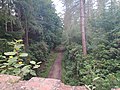
 New Lipchis Way in West Copse - geograph.org.uk - 1614831.jpg 470 × 640; 106 KB
-

-

-
 New Lipchis Way on Woolbeding Common - geograph.org.uk - 1614881.jpg 640 × 360; 86 KB
-
 New Lipchis Way route marker.JPG 2,560 × 1,920; 1.16 MB
-
 New lipchis Way waymarker.jpg 3,096 × 4,128; 5.81 MB
-
 Small footbridge on the New Lipchis Way - geograph.org.uk - 975850.jpg 640 × 360; 120 KB
-
 Stedham Hall.JPG 1,280 × 960; 490 KB
-
 Stedham Mill2.JPG 1,280 × 960; 498 KB
-
 Stedham Mill3.JPG 1,280 × 960; 504 KB
-
 Stile on the New Lipchis Way - geograph.org.uk - 1614809.jpg 640 × 360; 112 KB
-
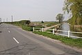
 The New Lipchis Way goes under the B2178 - geograph.org.uk - 994974.jpg 640 × 480; 147 KB
-
 The New Lipchis Way leaves Whites Lane - geograph.org.uk - 975887.jpg 640 × 360; 118 KB
-

-
 West Wittering Parish Church.jpg 640 × 427; 224 KB
-
 Wheatfield west of Moor Farm, Heyshott 01.jpg 4,000 × 3,000; 3.8 MB
-
 Wheatfield west of Moor Farm, Heyshott 02.jpg 4,000 × 3,000; 4.43 MB


